
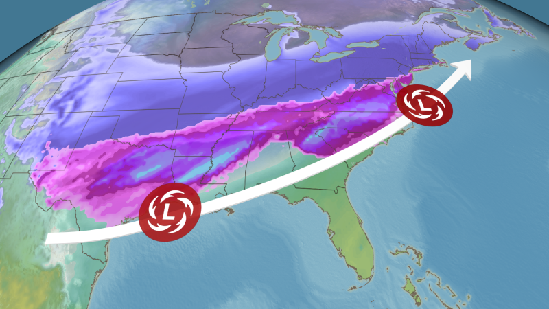
• Overview: A major winter storm is about to get underway in the Plains and will continue to intensify through Friday night as it spreads toward the mid-Mississippi Valley.
A combination of winter storm alerts and extreme cold alerts are in effect for nearly every state east of the Rockies.
• Saturday: The storm’s trail of snow and ice will likely stretch over 1,000 miles — from Texas and Oklahoma to the Southeast and mid-Atlantic.
• Sunday: The Northeast gets slammed by snow, although freezing rain and sleet could mix in near the mid-Atlantic coast.
• Threats: Ice build up from freezing rain will cause long-lasting power outages and major tree damage in parts of the South.
• Heavy snow will pile up to a foot or more from the Plains to the Ohio Valley and Northeast, making travel impossible.
• Confidence: There is high confidence that a significant winter storm will impact a large portion of the country, from the Plains to the East Coast this weekend. The storm’s track is much more certain now, but small shifts could still cause changes in local impacts, especially where the snow and ice zones meet.