
DETROIT – One of the biggest winter storms in years is hitting a huge swath of the United States this weekend, stretching from the Rockies east to Boston and New York, and reaching south as far as the Carolinas and Tennessee.
It’s forecast to bring a messy mix of rain, heavy snow and ice across its 2,000-mile track.
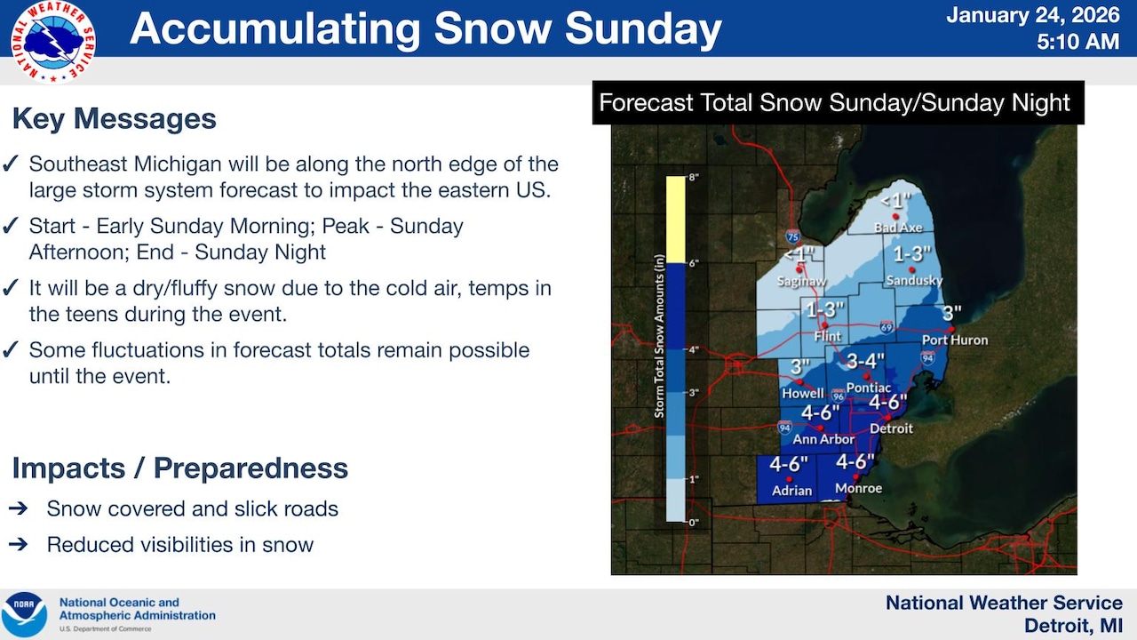
Southern Michigan is on the northern rim of this area, and is expected to get clipped by the system on Sunday, which means we could see some heavy snowfall at times.
As you can imagine, this storm has thrown some residents of southern states into a panic. In Michigan, we’re just keeping our shovels handy.
Southeast Michigan is in line for the heaviest snowfall. Areas like Ann Arbor and Detroit could see up to 6 inches of snow on Sunday. In Southwest Michigan, areas like Jackson and Kalamazoo could see up to 3 inches of snow, but that forecast has some fuzziness right now, as there is some possibility that the moisture from Lake Michigan could increase those snow totals around Chicago and into the Southwest corner of our state.
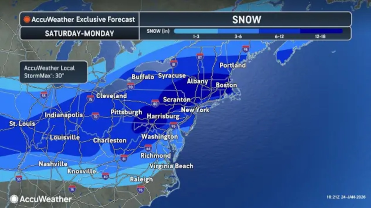 A massive winter storm is stretching 2,000 miles across the U.S., from Colorado to Boston.Graphic provided by AccuWeather
The heaviest snow is going to be Sunday afternoon, according to the National Weather Service.
Other NWS highlights of this incoming storm:
The snow across southern Michigan is expected to start late Saturday night near the Ohio border.
The snow will ramp up on Sunday afternoon. This will be the heaviest window of time for snow accumulation.
The snow will taper off on Sunday night.
Monroe and Wayne counties could see 5 to 6 inches of snow.
The rest of Metro Detroit could see 2 to 4 inches of snow.
Less than an inch of snow is expected north of M-46.