

The Met Office forecast for snow covers large parts of the country
17:49, 24 Jan 2026Updated 17:57, 24 Jan 2026

Snow is predicted for parts of the UK next week and Wales won’t escape the white stuff(Image: Christopher Furlong, Getty Images)
Parts of Wales are set to be hit by snow next week with weather maps predicting where and when it is expected to fall. Other areas have yellow warnings for rain and wind as the weather warms up throughout the coming week.
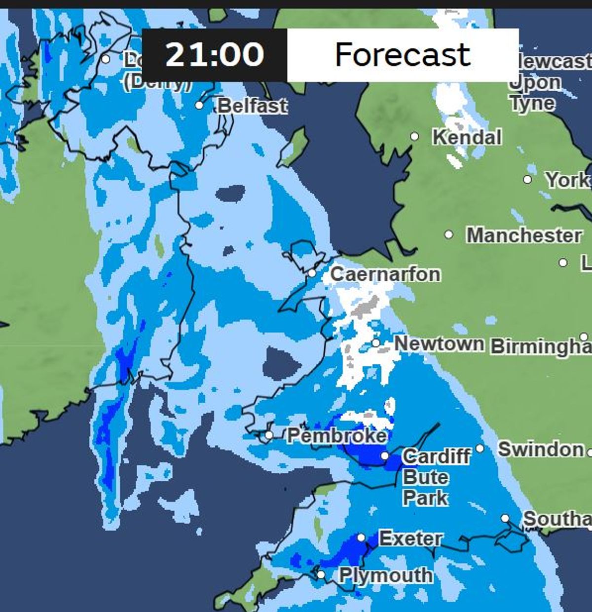
As colder air blows in the Met Office forecasts that from 9pm on Monday and overnight on Wednesday some areas of Wales will experience snow while heavy snow is predicted across Scotland, the north and north east of England as well as higher areas in north Wales.
European forecasters are predicting up to 22cm on Welsh mountains with smaller falls in other places.
Scotland will see the heaviest snow with up to 70cm forecast there. North east England will also see heavy snow, some of which may cause disruption.
By Tuesday lunchtime , January 27, the ECM (European Centre for Medium-Range Weather Forecasts) weather model predicts the mercury plunging below zero across large parts of Wales.
Met Office meteorologist Aidan McGivern said: “In this scenario there is significant snow (in the Midlands, Wales and especially further north), at least before we see the rain set in.”
The Met Office forecast for Monday to Thursday reads: “The weather will remain unsettled for much of the UK, with cold air bringing the chance of wintry hazards in the north.
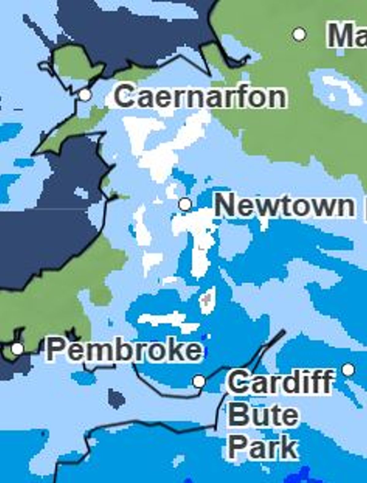
Snow in north Wales at 9pm on Monday(Image: )
“The UK continues to sit between the influence of high pressure to the northeast, and low pressure trying to move in from the southwest. This is leading to a continuation of unsettled weather, and a mix of conditions across different parts of the UK.”
As the week goes on there will also be heavy rain and winds across Wales.
The Met Office forecast adds: “Further south, an area of low pressure is bringing very wet and windy weather across the southwest of England and southern Wales.
“Gusts could reach up to 60mph in coastal locations, with rainfall accumulations of up to 30-40mm falling on already saturated ground. Yellow warnings have been issued for these regions too.”
Here, we’ve taken a look at the areas set to be worst affected by snow across Wales:
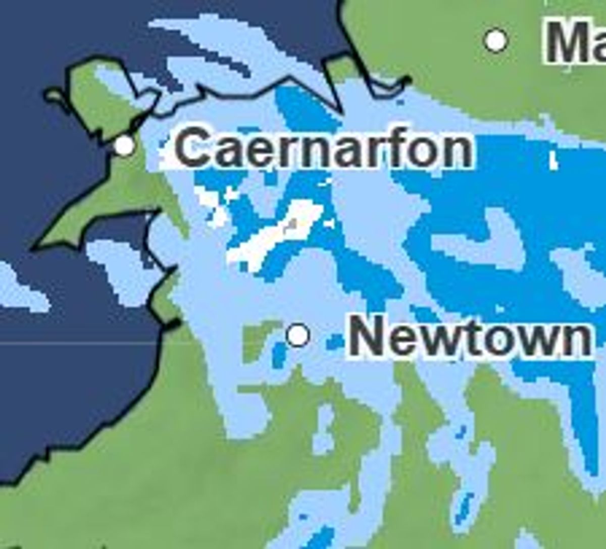
A huge swathe of Wales from Pembrokeshire to Caernarfon will see snow from Monday night January 26. Weather maps show snow fall from 9pm.
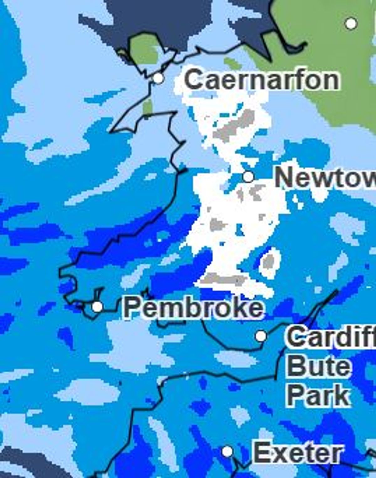
Snow at midnight on Tuesday January 27(Image: )
Snow will stay lying and is still shown on weather maps across Wales at midnight on Tuesday January 27.
The white stuff is still clearly on the weather maps for Wales at 3am on Thursday.
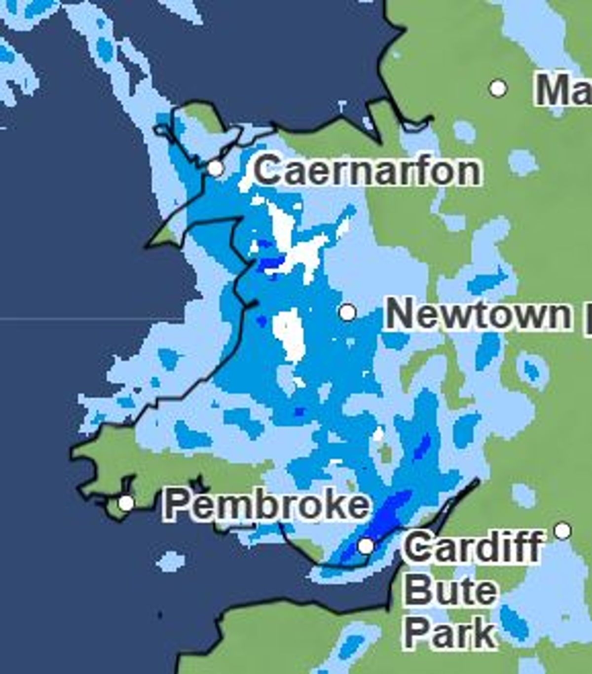
Still snow on the gorund on Wednesday in parts of Wales. (Image: )
Snow is still around in the early hours of Thursday.
This is how the weather maps are looking on Thursday at 3am in Wales (Image: Met Office)
There is also a yellow Met Office yellow weather warning for rain across much of south Wales next week. The warning is in place from Monday evening into Tuesday afternoon.
The forecaster has said rainfall totals of 20–30mm are expected widely, with higher ground seeing 50–80mm, particularly across the Brecon Beacons.
The rain warning is in place from 6pm on Monday, January 26, to 2pm on Tuesday afternoon and 15 Welsh regions are affected.
These are: Blaenau Gwent, Bridgend, Caerphilly, Cardiff, Carmarthenshire, Merthyr Tydfil, Monmouthshire, Neath Port Talbot, Newport, Pembrokeshire, Powys, Rhondda Cynon Taf, Swansea, Torfaen and the Vale of Glamorgan.
For the biggest stories in Wales first, sign up to our daily newsletter here