
Beatrice Vaisman speaks with the manager of road operations in Vaughan to see how they’re preparing for the incoming major snowfall.
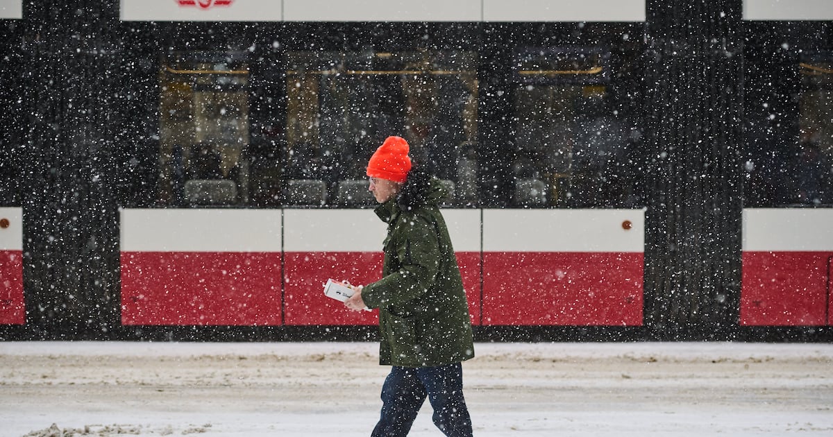
As bitterly cold wind chills remain in Toronto and much of the GTA, the region is bracing for “hazardous winter storm conditions” expected to hit on Sunday.
An orange winter storm warning is now in effect ahead of Sunday’s snow event.
An orange alert, which Environment Canada says is uncommon, is issued when severe weather is likely to cause significant damage, disruption or health impacts.
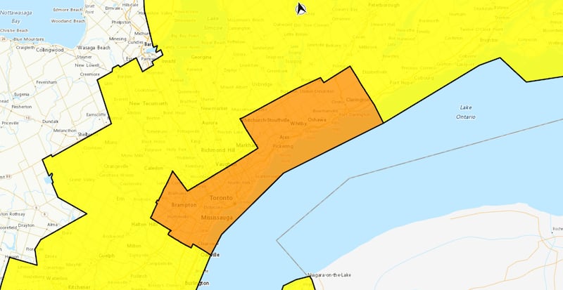 Environment Canada map Toronto and the GTA are under a winter storm warning.
The agency adds that the impacts are expected to be major and widespread, and may last a few days.
“A band of lake effect snow off Lake Ontario will impact areas beginning overnight or early Sunday morning, predominantly from western Northumberland county to the Greater Toronto Area,” Environment Canada said in its advisory.
“Widespread snow associated with an approaching system will develop Sunday morning. As this occurs, lake enhancement is expected. Locations affected by lake enhancement will receive the highest snowfall amounts.”
When will the snow arrive and how much could fall?
Environment Canada says the city could see snowfall amounts of 20 to 40 centimetres.
In addition to the snow, strong winds with gusts of up to 50 km/h are possible.
“Lake enhancement will occur over parts of the Greater Toronto Area through Sunday afternoon before shifting southward toward Oakville and Burlington later Sunday afternoon or Sunday evening as winds become northeasterly,” Environment Canada said.
“Roads and walkways will likely be very difficult to navigate. Travel will likely be hazardous. Visibility will likely be suddenly reduced to near zero at times.”
Also under an orange winter storm warning are Mississauga, Brampton, Pickering, Ajax, Whitby and Oshawa.
Areas in southern York Region, such as Richmond Hill, Markham and Vaughan remain under a yellow winter storm warning as well as those in Halton Region, Niagara Region and the City of Hamilton. They are forecast to see 15 to 30 centimetres of snow.
A yellow cold warning issued on Friday has been lifted. According to Environment Canada, a wind chill of -28 was recorded at Toronto Pearson International Airport at 11 p.m. on Friday.
On Sunday, Toronto will see a high of -7 C with a wind chill of -25 in the morning and -15 in the afternoon.
Here’s a breakdown of what you need to know and how the weather is impacting the GTHA.
Power outage hits parts of Hamilton
Officials say a power outage is affecting about 305 homes and businesses in the area of King Street East and Wellington Street North in Hamilton.
Crews are working to repair “multiple underground cable faults,” and the estimated time of restoration is between 10 p.m. and 12 a.m., according to Alectra’s post on social media.
UPDATE: #Outage in #HamOnt affecting the remaining 305 homes and businesses in the area of King St E and Wellington St N. Crews are making repairs after multiple underground cable faults. ETR is 10:00PM-12:00AM. For more, info visit https://t.co/nCMFAKgACx #pwrout ^pa
— Alectra (@alectranews) January 24, 2026
At the peak of the outage, there were 935 homes and businesses affected.
Travel conditions could deteriorate
Alongside the previous cold warning that ended this morning, Environment Canada has also issued a winter weather advisory, warning that travel may become hazardous as conditions change.
“Prepare for quickly changing and deteriorating travel conditions,” the agency said, advising people to allow extra time for travel.
Toronto Pearson Airport is advising passengers to check their flights with their airline before heading to the terminal.
Air Canada also says its operations could be impacted by the winter weather.
Airline operations may be impacted by a polar vortex bringing extreme cold temperatures and winter weather across Canada and the U.S. in the coming days. Check your flight status before going to the airport via the Air Canada app or at https://t.co/j6Q9rcq8zw. (1/2) pic.twitter.com/Mtu8NhJFLa
— Air Canada (@AirCanada) January 23, 2026
How is the City of Toronto responding?
In response to the extreme cold, the City of Toronto says its warming centres and surge sites are open to anyone who needs a place to get out of the cold.
Warming centres are currently operating at:
81 Elizabeth St.885 Scarborough Golf Club Rd.136 Spadina Rd.349 George St.12 Holmes Ave.
The city has also opened surge warming sites, which activate when temperatures hit specific thresholds. The first surge site is open at Jimmie Simpson Recreation Centre at 870 Queen St. E., while a second surge site is operating at Cecil Community Centre at 58 Cecil St.
City officials continue to urge residents to limit time outdoors where possible and to check in on vulnerable neighbours as the cold snap continues.