
Weather forecasters have listed the cities across the UK that could be hit by snow in the coming days, as wintry conditions continue to blast England, Scotland, Wales and Northern Ireland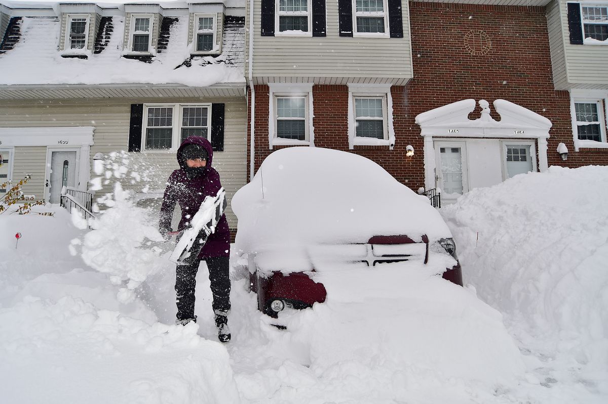
Latest weather charts show a vast band of snow sweeping in from the Atlantic(Image: Getty Images)
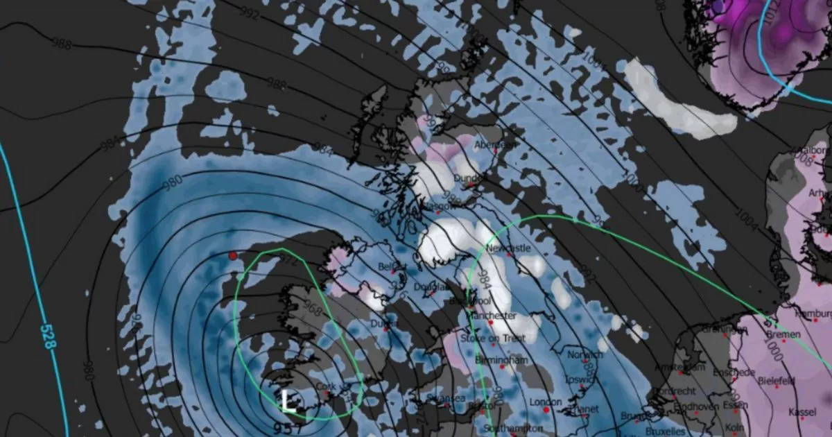
A brutal 247-mile “wall of snow” is set to smash into the UK in just days, with dramatic new maps revealing 19 major cities braced for wintry chaos.
Latest weather charts show a vast band of snow sweeping in from the Atlantic and tearing across the country in a matter of hours, dumping heavy falls from Northern Ireland through Wales and into England and Scotland.
Maps from WXCHARTS show huge white swathes, indicating snowfall, pushing into the UK on Tuesday, January 27, as a deep area of low pressure barrels in from the southwest. By midday, north Wales, all of Northern Ireland, and large parts of Scotland are forecast to be buried under snowfall, with some areas seeing up to a staggering 55cm.
In England, snow is expected to hit Cumbria, Manchester, Birmingham, Liverpool, Blackpool and large parts of Yorkshire as the icy front surges east. Forecasters say the wall of snow will stretch more than 200 miles from top to bottom, effectively cutting the UK in two as it powers across the nation.
READ MORE: Emergency rescue launched after reports car swept into sea in 75mph windsREAD MORE: Storm Ingrid horror as iconic pier destroyed and sea wall collapses in 60mph winds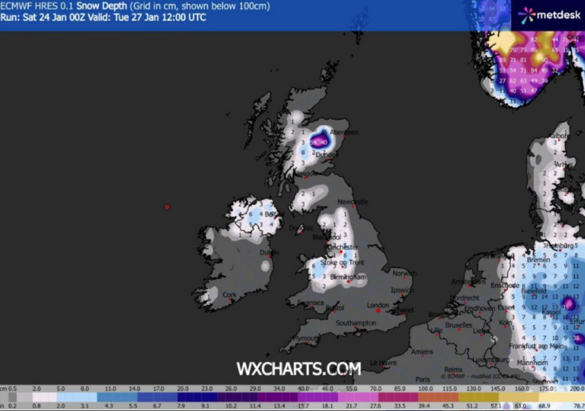
New snow maps have pinpointed which cities will be hit by snowfall(Image: )
By 3pm, conditions are expected to rapidly deteriorate for many, with rain spreading into other regions and turning already miserable conditions even worse. WXCHARTS maps show most areas of the UK will be soaked by heavy rain later in the day, with only a handful of regions managing to dodge the worst of the downpours.
Those lucky enough to stay mostly dry include Cornwall, Devon and parts of south Wales. The Met Office’s five-day forecast paints a bleak picture as the icy blast closes in, the Express reports. It says: “Remaining unsettled throughout, with bands of rain moving north and east across the country, particularly on Tuesday when another deep area of low pressure approaches from the southwest. Feeling cold.”
Sunday brings little relief, the weather company predicting the UK will be cloudy with many outbreaks of rain or showers to hit. The Met Office’s weather warning said: “There will be a few brighter breaks developing, with many areas becoming dry later. There is further hill snow likely across parts of northeast Scotland.”
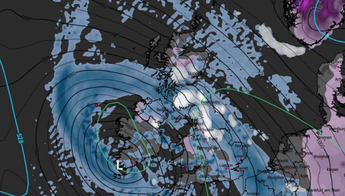
Several parts of the UK are set to be battered by a snow wall this week(Image: )
The looming snow wall comes just hours after heavy rain battered large swathes of the UK, prompting the Met Office to issue weather warnings across 32 areas this morning.
Flooding, travel disruption and power cuts are all possible as the country lurches from soaking rain straight into heavy snow and freezing conditions. Drivers and commuters in major cities including Manchester, Birmingham, Liverpool and Belfast have been urged to prepare for difficult journeys as the blizzards move in.
Weather experts say the speed and size of the snow band could catch people off guard, with conditions deteriorating rapidly over just a few hours. With freezing temperatures expected to follow behind the system, any snow that settles is likely to linger, raising the risk of icy roads and pavements well into midweek.
Full list of cities set to see snowEnglandManchesterLiverpoolCarlisleBirminghamStoke-on-TrentSalfordChesterLancasterScotlandWalesNorthern IrelandBelfastDerryLisburnNewryArmaghBangor
Brits are being urged to keep an eye on local forecasts and prepare for rapidly changing conditions as the brutal wall of snow closes in.