
Huge waves crashed across the coast from Lyme Regis in the west, all the way to Swanage in the east with dramatic scenes of crashing surf, sea spray and foam captured by residents and weather watchers.
Storm Ingrid, Newtons Cove, Weymouth (Image: Sarah Dawson)
As a result of the adverse weather conditions, a temporary road closure was put in place at Portland Beach Road from 10pm on Friday night until shortly before 1am on Saturday.
At the time, a spokesperson for Dorset Council said: “Residents and road users should avoid travel on roads leading up to the Portland Beach Road and Causeway.
“Multi-agency teams, including the Environment Agency, emergency services and Dorset Council Officers are currently on site closely monitoring the road, weather conditions, and local water levels.
“Rest centres are being prepared if they are needed. Highways teams are ready to clear roads of debris and to check the safety of the road before it is reopened.”
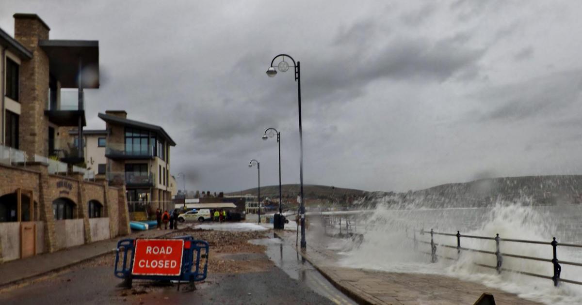
A section of Swanage’s seafront was closed for public safety as the area saw large waves and debris thrown onto the road.
Road closure in Swanage (Image: Robin Boultwood)
With storm conditions hitting Dorset again, Swanage Coastguard, alongside teams from St Albans Coastguard, were tasked with monitoring sea defences and providing safety advice to the public in the Lower High Street area in Swanage.
High tides also caused flooding near Weymouth Harbour at Commercial Road.
One motorist said: “I parked my car for an hour and there was no water on the road. When I came back, the road was completely flooded.”
The main flood area was at the junction with Lower St Alban Street and the Cosens Quay Car Park.
Flooding at Commercial Road, Weymouth (Image: Sam Boylan-Jones)
A yellow weather warning for rain remained in place throughout Saturday with a number of flood warnings and alerts also issued by the Environment Agency.
Lyme Regis RNLI also issued urgent advice following warnings.
A spokesperson said: “There are two Met Office yellow weather warning for wind and rain today in Lyme Regis. With this it will bring strong winds, large waves, and a risk of storm surges. Please follow safety advice and take extra care if you are heading to the coast.”
A further yellow weather warning remains in place from 6pm on Monday until 2pm on Tuesday as more rain is set to batter the county.
Storm Ingrid, West Bay (Image: Marc Coady)
These outbreaks of heavy rain could result in more flooding and disruption.
A spokesperson for the Met Office said: “Outbreaks of rain, heavy at times, will affect south west England from Monday evening, through Tuesday morning before clearing to heavy showers later in the day.
Huge waves from Storm Ingrid crash against the the Cobb Harbour wall at Lyme Regis on a morning of gale force winds, rain and rough seas. 24th January 2026. Picture Credit: Graham Hunt Photography (Image: Graham Hunt Photography)
“Rainfall totals are expected to reach 20-30 mm widely, with 50-80 mm likely across higher ground, with wet conditions prior to this period, the rain will fall onto saturated ground, accentuating flooding impacts in places. Strong south easterly winds are also likely.”