
Yes, we’ll stay below freezing until Tuesday, but it will be sunny. So, will we see any melting on the roads?
DALLAS — Our meteorologists are calling for WFAA Weather Alert Days through Monday. Stay informed by watching regular forecast updates and live radar from across the region on our smart TV streaming app, WFAA+. You can also download the WFAA mobile app for up-to-the-minute alerts from our weather team as they come.
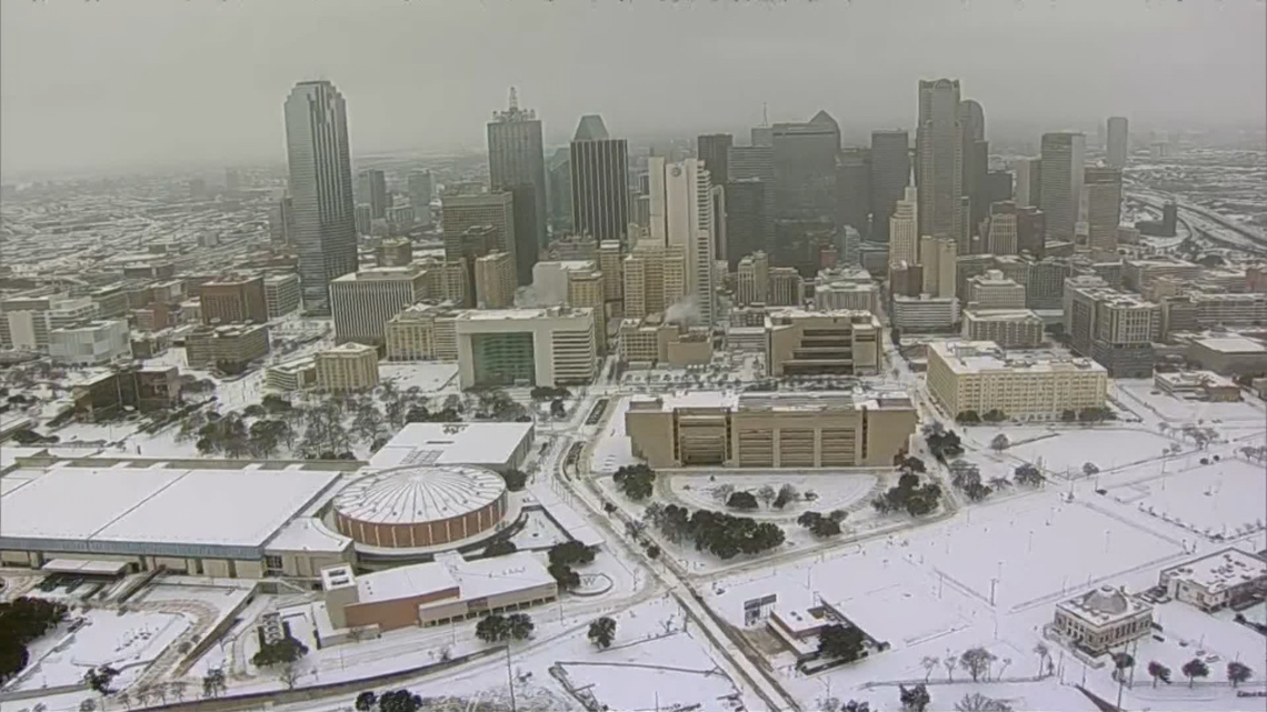
Our roads are icy, from a combination of freezing rain, sleet, and snow. Most of that has been compacted to a certain extent by now. But Monday we’ll see the sun out in abundance! Can it melt the ice when temperatures are below freezing? The answer is yes.
Sunlight through the day today (Monday) will likely begin to melt some of the ice out there, just due to direct solar radiation. There’s another way we’ll likely see some disappearing ice and snow today as well, through a process called sublimation, where ice can turn directly into water vapor when it’s dry, sunny, and there’s some wind present. The sun’s angle is also a bit higher than say, in December or early January, so the radiation will have more potency today, given it’s late January. Some melting, radiation, and sublimation will occur today.

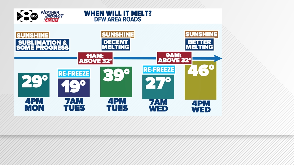
On Monday night, as temps drop below freezing again, expect a little more re-freezing to occur. However, no extra precipitation is expected. But spots that saw some liquid leftover from melting, could see re-freezing as well.
Finally, by Tuesday at 11 a.m., our air temperature will rise above freezing and road temperatures will likely be 2-5 degrees above that mark. Add in sunlight, direct solar radiation, sublimation, and we should start to see significant decreases in ice out there. By Tuesday afternoon, temps should be nearing the 40-degree mark, further accelerating melting potential.
Wednesday morning will likely be our last morning for any re-freezing of liquid and ice out there, with temps just below 32. Perhaps a little residual leftovers are still around by Thursday morning, but far less. However, even faster than Tuesday morning, we’ll reach above freezing by around 9 a.m. on Wednesday. With more sunlight and warming, much better melting of remaining ice should occur through the afternoon when temps rise into the upper 40s, with sunlight. Many spots will see significant decreases in what’s left out on the roads by late Wednesday.