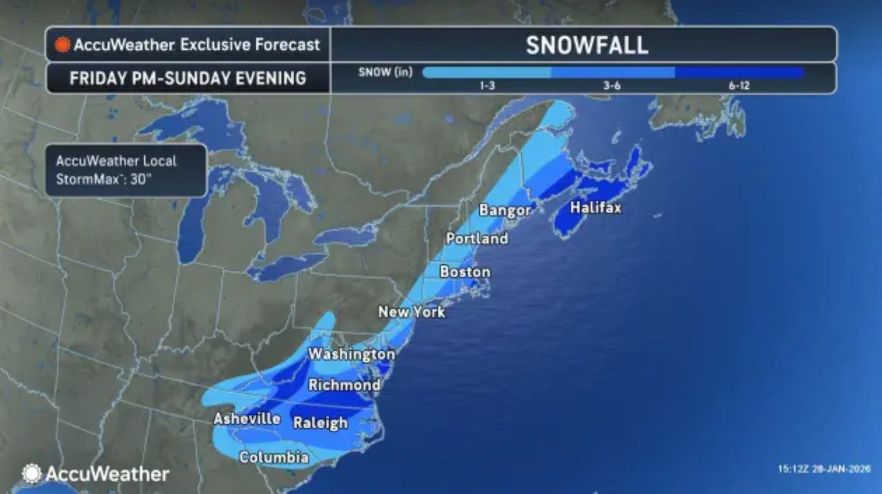
A coastal storm system expected to intensify into a powerful nor’easter and “bomb cyclone” could dump 3 to 6 inches of snow over parts of New Jersey this weekend and potentially bring blizzard conditions to the Jersey Shore, according to forecasters from AccuWeather.
Inland areas of the Garden State could get 1 to 3 inches of snow on Saturday and Sunday, along with gusty winds, AccuWeather said in a storm update Wednesday afternoon.
Although a high level of uncertainty still exists over the track of the storm, which hasn’t formed yet, AccuWeather forecasters said New Jersey is in the likely target zone for snow, strong winds and coastal flooding.
Forecasters say it will be a “close call” between light to moderate snow or heavy snow for the Mid-Atlantic region and for coastal sections of New England.
 A rapidly intensifying “bomb cyclone” storm could race up the East Coast and bring heavy snow and coastal flooding to New Jersey this weekend. High winds could cause blizzard conditions along the Jersey Shore, AccuWeather forecasters say.AccuWeather.com
Computer guidance models keep flip-flopping on the projected track of the weekend storm.
Conflicting projections show the storm moving close enough to the Atlantic coast to bring heavy snow and serious coastal impacts, and sometimes keeping the storm several hundreds of miles farther offshore.
The offshore scenario would limit the amount of snow and coastal flooding, forecasters say.
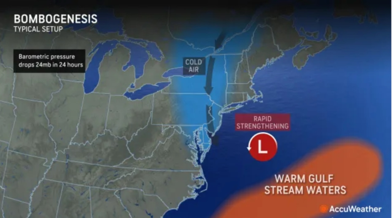
Despite the variations on the storm’s track, most forecast models seem to agree that the storm will intensify quickly enough to be classified as a bomb cyclone.
That’s an actual term used by meteorologists to describe the process of bombogenesis, when a storm system in our sector of the Atlantic Ocean rapidly strengthens with a specific drop in pressure during a 24-hour period.
 A rapidly intensifying bomb cyclone storm could race up the East Coast and bring heavy snow and coastal flooding to New Jersey this weekend. High winds could cause blizzard conditions along the Jersey Shore.AccuWeather.com
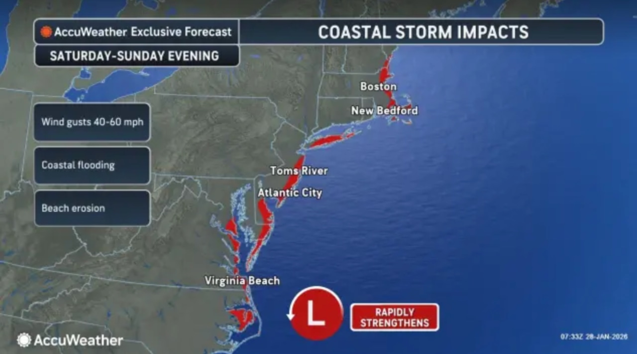
AccuWeather is confident this weekend’s storm “will raise winds and seas, leading to significant coastal flooding and beach erosion.”
The private forecasting company also says “blizzard conditions are also likely in the hardest-hit areas,” although it’s too early to pinpoint which areas they will be.
On one AccuWeather’s forecast maps, it includes most of the Jersey Shore among the areas of the eastern U.S. that could get “potential” blizzard conditions.
The National Weather Service says it continues to monitor the storm system, but it hasn’t yet issued snowfall projections or wind impacts.
“While confidence in specific forecast details remains low, the storm could bring at least portions of the area moderate to significant impacts from snow, strong winds, and coastal flooding,” the weather service said early Wednesday.
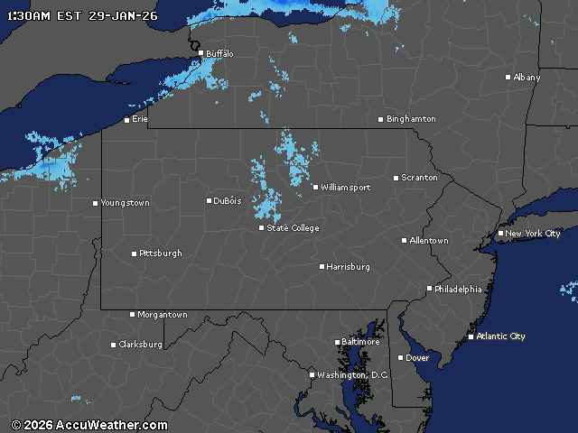
Current weather radar