
Snow is forecast on Friday, the Met Office says, as temperatures will feel as cold as -8C — and this is due to a bitter southeasterly wind, gusts of which will reach 70mph in Scotland
05:00, 29 Jan 2026Updated 07:21, 29 Jan 2026
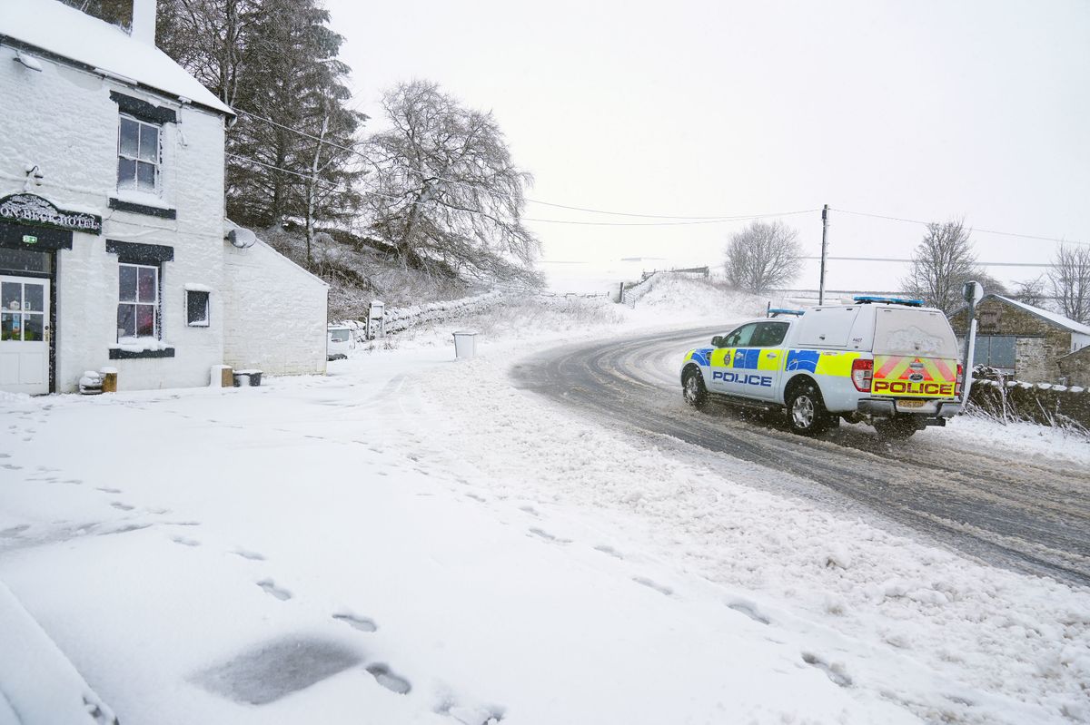
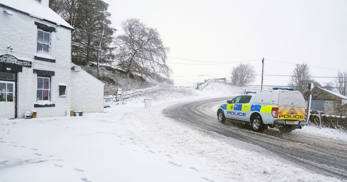
Parts of County Durham and North Yorkshire were blanketed on Tuesday(Image: PA)
This striking weather map shows snow is forecast as temperatures tumble.
It will feel as cold as -8C across parts of the UK today and, though the actual air temperature will be slightly warmer, a fierce southeasterly wind will bruise the country. The Met Office forecasts snow, an understanding supported by meteorologists at Metdesk whose new weather maps capture a bleak picture on Friday.
The white hues in the map below show snow is expected as far south as parts of the Midlands, including Staffordshire and Derbyshire, and as far north as Aberdeenshire. The heaviest of the flurries are anticipated across Cumbria and hills over the Peak District by around 9am on Friday.
But the Met Office understands the wintry weather could arrive sooner — today even. Concerning today’s forecast, its website reads: “Rather cloudy and breezy with some rain and hill snow lingering in the northeast, whilst showers give way to more persistent rain towards the southwest. Some brighter breaks developing elsewhere.”
READ MORE: Storm Chandra aftermath threat amid fears the worse could be yet to comeREAD MORE: Britain facing -4C DEEP FREEZE as weather maps turn icy blue – 99 areas sent urgent alert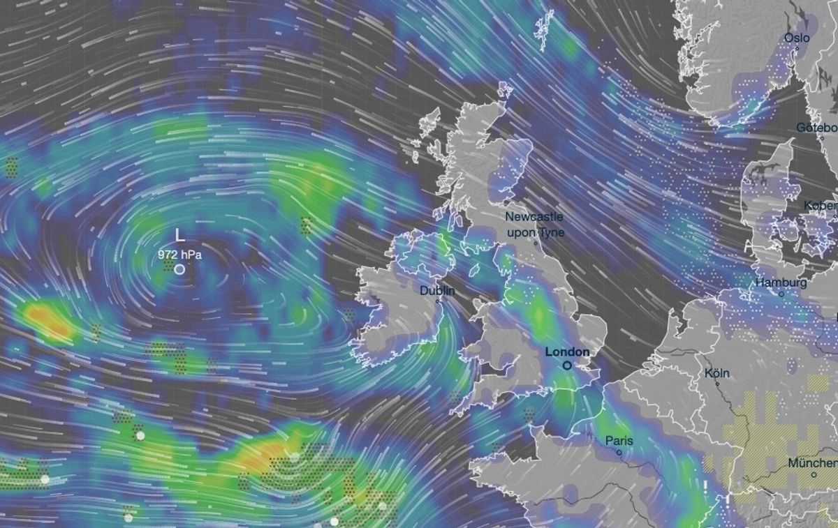
Snow is forecast on Friday morning for various areas, including parts of the Midlands and the Northwest of England(Image: Ventusky)
Ice remains a hazard already as temperatures have fallen this week following Storm Chandra’s rampage. Temperatures plunged to below freezing on Wednesday, including near Braintree, Essex.
It was cold enough for snow on Wednesday in Essex among other places, but there was little precipitation. Rain is moving in from the southwest today though, and will be heaviest across Devon and Cornwall. A weather warning is in place for the Southwest of England, because transport disruption is likely and the rain will exacerbate flooding in places.
When Friday’s snow thaws this weekend, it is feared further flooding will happen across northern England and parts of Scotland. There is concern, for instance, for properties beside the River Ouse at York and the River Wye in Derbyshire.
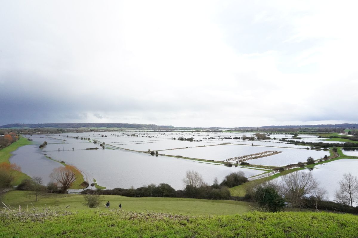
Somerset is experiencing flooding after recent downpours(Image: PA)
Matthew Lehnert, chief meteorologist at the Met Office, said: “On Thursday, showers in southwest England will be replaced by a more organised area of rain when the next system reaches the south of Cornwall around Thursday lunchtime. There’s a Yellow Warning for rain in place from noon until Friday morning, with the focus for heavier rain across southwest England as the wet conditions spread northeast across the warning area.
“The rain is only likely to last for a few hours in each location but will be heavy at times. 10 to 15 mm is likely quite widely, but in some areas, particularly towards the south coast, a further 20 to 25 mm is possible. This rain will fall onto already saturated ground, compounding the impacts of Storm Chandra, so we’re encouraging people to stay up to date with the latest forecast and follow any advice from the emergency services and local authorities.”
Flooding of a few homes and businesses is expected. There is one severe flood warning in place, which is for Lower Stour at Iford Bridge Home Park in Dorset. Residents at this home park were evacuated yesterday because levels on the river were rising — and this remains the case today.