

Published on Jan. 31, 2026, 9:13 PM
Satellites captured stunning imagery of the Golden Horseshoe in the wake of its historic snowstorm last weekend
A pair of satellites have captured stunning, high-resolution views of the aftermath of southern Ontario’s recent historic snowstorm.
PHOTOS: Toronto’s snowiest day on record, 40-50+ cm reported
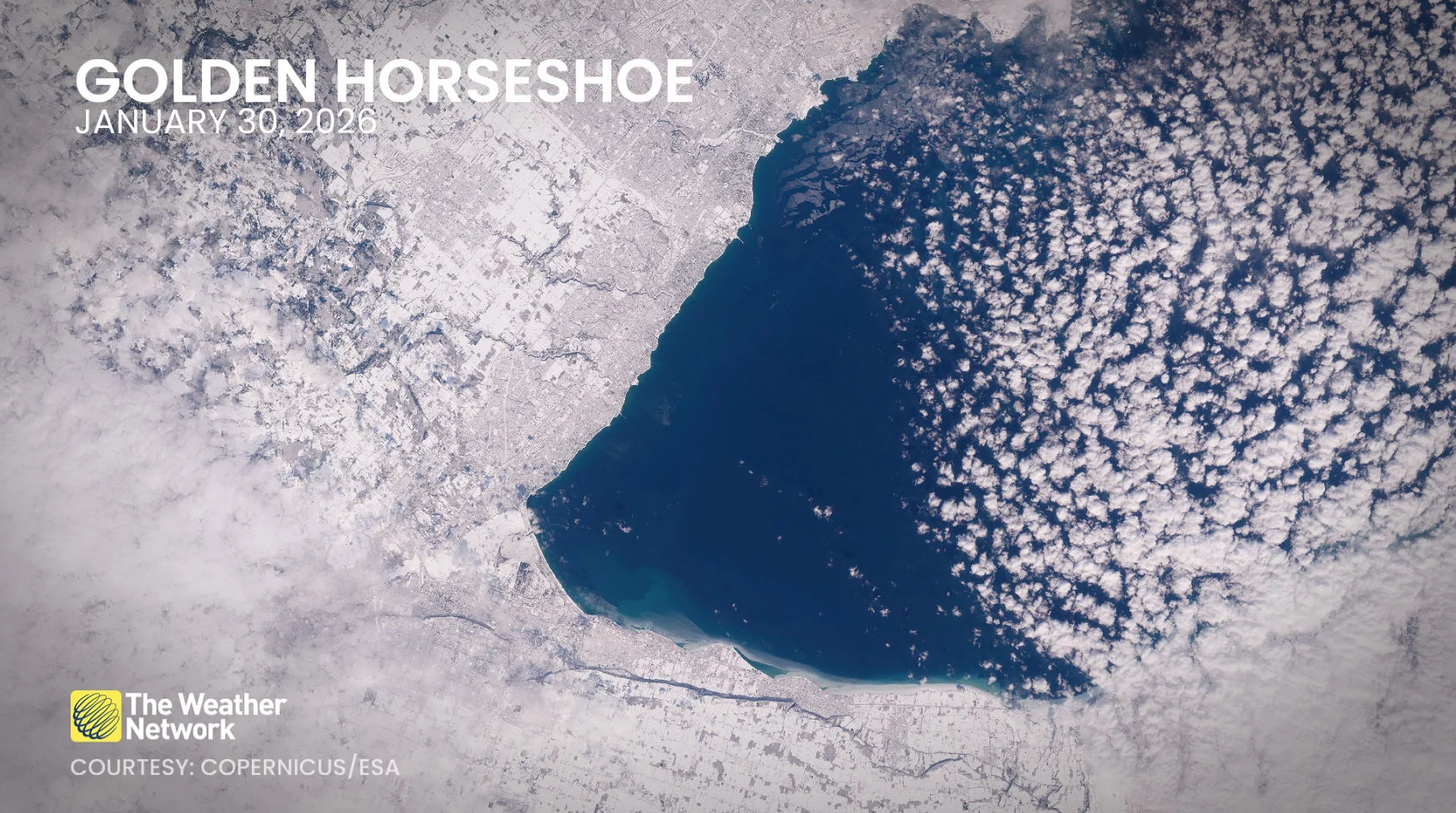
We’ve all seen satellite images of snowpack blanketing the landscape. But rarely do we get to see the zoomed-in view of our midwinter surroundings.
The European Union’s Sentinel-2A and Sentinel-2B satellites pass 786 kilometres over Ontario’s latitude every few days, but we need clear skies to capture these photos. Onboard sensors are capable of taking phenomenal images of our planet’s surface down to a resolution of 10 metres per pixel.
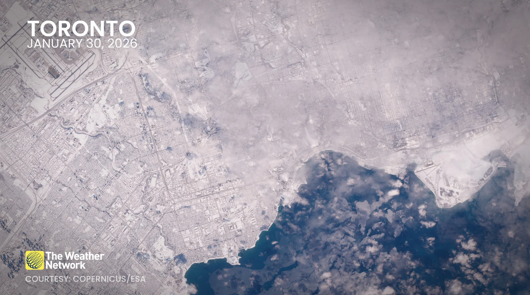
Unprecedented snowfall totals blanketed the region during the Jan. 25 winter storm, with more than 60 cm of accumulation reported in parts of the Greater Toronto Area.
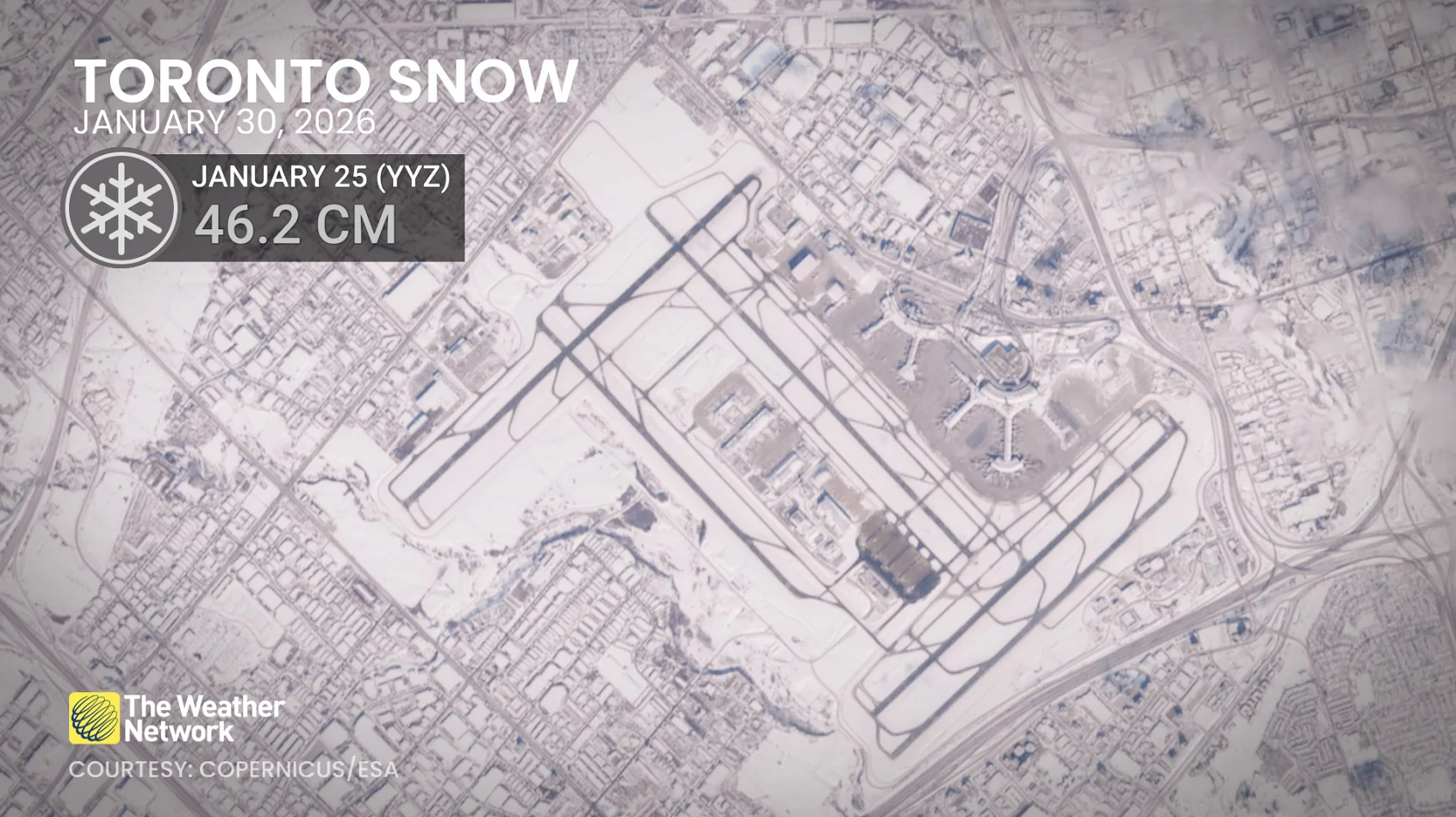
Toronto-Pearson Airport saw its snowiest day in 88 years of recordkeeping with a formidable one-day total of 46.2 cm. This total helped push the airport to record its snowiest January on record. 42 cm of snow remained on the ground as of Jan. 30.
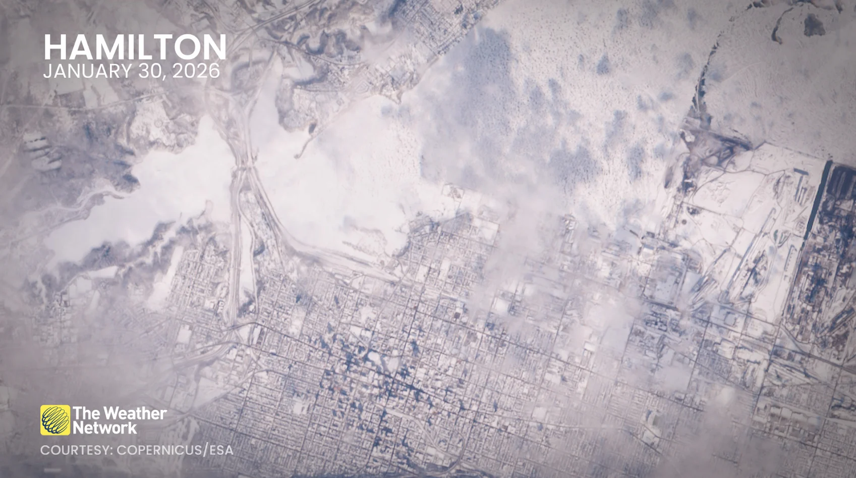
Looking a little farther south, the snow cover accentuates the unique geography and coastline around Hamilton. The city received significantly less snow from the Jan. 25 system, with only 19 cm of snow on the ground there on Jan. 30.