
There are claims that a “Beast from the East” storm could bring up to 25 inches of snow
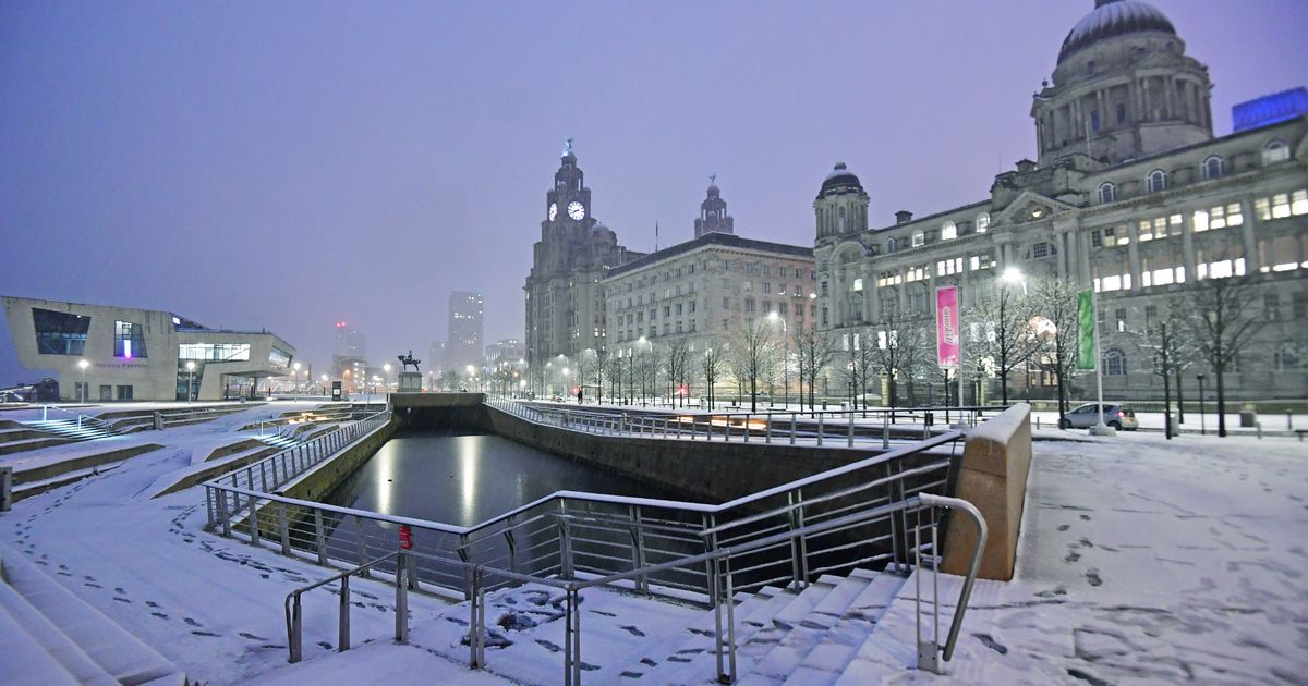
Snow falls on the Liverpool waterfront(Image: Colin Lane/Liverpool Echo)
Forecast models depict a potential blizzard sweeping the UK, bringing a nationwide snowstorm of up to 65cm (25 inches). Data from WX Charts indicates the snow may move in from Scandinavia around February 8, with a similar feel to the “Beast from the East” freezing cold in 2018.
WX Charts maps show heavy snow developing across southern England by midnight, while a broad band of heavy snowfall makes its way across Midlands, Wales, northern England and Scotland.
Cities including Liverpool, Birmingham, Newcastle and Edinburgh appear to be in the direct path as the two weather systems converge.
Snow coverage maps for February 17 show every inch of the UK shaded in purple – meaning there could be snow settled on the ground everywhere. Snow depth charts reveal the greatest accumulations will come in the Scottish Highlands, where 54cm (21 inches) is possible.
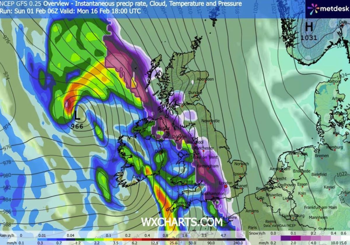
Several major cities including Liverpool, London and Birmingham could face snow(Image: WX CHARTS)
However, potential snow appears to be contained to hilltops and more northern regions rather than cities, and not a national blizzard as the models suggest, according to long forecast readings from BBC Weather and Met Office.
The BBC says a colder set-up is expected to develop during the second week of February as a stronger push of high pressure comes in from the north and north-west towards the UK.
“Drier and calmer interludes will lead to sharp overnight frosts and risks of fog but “there is no sign of any major snow event”.
The middle of February will remain colder than normal across the UK before becoming mild. BBC Weather said: “However, with cold air lingering for longer across the northern UK, rain bands may be preceded by snow.

Snow in Sefton Park, Liverpool(Image: Iain Watts)
The Met Office’s shares a similar sentiment, claiming the wet weather may turn to snow in some hills. Leading up to Sunday, February 15, the forecast says: “As these bands of rain spread northwards, some snow will be possible in northern England and Scotland, mainly over higher ground, as they encounter colder air.
Through the month “some hill snow will be possible at times as the wet weather encounters colder air across northern parts of the UK”.
Rainy spells are likely across Merseyside for the next seven days with temperatures teetering around 2C.