

Up to 1in of snow could fall over parts of the Midlands region on Thursday, with the latest wintery spell hitting the region
Around one inch of snow could pepper parts of the Midlands on Thursday. Pictured: Snowy scenes in Staffordshire
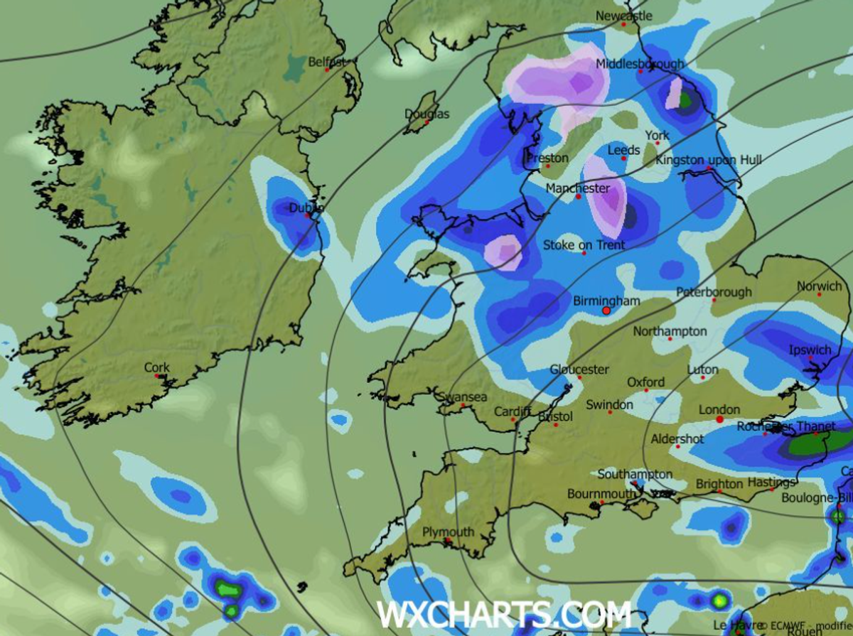
Weather maps have revealed that parts of the Midlands region are set for a blanketing of snow this week.
Conditions are set to turn wintery tomorrow, February 5, with a band of snow appearing over parts of central and northern England.
WX Charts weather maps have turned purple, with a mass of snow stretching 44 miles from Staffordshire up to West Yorkshire.
READ MORE: All the towns in England, Wales and Scotland named by Met Office for snowfall
Get breaking news on BirminghamLive WhatsApp, click the link to join
While Birmingham, the Black Country and South Staffordshire are set to escape any snow, parts of the Staffordshire Moorlands could face a sprinkling.
Around 2.7cm (1in) of snow is forecast to arrive over the north-eastern part of the county at 3pm on Friday, according to wxcharts.com.
Snow is set to hit parts of the Midlands on Thursday(Image: WX Charts)
While Birmingham looks set to avoid a powdering, the city is set for showers the following day on Saturday, February 6, with 3.5mm of rain arriving at 6pm.
In its forecast for Wednesday evening tonight, February 4, the forecaster said: ” Turning cloudier once again as rain continues for Scotland with hill snow again in the east.
“A new band of rain will arrive across the south overnight and move north with a strengthening wind.
“Remaining largely frost free.”
While for Thursday, the forecaster added: ” Rain moves northwards through the day, turning heavy in places and again, possible snow across north Wales, the Pennines and Scottish mountains.
“Winds staying strong in the north.
“Average temperatures.”