
Several areas could see snow today as wintry weather is expected to move across the country – the Met Office has explained exactly where could see some flurries
07:40, 05 Feb 2026Updated 07:47, 05 Feb 2026
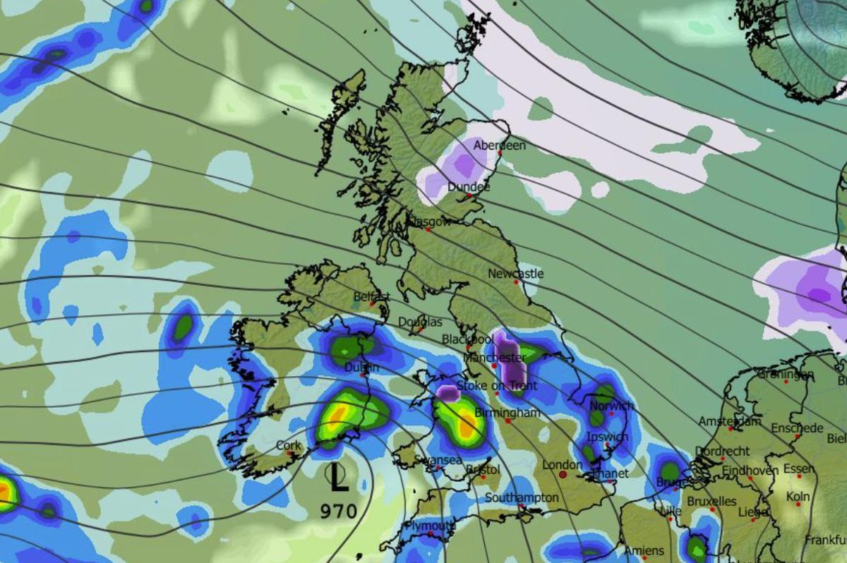
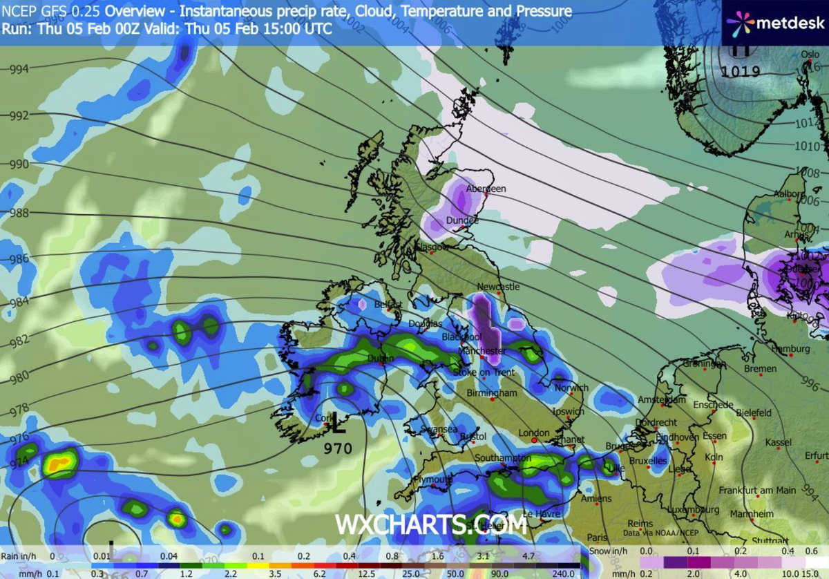
Snow is expected in some parts of the UK today(Image: WXCHARTS)
The Met Office has named which parts of the UK could see snow today, with 26 areas potentially in the firing line.
Several weather warnings for snow, ice and wind have been issued by the national weather agency this week. And now it looks as if more snow could come today.
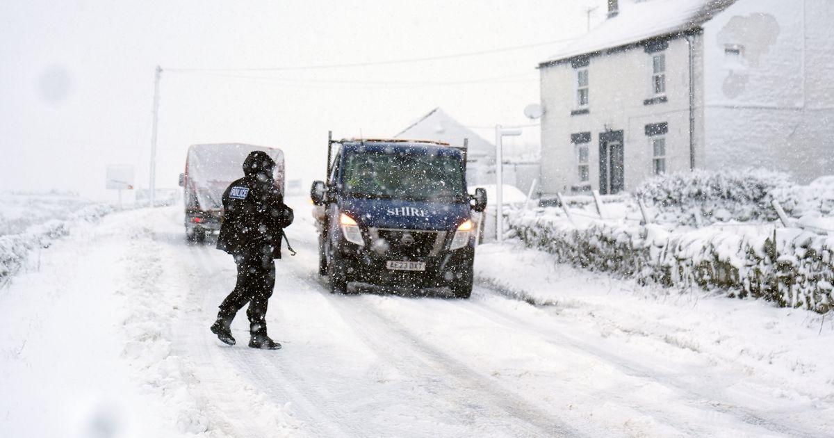
The Met Office says rain is expected to move northwards across the country today, turning heavy in places. It could then turn to snow over three regions – North Wales, the Pennines and the Scottish mountains.
The Met Office forecast states: “Rain moves northwards through the day, turning heavy in places and again, possible snow across north Wales, the Pennines and Scottish mountains. Winds staying strong in the north. Average temperatures.”
The Pennines and Scottish mountains are expected to see snow today(Image: WXCHARTS)
READ MORE: Snow forecast as London and Birmingham buried in winter storm covering 90% of UKREAD MORE: Snow maps reveal four-day blizzard will hit major UK cities and bring 28 inches
North Wales, the Pennines and the Scottish mountains consist of 26 counties (or council areas in Scotland).
Areas facing snow today:North WalesIsle of AngleseyGwyneddConwyDenbighshireFlintshireWrexhamThe PenninesDerbyshireStaffordshireGreater ManchesterCheshireLancashireWest YorkshireSouth YorkshireNorth YorkshireCumbriaNorthumberland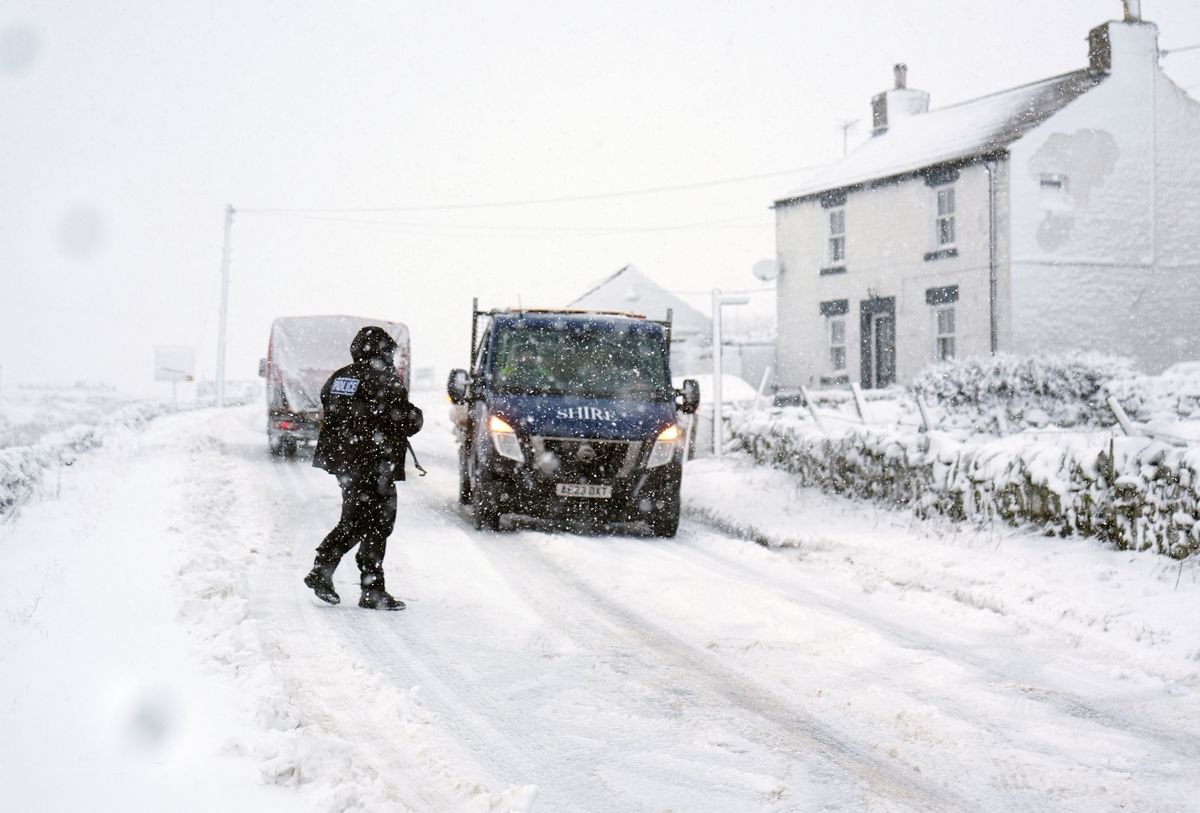
More snow could come later this month (stock)(Image: PA)
READ MORE: ‘Beast from the East’ snow forecast as major cities including London buriedScottish mountainsHighlandAberdeenshirePerth and KinrossArgyll and ButeAngusMorayDumfries and GallowayScottish BordersSouth LanarkshireEast AyrshireREAD MORE: Met Office urges Brits in 7 areas to make ’emergency’ kit with 3 essential itemsREAD MORE: Snow maps reveal twin blizzards to bury most of Britain in 48 hour weather blast
The Met Office says more snow could come across parts of England and Scotland later this month. In its forecast for February 9 to 18, the weather agency says: “Rainfall amounts will probably be highest in parts of the west, including across areas already sensitive to flooding.
“As these bands of rain spread northwards, snow is possible across northern England and Scotland, mainly over high ground. Strong winds could develop in places, especially coasts. Temperatures will probably be close to normal overall, with any cold conditions more likely in the north.”
And more hill snow could follow for February 19 to March 5, as the Met Office adds: “Changeable conditions are expected across the UK during this period.
“Low pressure systems will probably dominate, meaning showers or longer spells of rain, heavy at times, for much of the UK and some hill snow in the north. Periods of strong wind are also possible, especially around coasts. Temperatures will likely be close to average or slightly above overall.”