
Weather maps suggest several inches of snow will fall when a blizzard hits the UK in a few days’ time, with just a handful of areas missing out on the white stuff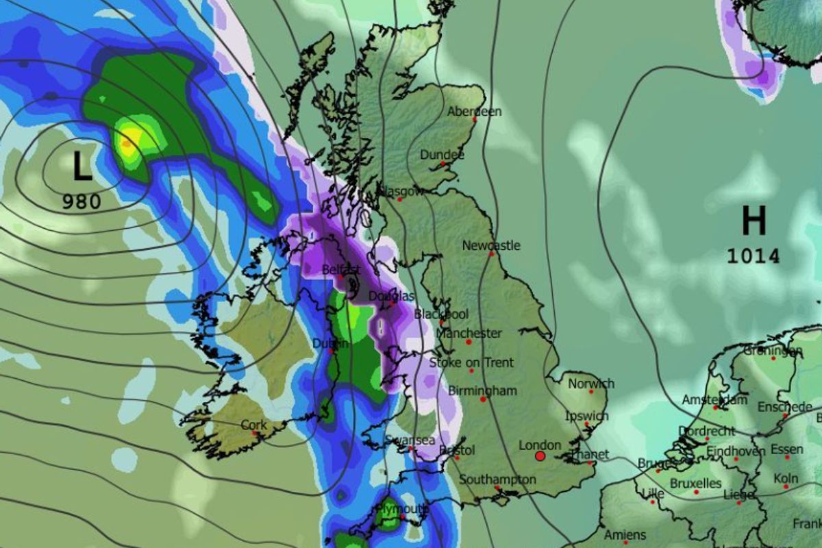
Snow will hit Northern Ireland and Wales at first on February 14, the weather maps suggest(Image: WXCharts)
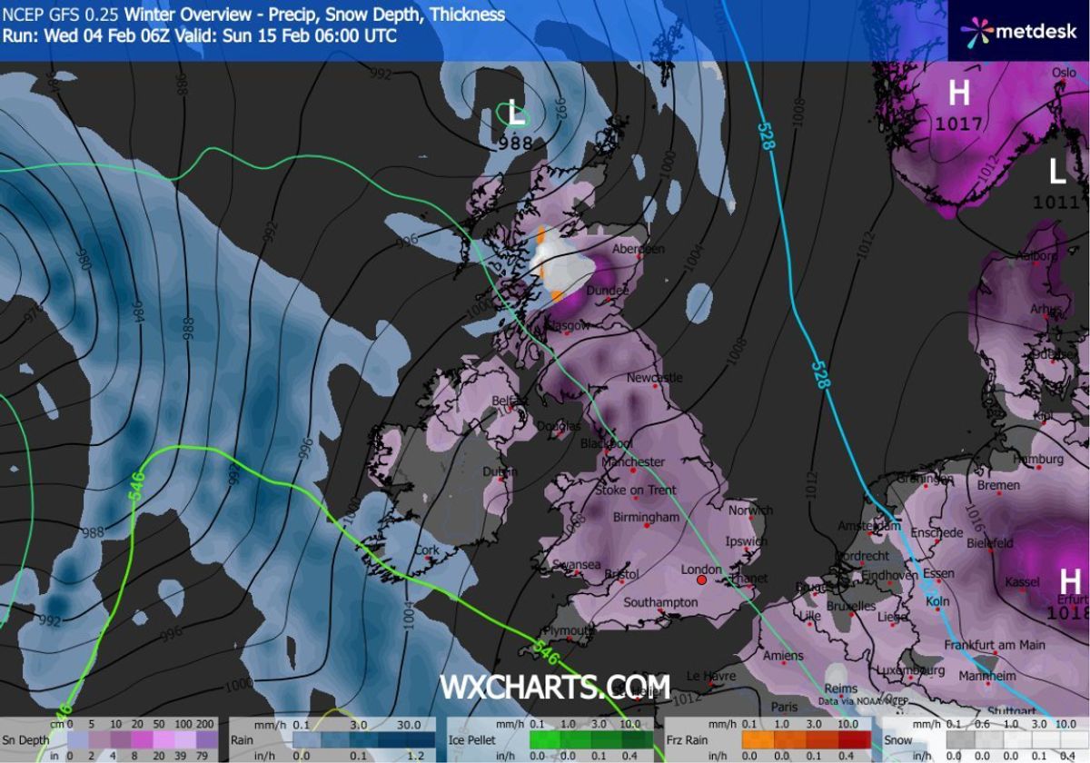
A huge blizzard could soon bring snow to almost every inch of the UK – with roughly 5 per cent of the country missing out on the white stuff.
The GFS weather model shows flurries hitting Northern Ireland and Wales at around 9am on February 14, before moving eastward throughout the day and bringing snow to England and Scotland too.
At around 3pm, the weather maps show a band of snow stretching from the south coast of England to the far north of Scotland. Several major cities including Southampton, Birmingham, Manchester, Liverpool, Edinburgh and Glasgow could see snow around this time.
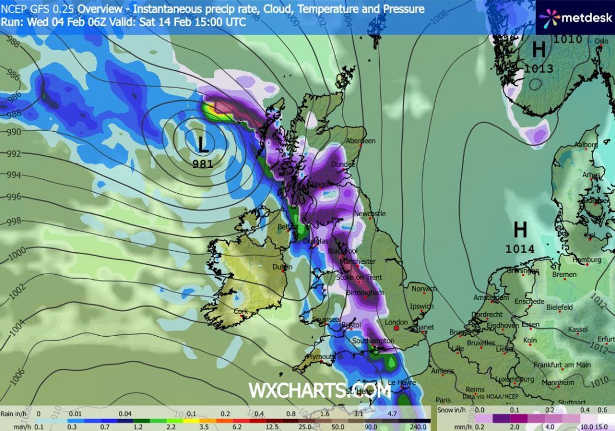
Snow will also hit Scotland and England(Image: WXCharts)
READ MORE: UK snow brings ‘very large’ hazard as AVALANCHE warnings issued in six areasREAD MORE: Met Office names places facing snow today as list of 26 areas revealed
London could see snow at around 9pm as the weather front continues to move eastwards, also hitting Yorkshire and the north-east. It will then move off into the North Sea, the maps suggest, leaving the country covered.
Snow coverage maps show almost all of the UK coloured in purple at 6am on February 15, representing snow settled on the ground. Only small parts of Northern Ireland, the south-west, East Anglia and northern coasts of Scotland are shown with no snow.
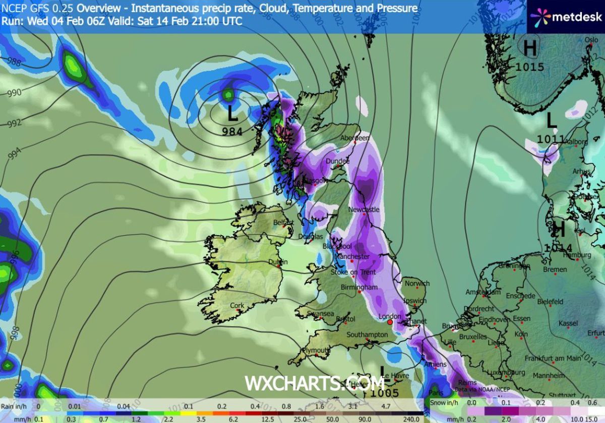
London could be in the firing line too(Image: WXCharts)
READ MORE: UK snow maps reveal 600-mile blizzard will impact millions of Brits within days
As much as 19cm (roughly seven inches) could settle on hills in northern Scotland, the data suggests, with 5cm to 6cm (roughly two inches) possible in northern England, the Midlands and Wales.
BBC Weather also suggests snow could come later this month. Its forecast for February 9 to 15 states: “Changeable conditions are expected. England and Wales should expect normal or above average amounts of rainfall, with further risks of some heavy rain and local risks of flooding, especially in south-western areas.
“The northern edges of any precipitation bands will still be susceptible to snow as they move into the colder air, mostly on northern hills.
Almost every inch of the UK will be covered in snow, the maps suggest(Image: WXCharts)
READ MORE: Snow forecast as London and Birmingham buried in winter storm covering 90% of UK
“The northward extent remains uncertain but there will be wintry showers across northern regions nonetheless, potentially to lower levels in Scotland, although here the north-west should be drier than normal.”
The Met Office says for February 9 to 18: “Cyclonic patterns are expected to dominate across the UK during mid-February. Frontal systems over the Atlantic are likely to approach the UK at times, tending to become slow moving as they encounter a blocking area of high pressure to the northeast.
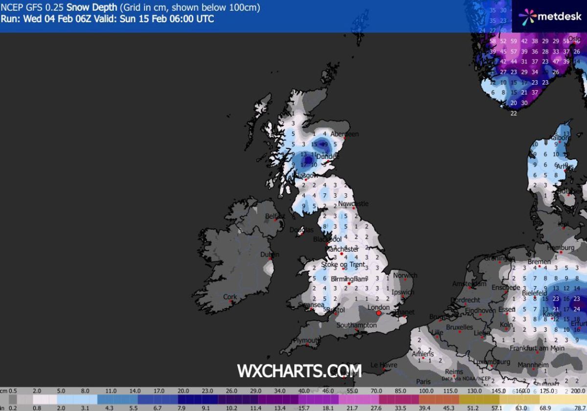
Snow depth (cm) at 6am on February 15(Image: WXCharts)
READ MORE: Met Office snow warning names 16 areas facing ‘rare and dangerous’ weather event
“This will result in showers or longer spells of rain spreading across the UK, these heavy at times. Rainfall amounts will probably be highest in parts of the west, including across areas already sensitive to flooding.
“As these bands of rain spread northwards, snow is possible across northern England and Scotland, mainly over high ground. Strong winds could develop in places, especially coasts. Temperatures will probably be close to normal overall, with any cold conditions more likely in the north.”