
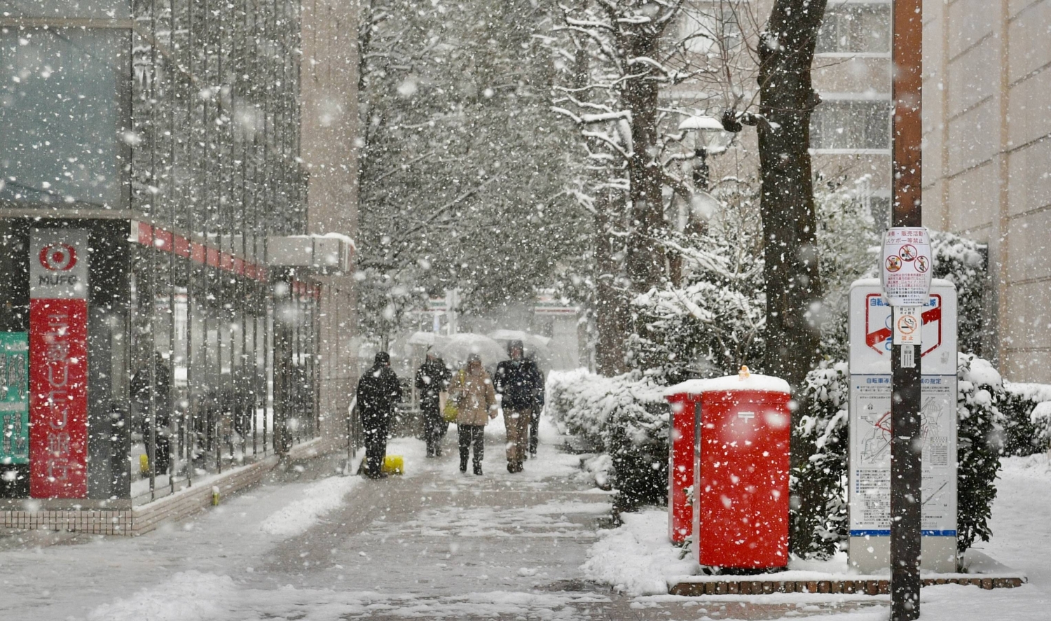
Snow blanketed swaths of Tokyo on Sunday as a powerful winter pressure pattern tightened its grip over the country.
According to the Japan Meteorological Agency (JMA), a strong winter pressure system has continued over the weekend, with frigid air flowing into the upper atmosphere.
Chiyoda Ward in central Tokyo recorded around 5 centimeters of snow as of 4 p.m. Sunday, according to the JMA, while nearby Chiba, Saitama and Ibaraki prefectures also saw up to 9 cm in some areas.
Officials warned that freezing temperatures turned roads icy, raising the risk of traffic accidents and transit delays across the greater Tokyo metropolitan area.

Stair sweeping operations near Shin-Yurigaoka Station
| Daniel Traylor

A snow-covered statue near Sensoji Temple in Asakusa, Tokyo
| Johan Brooks
Over a hundred slippery-road accidents had occurred in Ibaraki Prefecture between Saturday evening and Sunday morning, NHK reported. In Tokyo, a seven car pile-up on the Tsukuji Ohashi bridge in Chuo Ward on Sunday morning injured six, including two police officers with broken necks and backs, according to media reports.
JR East announced Sunday that many rail services across the nation would see delays or suspensions due to snowfall. In the Kanto region as of 5 p.m, the Ito, Kashima, Narita and Sobu lines were completely suspended. The Hokuriku Shinkansen was also experiencing delays.
As of 5:30 p.m., most sections of the Tomei Expressway and Shin-Tomei Expressway were closed to traffic at and around the border between Shizuoka and Kanagawa prefectures.
The heavy snowfall came during a national election and university entrance exam season. Multiple universities — including Hosei University and Chuo University — have posted notices on their websites stating that the starting time for their entrance exams had been delayed due to the snow.

Snowball collectors near Kawasaki Station in western Tokyo
| Johan Brooks

A worker clears snow from a pathway outside the Asao Ward office in Kawasaki on Sunday
| Daniel Traylor
The heaviest snowfall has been along the Sea of Japan coast, with some regions already reporting snow accumulation well above seasonal averages.
In Hokuriku, snowfall could reach as much as 60 cm over a 24-hour period from 6 p.m. Sunday, while the Kanto-Koshin region was expected to receive 50 cm, and 40 cm was expected in Hokkaido and the northern Tohoku region over the same period.
Meteorologists also warned of unstable atmospheric conditions along the Sea of Japan side from eastern to western Japan, raising the risk of lightning strikes, sudden violent gusts and possible tornadoes.

A impromptu snowman on Sunday in Tokyo
| Johan Brooks

Kimono finery in the snow in Asakusa
| Johan Brooks
Blizzard conditions and powerful winds are expected in parts of northern and western Japan, with gusts up to 30 meters per second predicted in the Tohoku and northern Kyushu regions.
Warning-level high waves are forecast along coastal areas for Monday, with forecasts of 6 meters per second in the Izu and Ogasawara islands and 5 meters per second on the Hokuriku coast.
The weather pattern was expected to persist through Sunday, as the system’s pressure trough moves southward from southern Kanto toward the Izu islands, with heavy snowfall also forecast for mountainous areas on Monday morning.
Authorities are urging residents in heavy snowfall areas to remain alert for avalanches, falling snow from rooftops and snow buildup on power lines and trees.