
Britain is forecast to be battered by five days of snow next week, with weather maps showing up to 51 inches in Scotland, and freezing temperatures grip the entire UK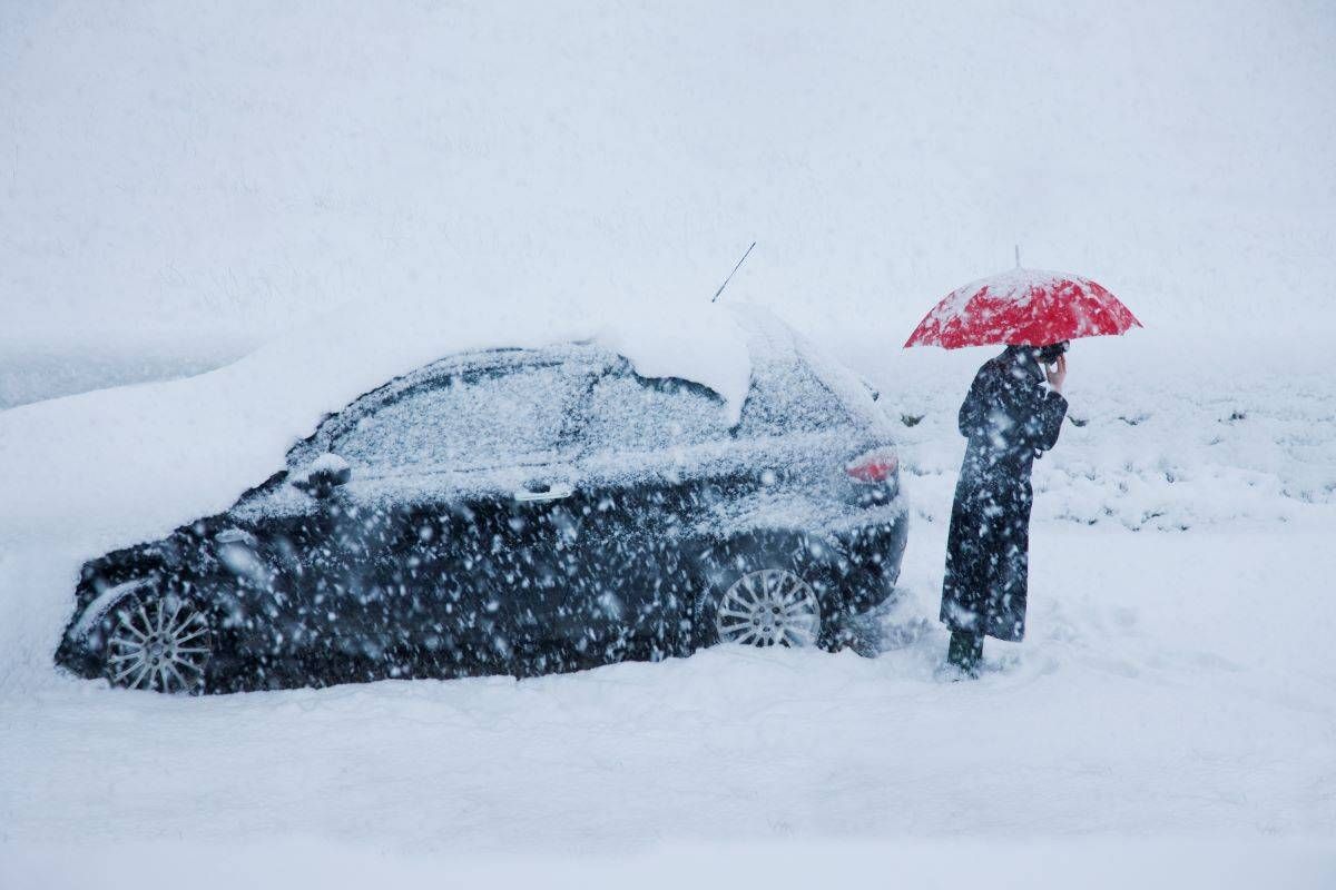
Snow will be heaviest in Scotland(Image: WXCHARTS)
The UK is bracing for a deep freeze, with snowfall predicted to sweep across the country soon. This follows recent snowfall that has already blanketed large parts of Britain at the start of 2026.
Weather maps from WXCHARTS indicate that snow will descend from Friday, 13 February to Tuesday, 17 February. The latest projections suggest the snow will begin on the Friday, with Scotland potentially seeing up to 51 inches.
By 6am, snowfall rates could reach up to 20mm per hour, affecting north Wales, the Midlands and the East of England. On Sunday, 15 February, at 6am, the maps reveal a cold front sweeping across the UK.
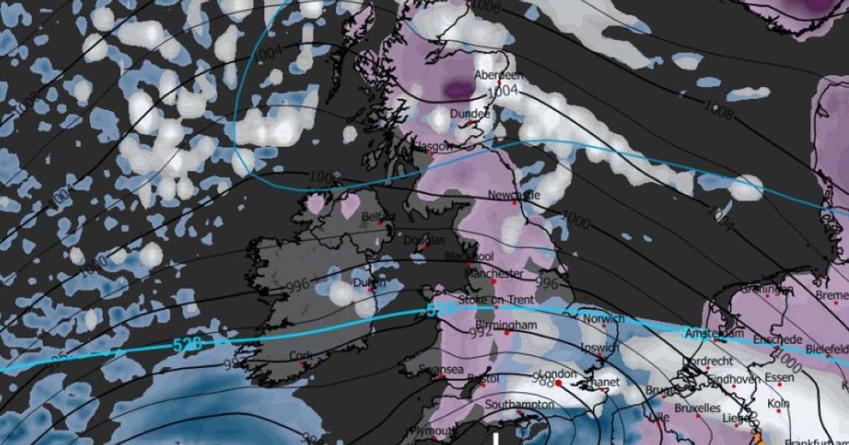
Icy blue hues represent temperatures between 0C and -3C across the entire country, with only the southernmost part of Cornwall experiencing slightly warmer conditions around 8C.
READ MORE: UK snow: Horror maps show 450-mile blizzard burying 29 cities in just DAYSREAD MORE: Pizzo Meriggio avalanche tragedy as two dead and major search operation launched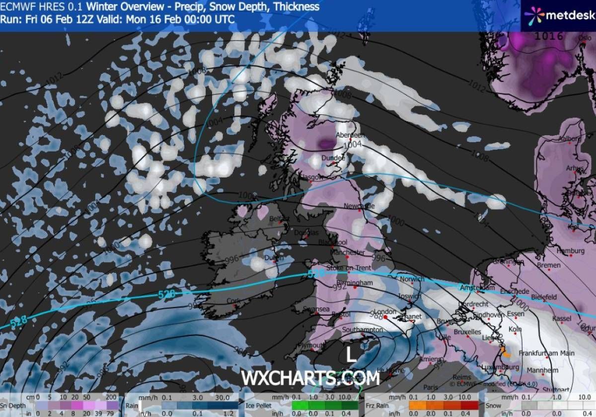
Snow is indicated by purple on the map(Image: WXCHARTS)
Valentine’s Day may see a slight reprieve in the weather, but patches of rain and snow are still expected, primarily in Scotland and Wales, reports the Express. By midnight on Monday, 16 February, extensive areas of the country are forecasted to be blanketed in snow.
The maps depict almost the entirety of the UK swathed in purple, signifying snowfall. It extends from the Scottish Highlands all the way down to Plymouth, with very few regions escaping.
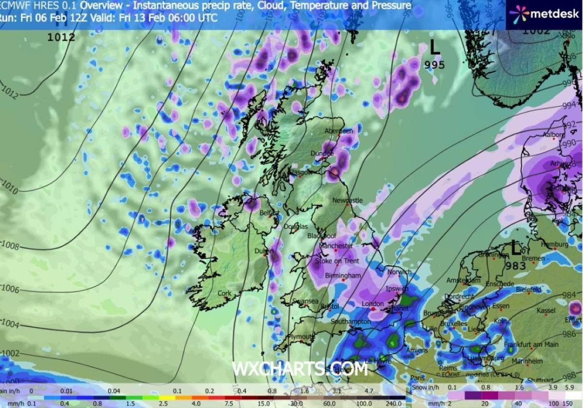
Maps show rain will also hit some areas(Image: WXCHARTS)
By Tuesday, 17 February, the snow is predicted to reach as far south as the Midlands, while the south of England appears to be drier. However, the Met Office cautions that forecasting snowfall is notoriously challenging.
A Met Office forecast states: “Predominantly cyclonic patterns are expected to dominate the UK. The early part of this period could see colder conditions becoming established more widely for a time, bringing with it the likelihood of some snow.
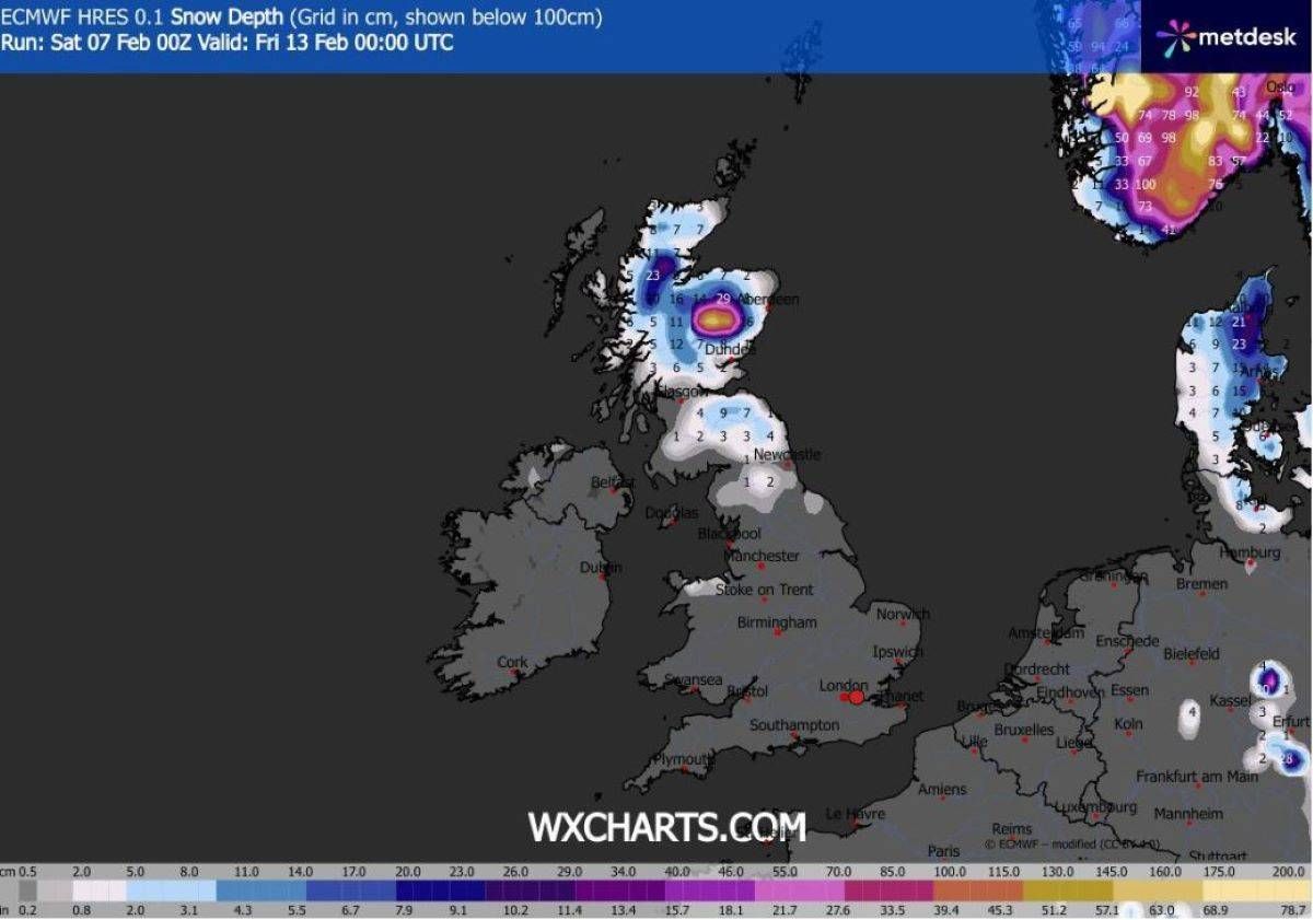
Snow depth maps show the high levels of snow will be in Scotland(Image: WXCHARTS)
“Milder and wetter weather may however hang on in the far south. By the end of this period, the track of Atlantic depressions may shift a little further north than during the last few weeks.
“This will maintain broadly unsettled weather, with further spells of rain and perhaps strong winds at times.
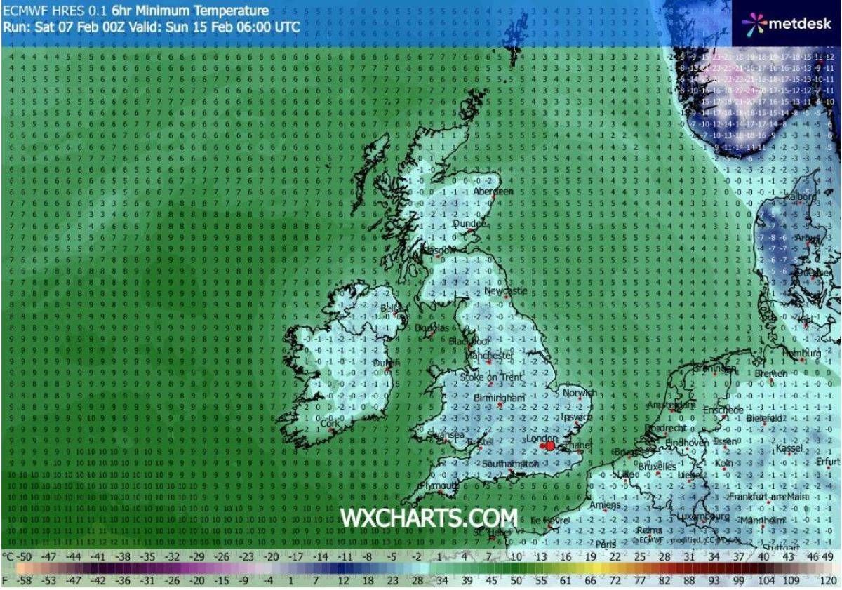
Temperatures will reach lows of -3C in some areas(Image: WXCHARTS)
“Many parts may become somewhat milder, given more of a westerly influence, though there remains the chance that colder conditions could linger towards the northeast.”