
Descrease article font size
Increase article font size
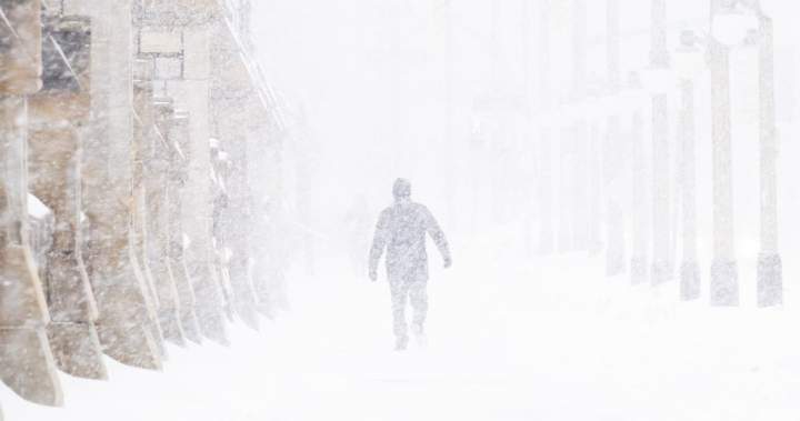
Old man winter isn’t done with Ontario yet with extreme cold temperatures forecast for much of the province.

Yellow alert cold warnings are in place for numerous communities, reaching as far south as Windsor and the Greater Toronto Area as well as east to Ottawa and north to Kapuskasing.
Environment Canada says wind chill values could hit between -30 C and -40 C this morning depending where you live.

Get daily National news
Get the day’s top news, political, economic, and current affairs headlines, delivered to your inbox once a day.
Northern Ontario residents are mostly like to see the coldest values, some of which will break as the day goes on. But the agency warns that much of southern Ontario, including the Greater Toronto Area and Ottawa, will see -30 C wind chills through Sunday evening and into Monday morning.
Trending Now

Bodies found in area in Mexico where search is on for 10 missing workers from Canadian mine

Canadian Tire ordered to pay nearly $1.3 million for false advertising
Both the GTA and Ottawa have already endured some effects of the cold snap, with wind chills on Saturday reaching -34 C in Ottawa and -33 C in the GTA.
Story continues below advertisement
Ontario’s weather is a stark contrast to what’s being seen in the West, where balmy conditions have broken daily temperature records in both Alberta and B.C.
More on Toronto
More videos
© 2026 Global News, a division of Corus Entertainment Inc.