
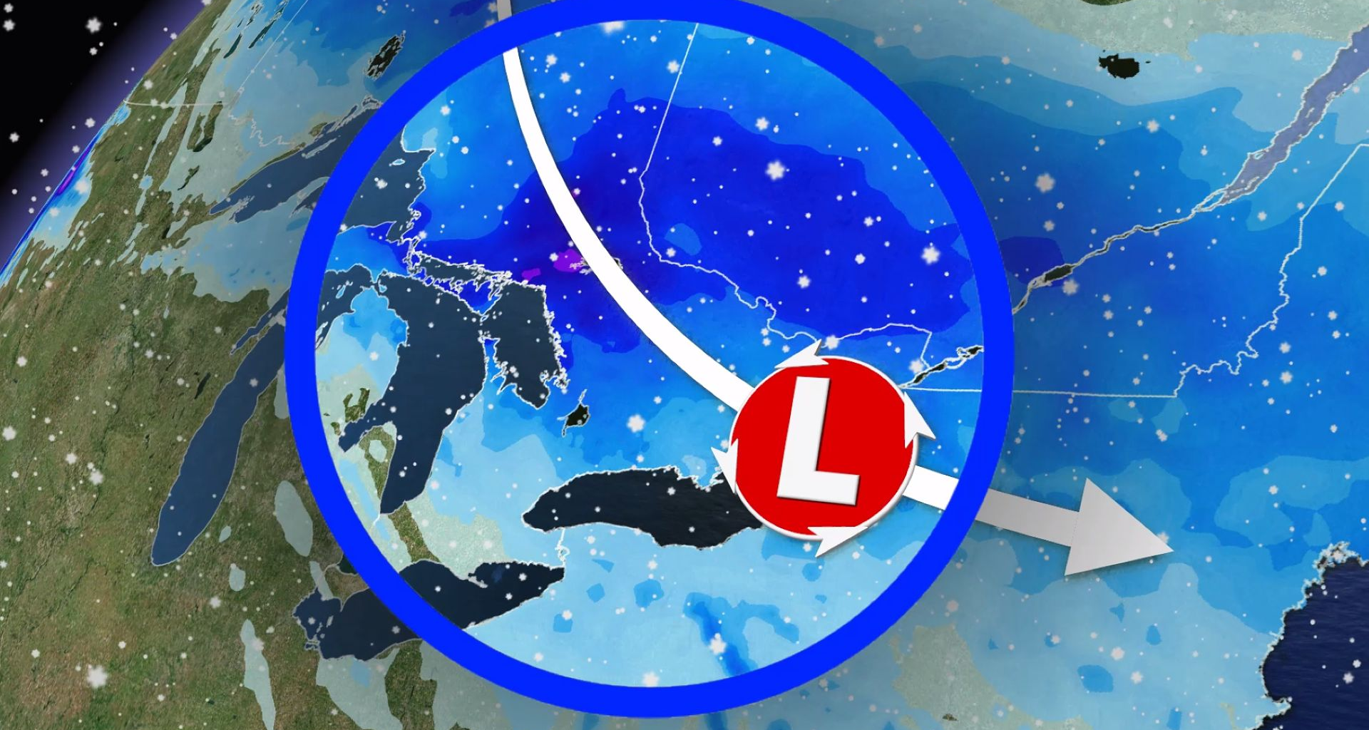
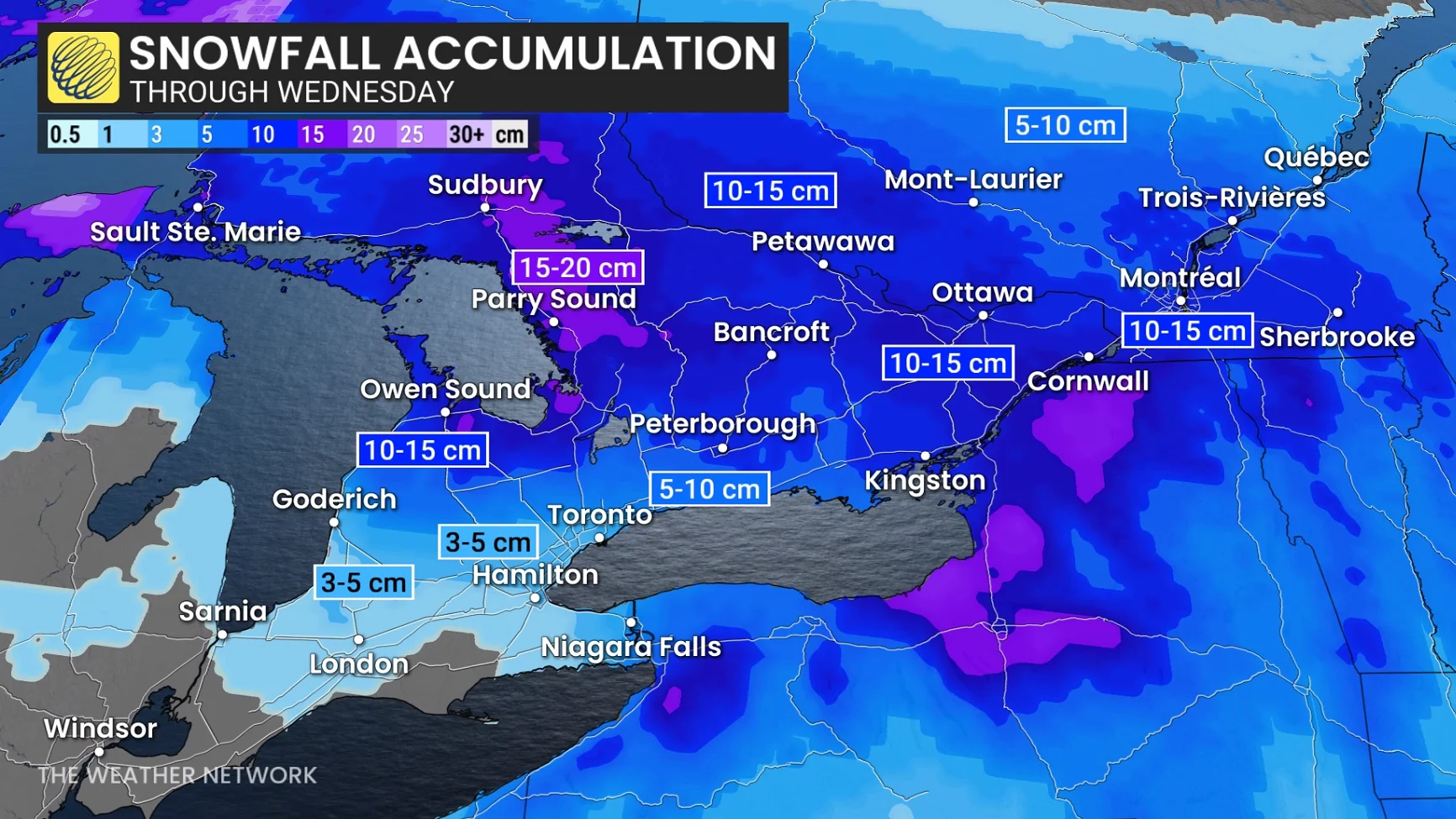
The system will lift north into eastern Ontario, including Ottawa, by the afternoon. Folks can expect 10-15 cm of snowfall by Wednesday morning.
As the system lifts northward, we’ll see a near-seasonal air mass lift into the province behind it.
Daytime temperatures on Tuesday are forecast to rise above zero on Tuesday for southwestern Ontario. Toronto may also see the thermometer rise above zero on Tuesday, ending the city’s sub-zero cold streak. Southwestern Ontario will likely climb above the freezing mark by a few degrees.
DON’T MISS: Canada’s 2025-26 winter report card: Did your province pass?
The rest of the province, including parts of northern Ontario, will also see a welcome, seasonal warm-up. Temperatures will still be below zero but will be much more bearable for anyone spending time outdoors.
On Wednesday, temperatures will still be cold enough for continued, scattered snowflurries off Lake Huron with some snow that could also accompany the trough swinging passed.
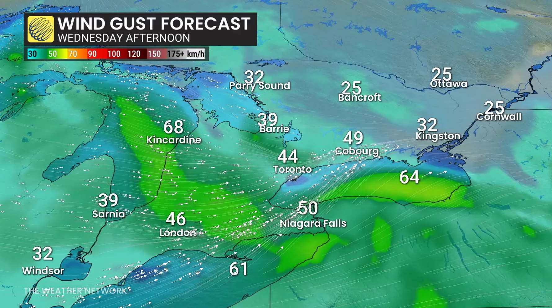
Blustery winds are forecast as a trough swings through central and southern Ontario, with gusts 40-60 km/h so watch for blowing snow, and hazardous travel at times with slick roads and reduced visibility.