
Major cities including London and Birmingham look set for snow this week as advanced weather forecasting maps suggest a blizzard could bring several inches to some regions
16:59, 09 Feb 2026Updated 07:57, 10 Feb 2026
UK weather map forecasts rain and snowfall
Several inches of snow could fall before the end of this week as weather maps suggest a huge blizzard is on its way to the UK.
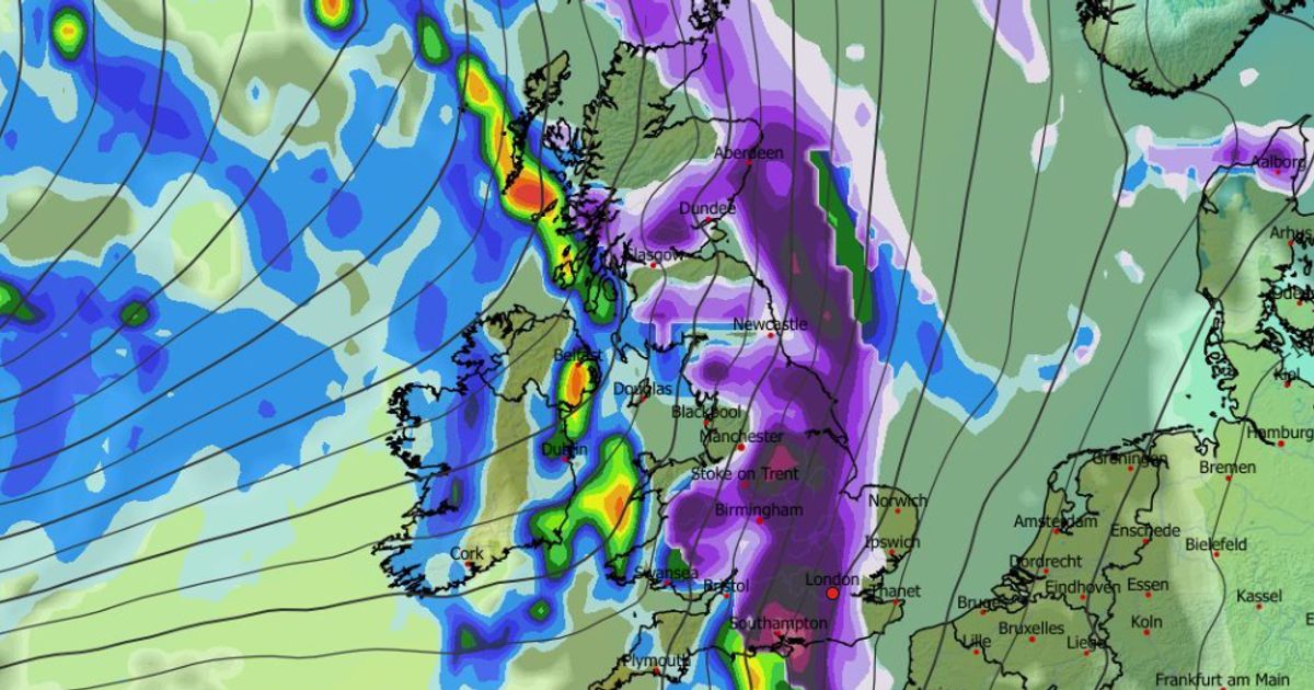
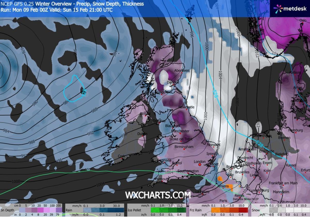
The GFS weather model shows snow sweeping across the UK on Sunday, hitting almost every inch of England, Wales, Scotland and Northern Ireland. Major cities including London, Birmingham, Cardiff, Manchester, Newcastle, Belfast and Edinburgh all appear to be in the firing line.
Flurries are first expected in Northern Ireland and western regions at around 3am on Sunday. The snow is then expected to drift eastwards throughout the day. At around 6am, maps show heavy snow falling across all of Wales, most of Scotland, the north-west of England, the West Midlands, and even some parts of southern England.
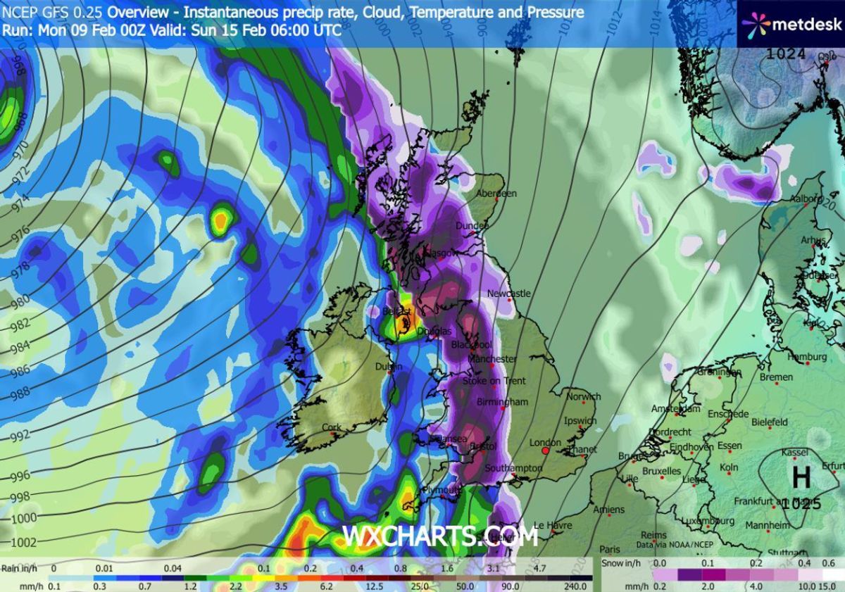
Snow will drift across the UK throughout the day, maps suggest(Image: WX CHARTS)
READ MORE: Snow maps show 90% of UK to be hit by 24-hour blizzard with 16 inches expectedREAD MORE: Snow maps show 16 counties buried as 2 day blizzard hits England – full list
And by midday flurries are expected to hit London as well as Yorkshire and the north-east. The data suggests the most intense snow will be falling over Southampton around this time.
The weather front is tracked to move off into the North Sea from 6pm, with snow passing over East Anglia too. By the end of the day, snow could be settled on the ground across roughly 90 per cent of the country.
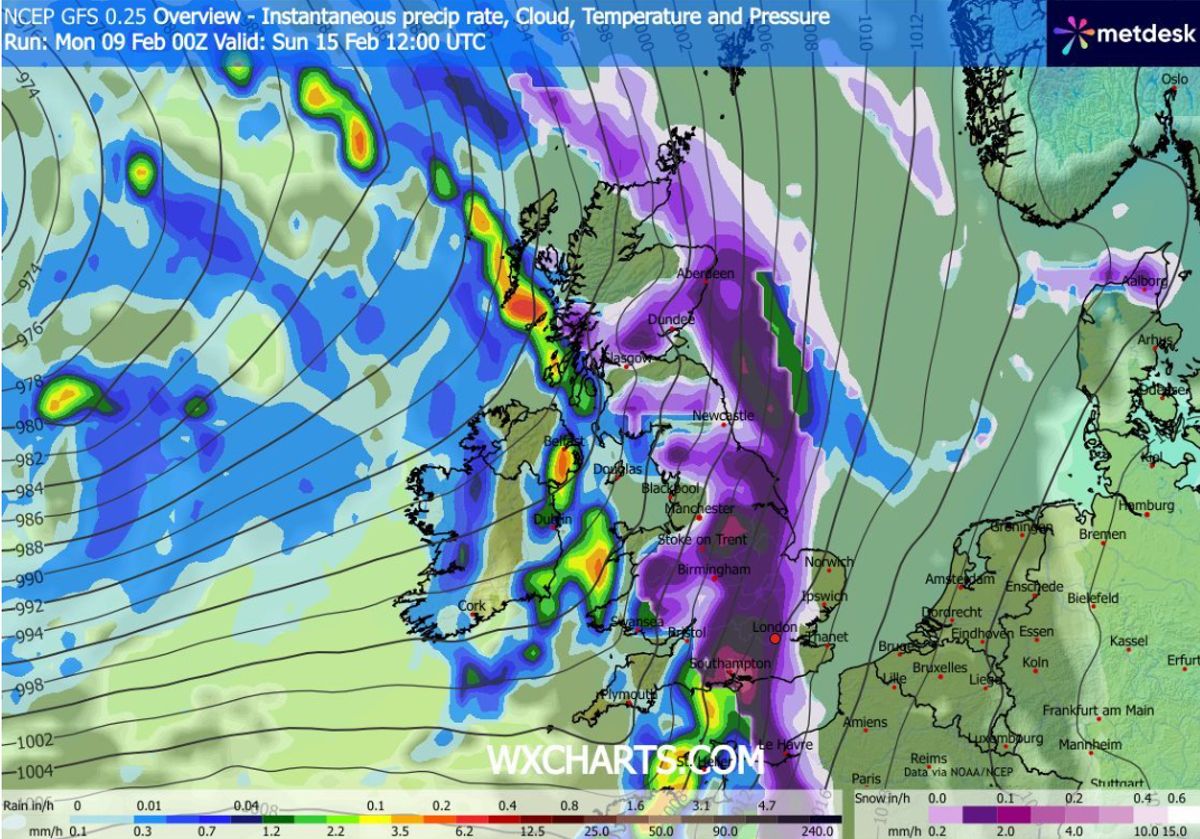
Snow could hit London at around midday(Image: WX CHARTS)
READ MORE: UK hit by week-long sunlight blackout as wet and windy weather drags on
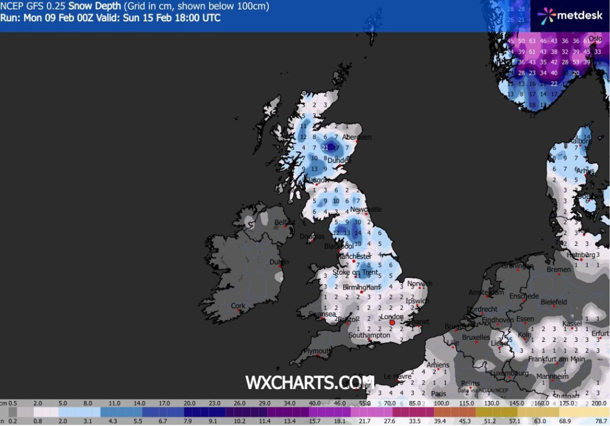
Snow coverage maps show only the south-west of England, parts of Wales and parts of Northern Ireland won’t have snow settled on the ground. Snow depth charts suggest as much as 21cm (eight inches) could settle on the ground over hills in Scotland, with 14cm (six inches) in northern parts of England. The Midlands and parts of Wales could see 5m (two inches).
The Met Office says “colder conditions” could impact some parts of the UK later this month. Its forecast for February 14 to 23 states: “After a briefly quieter spell, associated with some colder conditions, Atlantic frontal zones look to make a return near the start of this period.
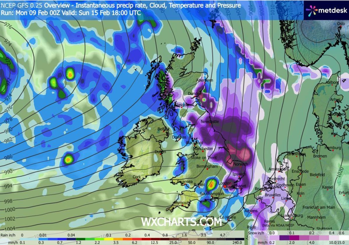
Snow will move off into the North Sea at around 6pm(Image: WX CHARTS)
READ MORE: UK snow maps reveal when 600-mile storm will bury cities including London
“The track of these depressions may be a little further north than over the preceding weeks, but will continue to bring broadly unsettled weather to many areas, with further spells of rain and perhaps strong winds at times.
“With the westerly influence, it should become somewhat milder for many, though there remains the chance that colder conditions could affect northern and northeastern parts from time to time.”
Most of the UK will be covered in snow, maps show
READ MORE: Snow maps reveal 51 cities in England to be buried by twin blizzards – full list
BBC Weather’s forecast for next week states: “The week may start cold with some wintry showers, but atmospheric patterns could shift again. High pressure to the north will most probably weaken and even be replaced by low pressure developing near Iceland by the end of the week.
“That should allow south-westerly wind flows to develop at times, bringing milder air across the UK, although Scotland may still be chillier with temperatures close to seasonal values.
Snow depth (cm) at 6pm on Sunday
READ MORE: Met Office names where will see snow before Saturday – full list of 10 areas
“Inevitably, this more Atlantic-driven regime will bring periods of wet and windy weather as frontal systems cross the UK, and above-average rainfall amounts are expected.
“This could exacerbate local flooding issues in parts of south-western UK in particular. There could be snow on the colder leading edge of these rain bands, especially over higher ground in northern areas. Brighter interludes could be just chilly enough for wintry showers on hills elsewhere.”