
New weather maps show a two-day blizzard is set to sweep the country on February 16 and continue into February 17 with many Brits waking up to 10cm of snow as drifts bury 16 areas
10:34, 09 Feb 2026Updated 08:27, 10 Feb 2026
UK weather map forecasts rain and snowfall
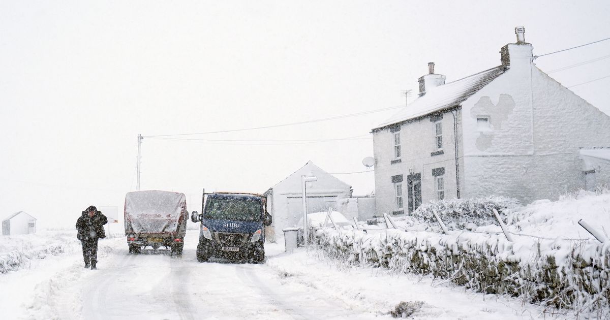
A two-day blizzard could sweep parts of England next week, Brits have been warned, as 16 counties are forecast to be hit.
Heavy snow is forecast to bury parts of the UK as a weather front moves across the country on February 16 and February 17, according to WXCharts.
The latest weather model shows snow spreading in from over the Irish sea as bands of the white stuff blow east across the UK. Northern and eastern areas of England as well as much of Scotland are due to see the brunt of the snowfall, but many other areas may see flurries too.
Snowfall will start develop on February 16 and continue into February 17, with disruption possible in some areas. A band of rain moving across the UK from west to east is due to collide with cold air, causing the first snow to start falling at around midnight on February 16.
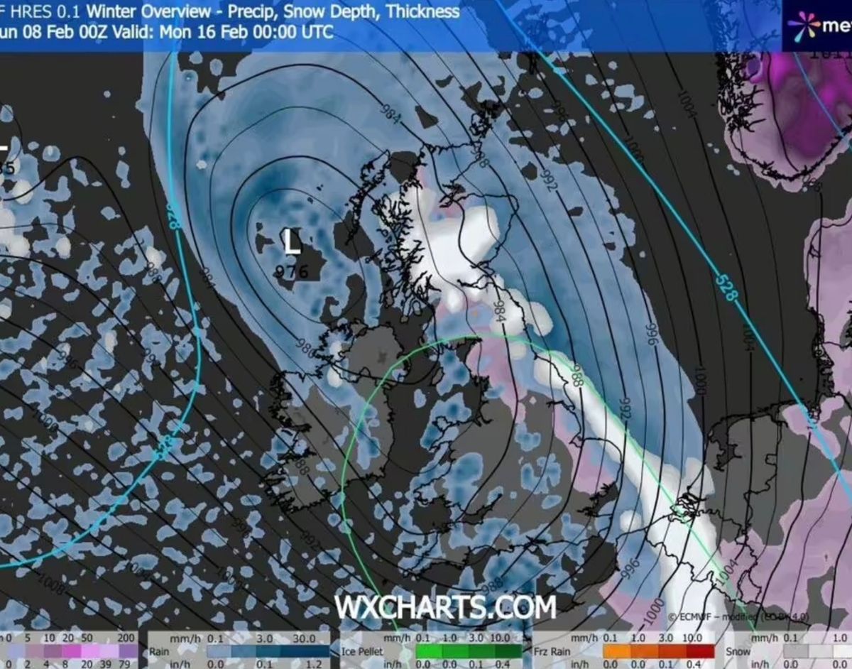
Weather map for February 16 at midnight(Image: WXCHARTS)
Areas in Suffolk, Norfolk, Lincolnshire, Yorkshire and the north east can expect to see flurries, The Express reports.
In more southern areas the precipitation will move on overnight but snow will remain over Cumbria, Northumberland, Lancashire, North Yorkshire and much of Scotland.
Many Brits could wake up to as much as 10cm of settled snow, while people in the worst-affected areas in Scotland will have to battle double that amount.
The snow will turn back into rain as temperatures rise later in the morning with a band of wet weather moving across the country. However the snow looks set to return as the sun sets and temperatures drop, with a belt of snow falling over much of the Midlands, spreading north west and into Wales.
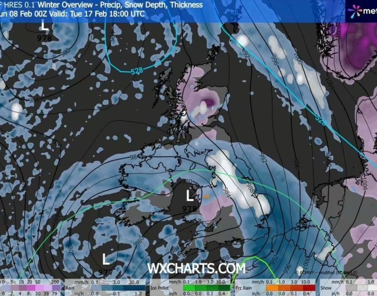
Weather map for February 17 at 6pm(Image: WXCHARTS)
As the cold temperatures persist, any snow that falls is likely to settle, and the freeze brings with it an increased chance of icy conditions overnight as well as possible travel hazards like black ice come morning.
The Met Office long-range forecast also warned that February could still bring wintry weather, particularly when low-pressure systems interact with colder air across the UK.
The Met Office said: “Predominantly cyclonic patterns are expected to dominate the UK.
“The early part of this period could see colder conditions becoming established more widely for a time, bringing with it the likelihood of some snow, primarily to the north and northeast.
“However, this should offer a few days respite from the wet weather across the south. By the end of this period, the track of Atlantic depressions may shift a little further north than during the last few weeks.
“This will maintain broadly unsettled weather, with further spells of rain and perhaps strong winds at times.”
Full list of the affected counties:County DurhamCumbriaDerbyshireEast YorkshireGreater ManchesterLancashireLeicestershireLincolnshireMerseysideNorfolkNorth YorkshireNottinghamshireNorthumberlandSouth YorkshireSuffolkWest Yorkshire