
If you’ve got Valentine’s Day or Mardi Gras plans, you’ll want to pay close attention to the forecast.
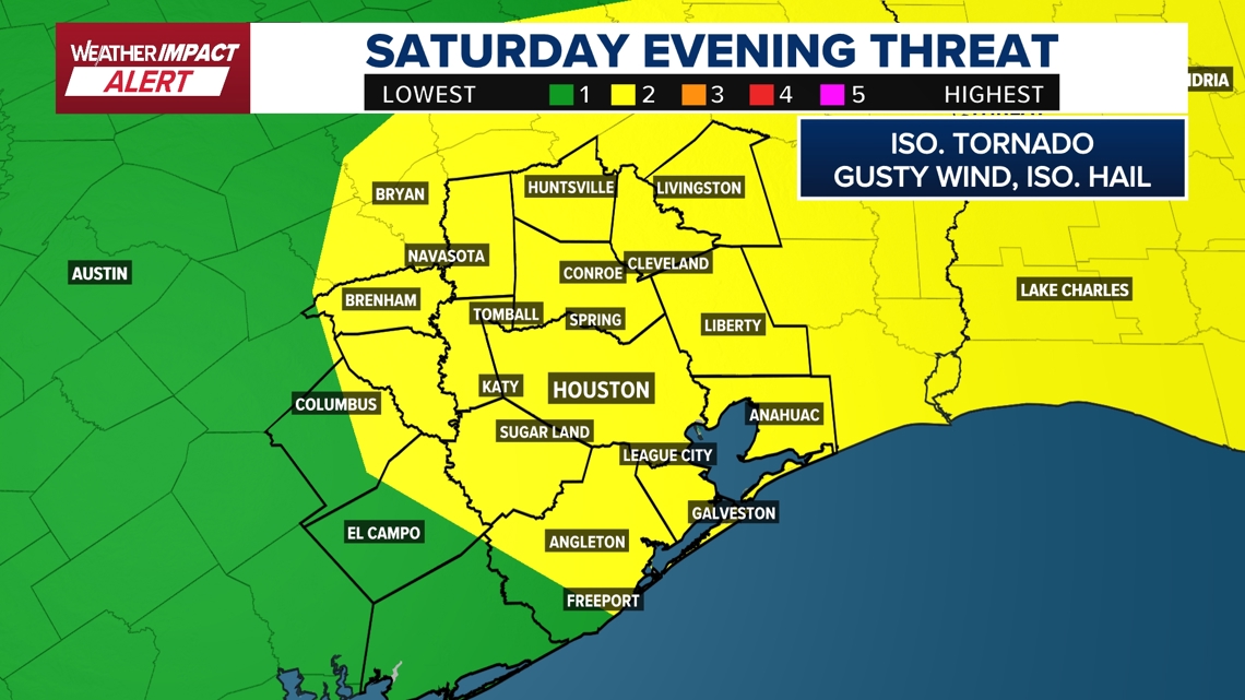
HOUSTON — If you’re out and about on Saturday, keep a close eye on the radar, especially in the evening hours. The Storm Prediction Center just upgraded the chance for severe weather. The Houston area is now under a threat level 2 out of 5. (What threat levels mean)
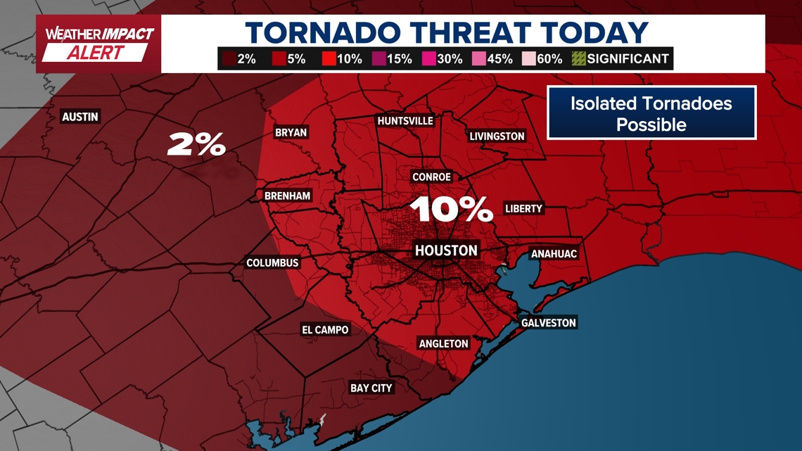
The biggest concern is going to be strong winds and a few tornadoes, according to KHOU 11 Meteorologist Kim Castro.
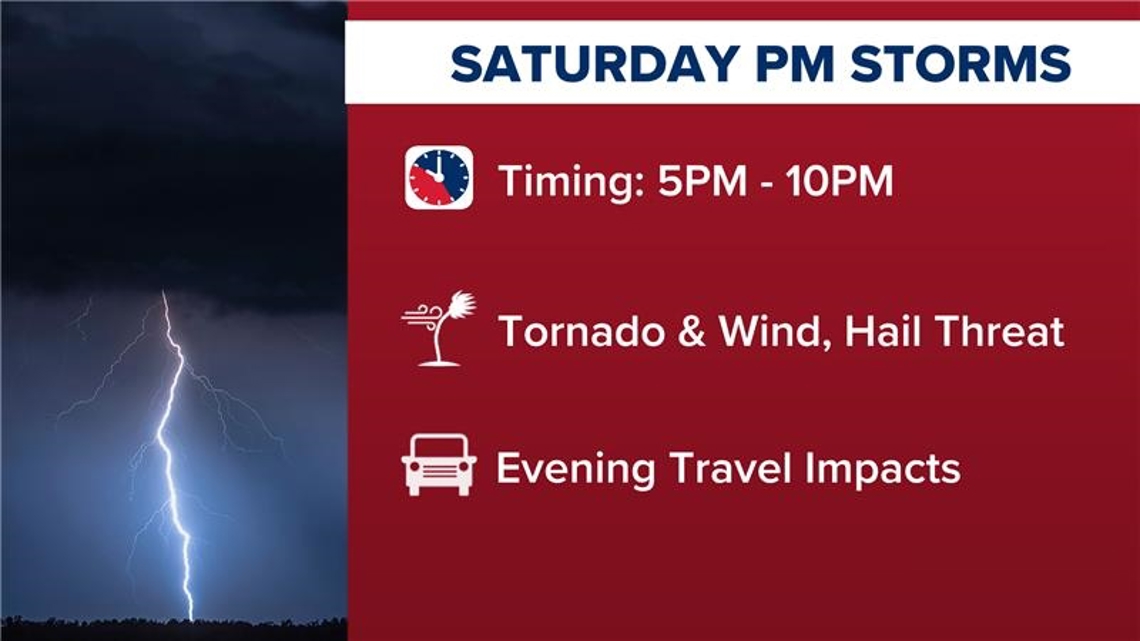
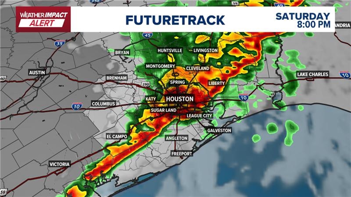
The Weather Impact Alert will be for the entire day Saturday, but the timeframe to really monitor is 5 p.m to 10 p.m. You don’t want to be out on the road during that time. New models put the line in Brenham by 5 p.m, downtown at 8 p.m., and in Galveston at 10 p.m. That could cause big problems for the big Mardi Gras parade. Event organizers say the parade will go on rain or shine, but weather conditions could delay it.
KHOU 11 will have regular updates on KHOU 11+ to provide the very latest timing of the storms. Download on your TV and watch for free.

Saturday morning
Saturday begins relatively calm.
The morning hours are expected to be cloudy with a couple of light, spotty showers across the area. Severe weather is not the main concern early in the day.
However, the Storm Prediction Center has upgraded Southeast Texas — extending into Louisiana — from a Level 1 to a Level 2 threat. That means storms expected later in the day have a higher likelihood of becoming stronger.
Because of the upgrade, a Weather Impact Alert has been issued for the entire day Saturday.

Saturday afternoon
By the afternoon, the system begins to evolve.
A line of storms is expected to develop first in northwestern cities and counties. Around 5 p.m., that line pushes through those areas and begins moving toward central Houston.
The later it gets, the higher the threat becomes.
Saturday evening
The most significant impacts are expected between 5 p.m. and 10 p.m.
The line of storms is forecast to pass through downtown Houston around 8 p.m., then continue pushing south toward Galveston by 10 p.m.

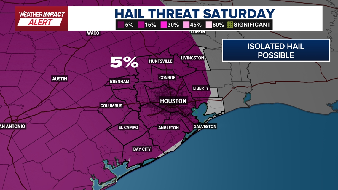
With the upgraded threat level, a couple of storms could produce damaging wind gusts, small hail, and there is the possibility of a few tornadoes.

Travel is not recommended during this window. Residents with Valentine’s Day plans or those of you on the island for the big Mardi Gras parade may need to make adjustments.

Late Saturday night
By 10 p.m., the storms are expected to be moving toward Galveston and coastal areas as the line continues progressing southeast.
The system’s strength increases as the day unfolds, making evening hours the period of greatest concern.
The better chance for one or two stronger storms appears to be along and north of Interstate 10, meaning northern parts of the area have the highest risk Saturday evening.
The storms are tied to a cold front moving in with a developing low-pressure system. That front will lift the atmosphere and pull in both Pacific and Gulf moisture, sparking showers and thunderstorms ahead of it before pushing through the region.
Sunday
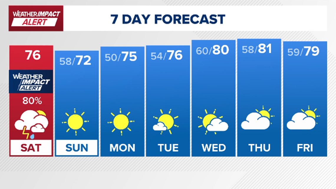
Conditions improve quickly after the front moves through. Skies clear by mid-morning Sunday, leading to a sunny and beautiful afternoon. Morning lows will be in the 50s, with highs reaching about 72 degrees. It will be cooler than recent days but still comfortably warm, making Sunday the clear winner of the weekend.
Looking Ahead
Dry and pleasant weather continues into early next week. President’s Day looks beautiful, and temperatures gradually warm again, with highs creeping back toward 80 by Wednesday and Thursday.
Despite Saturday’s rain chances, the region remains in drought, and one fast-moving system will not be enough to make a significant dent in dry conditions. For now, the focus is on navigating Saturday evening’s storms, especially for anyone with outdoor Valentine’s Day or Mardi Gras plans, before enjoying a sunny finish to the weekend.

Harris County (including Houston, Pasadena, Baytown), Fort Bend County (Richmond, Sugar Land, Missouri City), Montgomery County (Conroe, The Woodlands), Brazoria County (Angleton, Pearland, Alvin, Lake Jackson), Galveston County (Galveston, League City, Texas City), Liberty County (Liberty, Cleveland, Dayton), Walker County (Huntsville, New Waverly), Waller County (Hempstead, Prairie View, Waller), Polk County (Livingston, Corrigan), Chambers County (Anahuac, Mont Belvieu, Winnie), Wharton County (Wharton, El Campo), Washington County (Brenham), Matagorda County (Bay City, Palacios), Grimes County (Anderson, Navasota), Austin County (Bellville, Sealy), Colorado County (Columbus, Eagle Lake, Weimar), Trinity County (Groveton, Trinity).