
Another blizzard could bring widespread snow across the UK next week following a weekend of wintry weather chaos – cities including London and Birmingham are in the firing line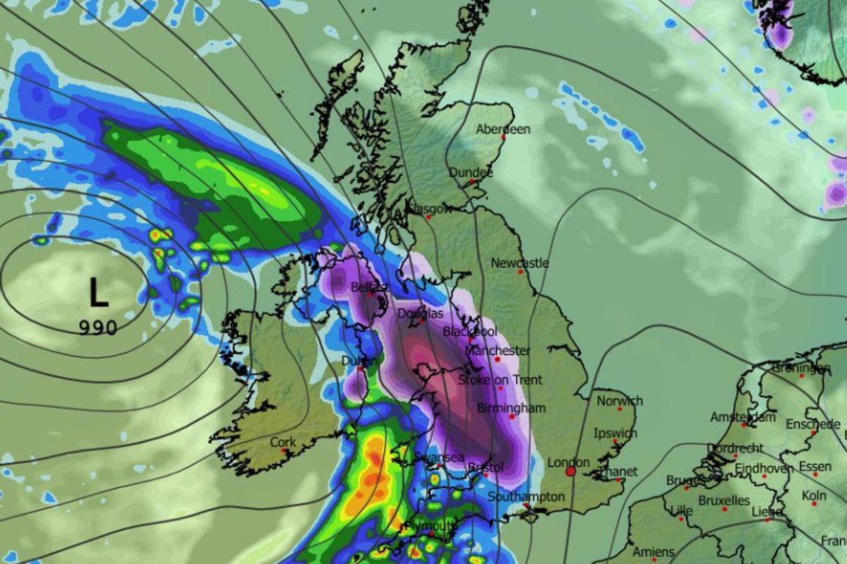
More snow could come at midnight on Tuesday, according to forecasting maps(Image: MetDesk)
While the Met Office has issued a number of weather warnings for snow and ice, covering almost every inch of the UK this weekend, a second blizzard looks set to batter the country next week.
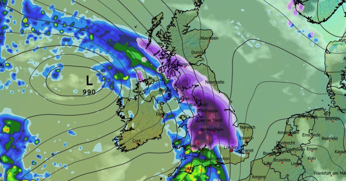
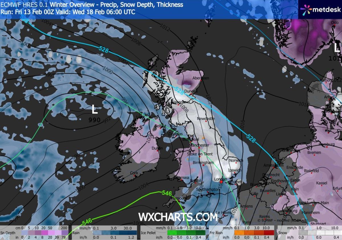
The ECMWF weather model shows snow and heavy rain hitting the UK at around midnight on Tuesday, with flurries set to bury Northern Ireland, Wales and western parts of England to begin with.
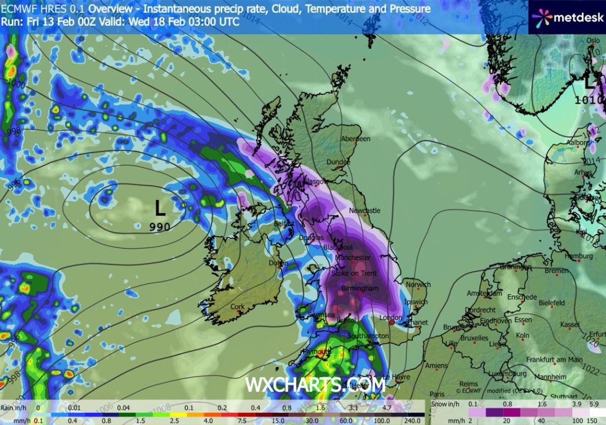
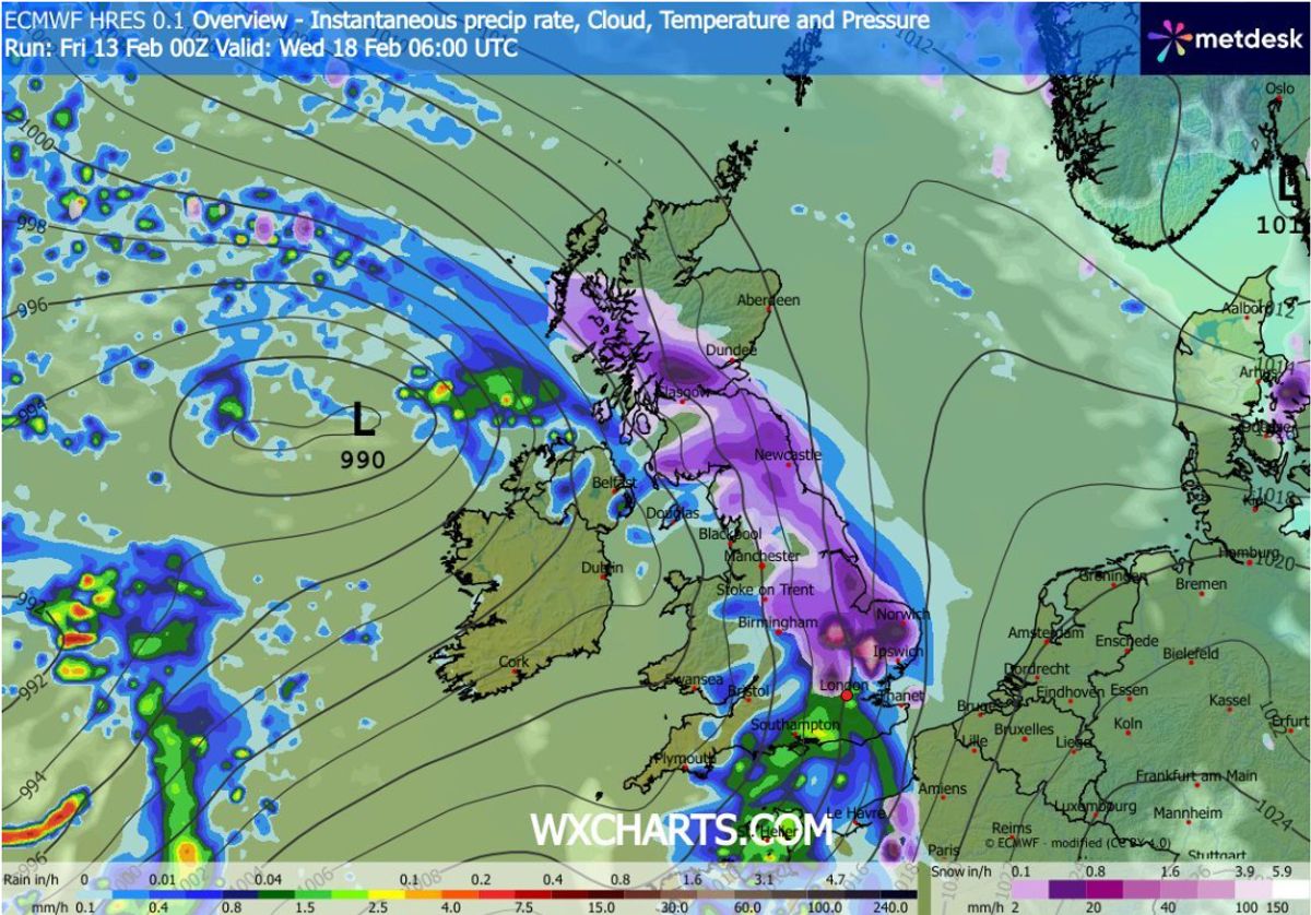
The maps show snow moving across the country on Wednesday morning, engulfing most of central and northern England by around 3am. Scotland could also see snow around this time. Major cities including London, Birmingham, Manchester, Liverpool, Cardiff and Glasgow could all see snow at around 3am. While by 6am, maps show the heaviest snow falling in the East Midlands and East Anglia.
Several major cities appear to be in the firing line(Image: MetDesk)
READ MORE: Snow maps reveal ‘wet’ phenomenon ‘perfect for building snowmen’ is coming to UKREAD MORE: Snow maps reveal 95% of UK buried in Valentine’s Day blizzard including London
Where snowfall is most intense, the data suggests it could be falling at a staggering rate of around four inches per hour. The snow is expected to subside shortly after 6am, meaning millions could wake up to the white stuff.
Snow coverage charts show almost part inch of the UK – barring the southern most regions of England – will have snow settled on the ground by 6am. While snow depth charts show several inches could accumulate.
Snow could fall at a rate of around four inches per hour(Image: MetDesk)
Low-lying areas of Scotland could see 7cm (2.8 inches), while the North Pennines could see 9cm (3.5 inches). Wales could see as much as 8cm (3.1 inches), with the Midlands possibly seeing 6cm (2.3 inches).
BBC Weather also suggests snow could come next week. However, it also warns that flooding is on the cards in several areas, as heavy rain is also expected.
Huge swathes of the UK will be covered by snow(Image: MetDesk)
Its forecast for next week states: “The widespread cold will be temporary, with high pressure to the north most probably weakening and even getting replaced by weak low pressure developing near Iceland by the end of the week.
“That should allow broadly south-westerly wind flows to develop at times, bringing milder air across the UK. Although Scotland may still be chillier with temperatures close to seasonal overall, or slightly below. There is higher confidence for a milder period in southern regions of the UK.
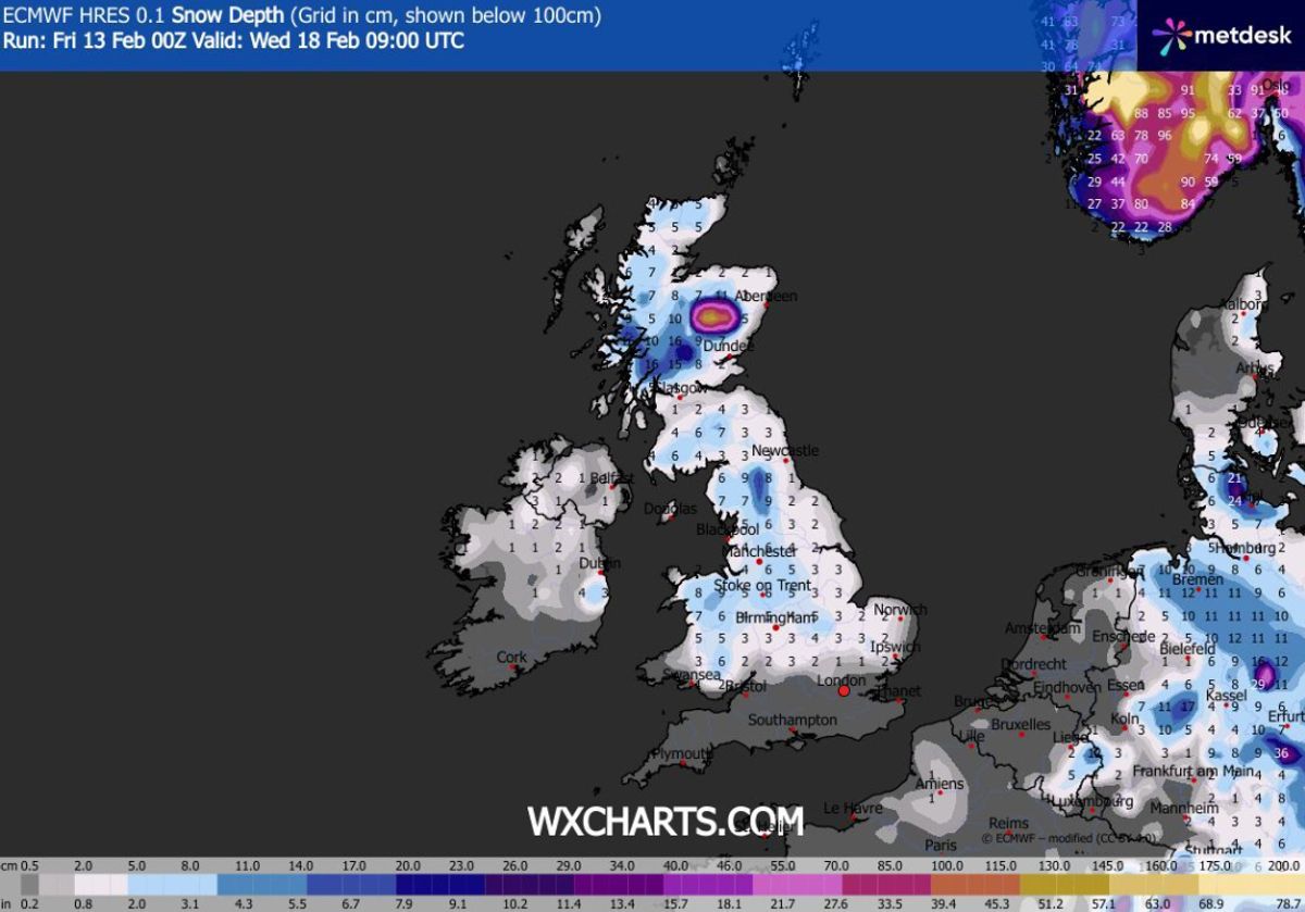
Snow depth (cm) at 9am on Wednesday(Image: MetDesk)
“This more Atlantic-influenced regime will bring periods of wet and windy weather as frontal systems cross the UK, and above-average rainfall amounts are expected.
“This could mean further risks of local flooding, particularly in parts of southern and south-western UK, and in South Wales. There could be snow on the colder leading edge of these rain bands, especially over higher ground in northern areas.
“There is a signal for high pressure to build over the eastern Atlantic between weather systems, delivering brighter but chillier interludes with some wintry showers on north to north-westerly winds.”