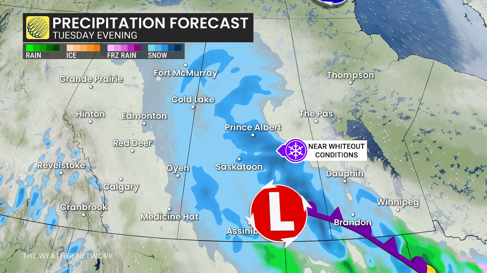
Farther east, a wintry mix will develop across southwestern Manitoba Tuesday evening before transitioning to snow Tuesday night.
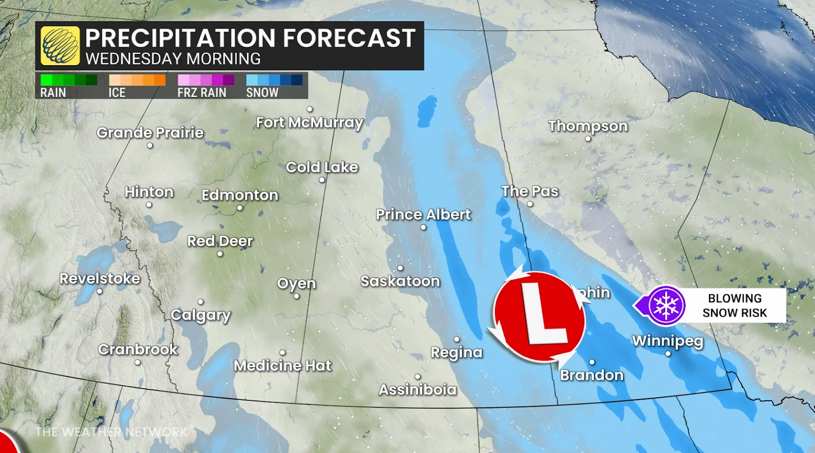
On Wednesday, delays are still expected across Saskatchewan and southern Manitoba due to the lingering snowy trough across the Prairies.

Despite the tapering snow throughout the day, travel conditions will remain hazardous due to blowing snow.
High winds combined with heavy snow will lead to low visibility, whiteouts, and possible road closures. Sustained winds of 30-40 km/h, with gusts up to 70 km/h, could lead to localized blizzard conditions at times. Expect major travel impacts all day Tuesday across central Alberta and Saskatchewan. Visibility will likely be poor, so allow extra time for travel if you have to be on the roads
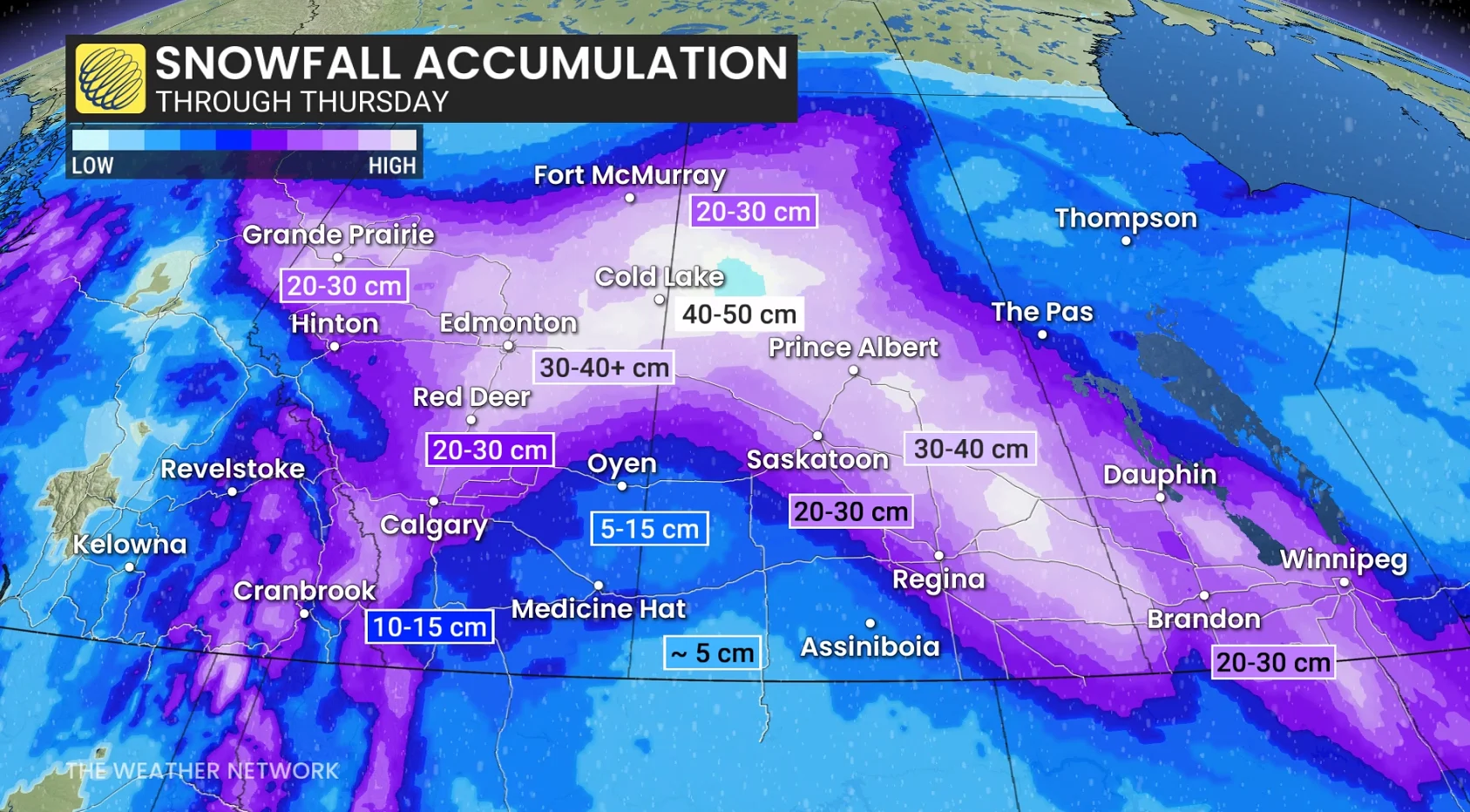
 Shovellable totals likely for many communities
Here are our current forecast snowfall totals from highest to lowest:
Cold Lake: 40+ cm
Prince Albert: 30-40+ cm
Edmonton: 30+ cm
Saskatoon: 20-30+ cm
Red Deer: 20-30 cm
Fort McMurray: 20-30 cm
Grande Prairie: 20-30 cm
Calgary: 15-25 cm
Winnipeg: 15-25 cm
Medicine Hat: 5-15 cm
Thompson: < 3 cm
Snowfall totals remain a bit uncertain at this time, but many areas will likely see enough to affect travel. Even a small amount of snow is dangerous on the roads when high winds create low visibility.
Stay with The Weather Network for all the latest on conditions across the Prairies.
WATCH: What turns a snowstorm into a raging blizzard?

