
Alongside snowfall, breezier conditions are forecast on Wednesday as low pressure influences the UK.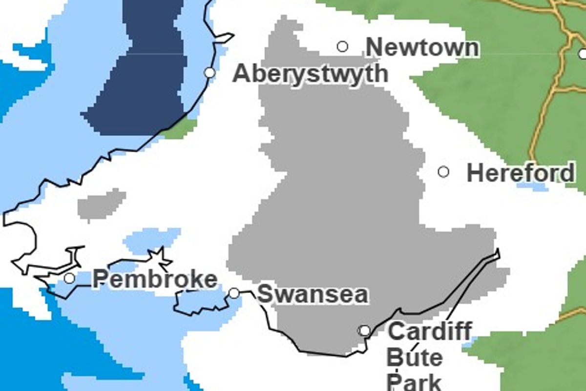
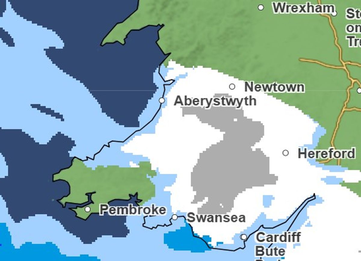
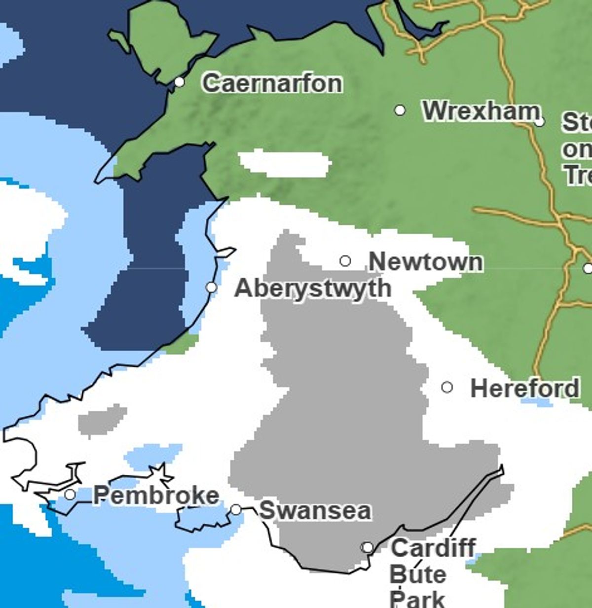
Maps indicate widespread snowfall across mid and south Wales by Wednesday afternoon(Image: Met Office)
Snow is forecast to reach parts of Wales from Wednesday morning, with weather maps indicating a band of wintry showers spreading across much of the country through the day. According to forecast projections, snowfall is expected to begin around 8am on Wednesday in Swansea before moving east and north.
By mid-afternoon, around 3pm, snow is predicted to extend across much of mid and south Wales. Areas expected to see the heaviest snowfall include Swansea, Newport, Powys, Blaenau Gwent, Cardiff and Merthyr Tydfil. Accumulations are likely to vary depending on elevation, with higher ground most at risk of disruptive conditions.
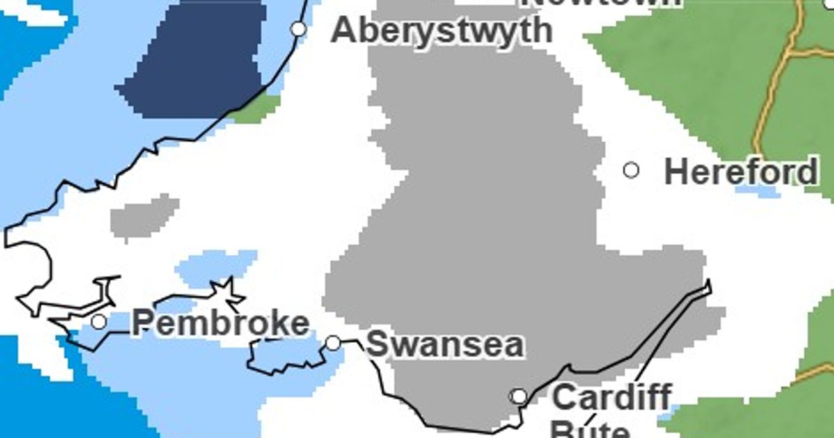
At 12pm, forecast charts indicate the most intense snowfall affecting Powys(Image: Met Office)
Forecasters say the wintry spell will be accompanied by strengthening winds, particularly across southern areas.
A Met Office spokesperson said: “Turning windier on Wednesday with rain and hill snow possible in the south. Otherwise a settled spell of weather with frosty nights. Southerly winds freshening on Friday with rain later.”
By 3pm on Wednesday, snow is forecast to extend across much of mid and south Wales as a band of wintry showers moves east and north.(Image: Met Office)
Looking further ahead, the Met Office’s long-range forecast for February 20 to March 1 indicates that unsettled conditions are likely to dominate at first, with Atlantic low pressure systems bringing showers or longer spells of rain and occasional strong winds.
Some heavy rain is expected in places, while snow remains possible at times – mainly on higher ground.
Temperatures during this period are forecast to vary, ranging from around or slightly above average in the south to colder conditions at times in the north.
However, forecasters say there will be drier interludes between weather systems, and these are expected to become more frequent and potentially more prolonged as the period progresses toward early March.
For now, drivers are being advised to check conditions before travelling, particularly during the morning and late afternoon when snowfall may intensify. Rural routes and higher ground could see reduced visibility and slippery surfaces.
The colder overnight temperatures are also expected to bring frost in places, increasing the risk of icy stretches into Thursday morning.
Get daily breaking news updates on your phone by joining our WhatsApp community here. We occasionally treat members to special offers, promotions and ads from us and our partners. See our Privacy Notice