
![]()
Listen to this article
Estimated 3 minutes
The audio version of this article is generated by AI-based technology. Mispronunciations can occur. We are working with our partners to continually review and improve the results.
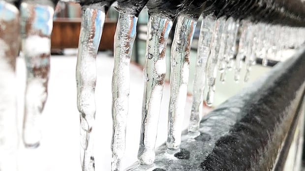
A high-impact ice storm is expected to hit Waterloo region, Guelph and Wellington County Wednesday with several hours of freezing rain possible.
The orange warning for freezing rain issued by Environment Canada calls for the freezing rain to begin overnight Wednesday or early that morning and taper off by the evening.
The weather agency says there will be likely several hours of freezing rain that will lead to about five to 10 mm of ice buildup, with up to 15 mm of ice buildup possible in some areas. That could lead to utility outages and tree damage, with winds gusting up to 60 km/h.
Eric Tomlinson, a warning preparedness meteorologist for Environment Canada, said the low pressure system started over Montana on Tuesday.
“It tracked eastward and then southeastward across the Great Lakes and is now impacting the southern half of our province,” he said.
He warned that surfaces are likely to be very slippery, especially over areas with higher elevation.
“Areas closer to Lake Huron may be less affected with temperatures likely rising above the freezing mark,” Environment Canada said in its orange warning posted online.
“Roads and walkways will likely become icy and slippery. There may be a significant impact on rush hour traffic. There is risk of injury due to slips and falls.”
This comes alongside a yellow fog advisory that went into effect for Waterloo region and Guelph on Tuesday morning, with near-zero visibility reported in some areas.
Environment Canada says visibility may be suddenly reduced at times on Tuesday before improving later in the morning. Motorists are advised to turn on their full headlight system, slow down and maintain a safe following distance.
People are encouraged to monitor the latest forecasts and alerts and to exercise caution if travelling.
Tomlinson also warned there’s more winter weather coming by the end of the week.
That second system “is going to form over Colorado and head towards us for Friday. And it’s a system that we’ll have to monitor. We’ll have a clearer picture once the one [on Wednesday] moves through, but it’s another one to watch because there is potential for mixed precipitation with this next system as well.”
GO Transit warning of delays
GO Transit warned customers Tuesday the storm could cause delays Wednesday for its routes around southwestern Ontario and the Greater Toronto Area.
“We’re encouraging everyone to plan ahead, allow extra time and travel with caution,” a release said.
The provincial transit service is asking people to visit their website or sign up for On the GO alerts to receive notifications about delays or cancellations.
“We know that weather-related delays can be frustrating for customers, however we must take appropriate measures to ensure the GO Transit network operates safely in all kinds of weather conditions.”