
Our second messy winter storm of the week is lining up for parts of Southern Ontario, and this one looks timed almost perfectly to cause headaches for the Friday evening commute with a burst of heavy snow in some areas and a messy mix in others.
After many communities dealt with significant impacts earlier in the week, there is very little breathing room before this next system arrives. While Wednesday’s storm largely spared much of Central and Eastern Ontario from the worst of it, this next round is expected to target many of those same regions that missed out last time, shifting the focus farther north and east.
This system comes with its own set of challenges. Temperatures will be hovering very close to the freezing mark for a large portion of the day on Friday, and that makes the forecast particularly sensitive. A difference of just a degree or two will determine whether you see cold rain, freezing rain, ice pellets, or heavy wet snow. That small shift in temperature could dramatically change road conditions and overall impacts in a short amount of time.
Some forecast models continue to show a slightly colder solution, which would support more mixing through the late morning and early afternoon hours. That includes a risk of freezing rain and ice pellets, especially across the higher elevations northwest of the Greater Toronto Area and east of Lake Simcoe.
Other models are holding onto slightly warmer air at the surface, which would keep precipitation mainly as rain through that same window and significantly limit any icing threat. This is the fine line we are watching very closely.
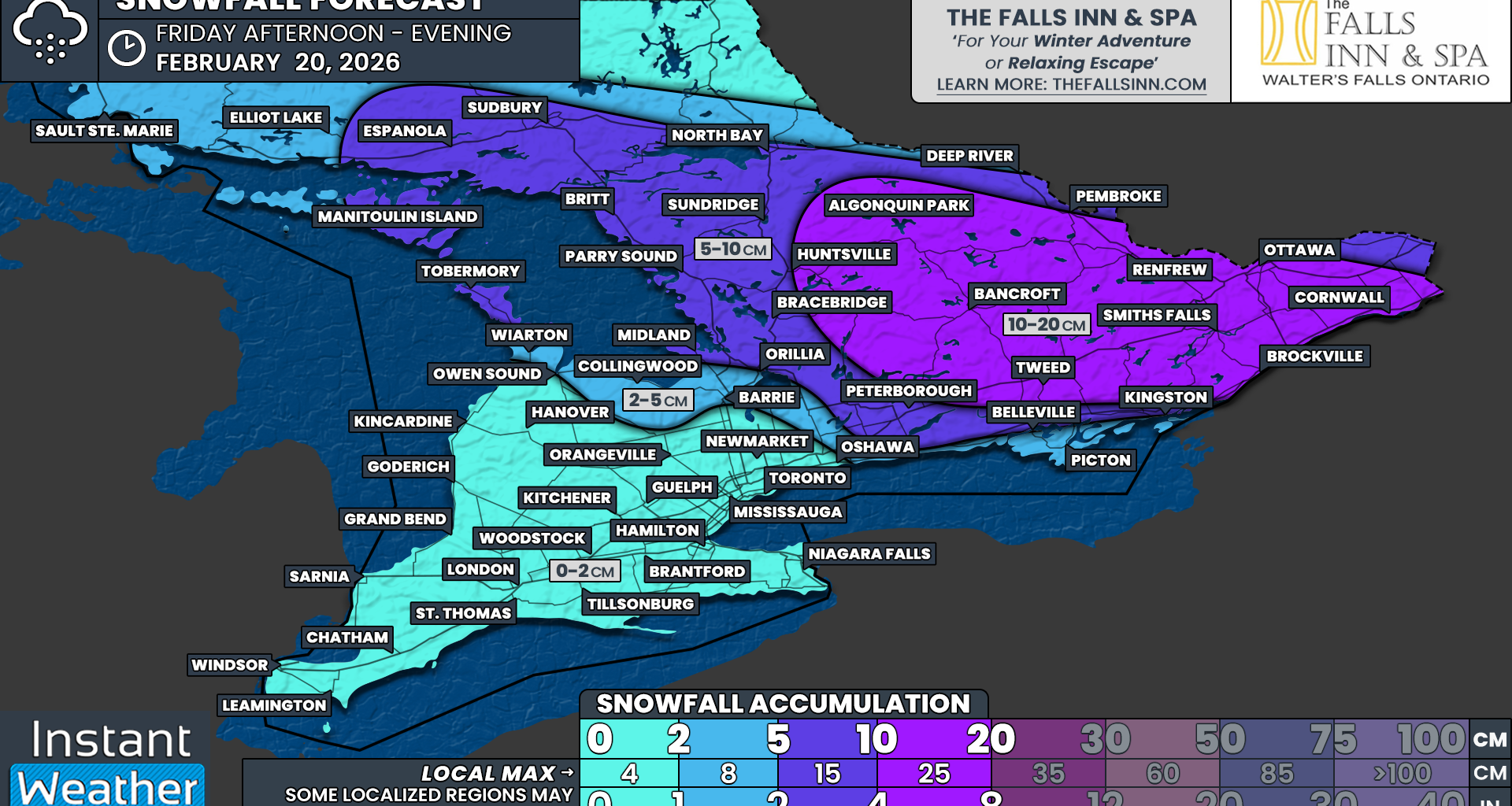
What does appear more certain is that colder air will remain firmly in place across northern sections of Central and Eastern Ontario throughout the day. That means once precipitation begins early Friday afternoon in those areas, it should fall predominantly as snow.
With colder air already established, there will be fewer questions about precipitation type and more focus on how heavy the snow becomes and how quickly it accumulates.
Although this storm is not expected to be a long-duration event, its short and intense nature may actually increase the impact. Several hours of heavy snowfall are likely through the late afternoon and evening, particularly across Eastern Ontario.
Snowfall rates could approach 5 cm per hour in the most intense bands, especially around the Ottawa Valley. When snow falls that hard, accumulation can happen rapidly, and visibility can drop off very quickly, creating hazardous travel conditions in a matter of minutes.