
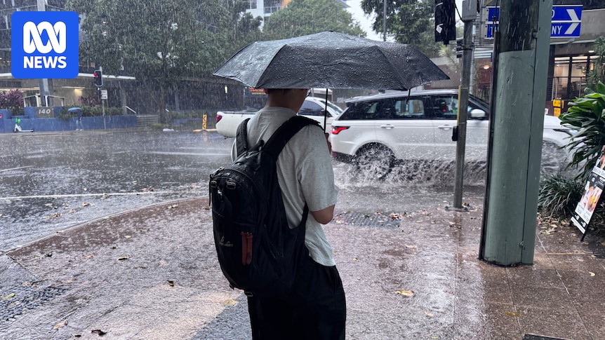
A wet finish to the year is increasingly favoured across Australia as a major climate driver emerges for the first time in three years.
During recent weeks, changes in ocean temperatures show the development of a negative Indian Ocean Dipole (IOD) — the wet phase of the Indian Ocean, which rivals La Niña for its positive impact on Australia’s rainfall.
Negative IODs in the past have contributed to most of Australia’s wettest winters and springs on record, including all four previous episodes this century in 2010, 2016, 2021 and 2022.
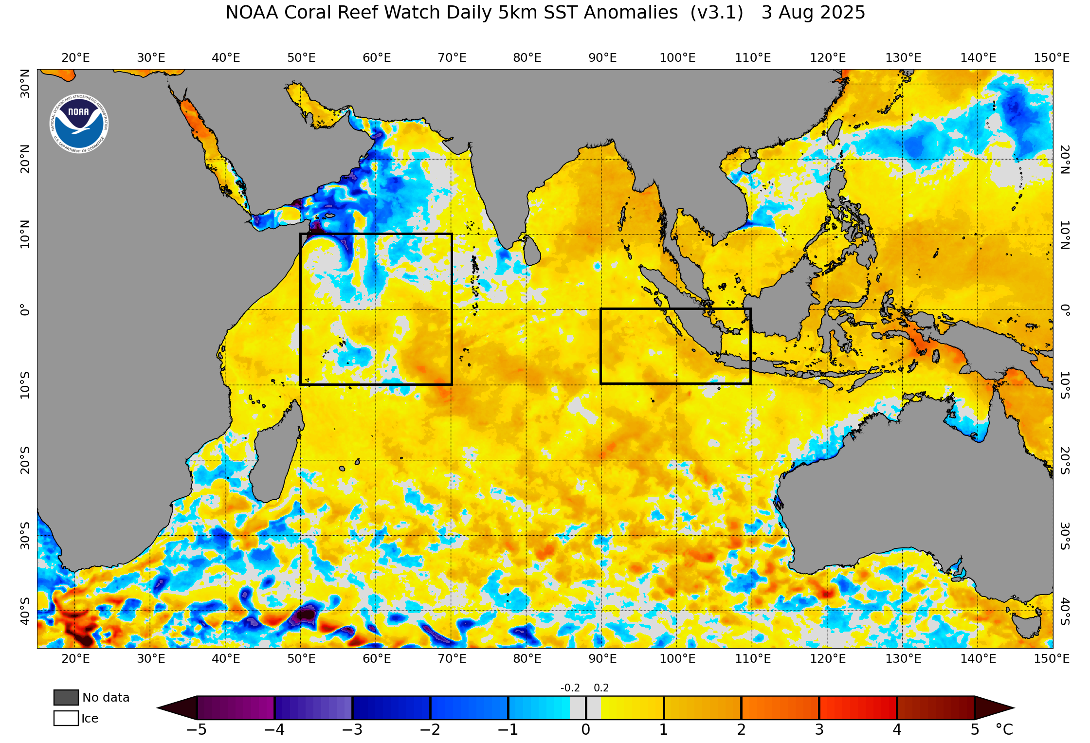
The key monitoring regions for an IOD show cooling off the coast of Africa and warming near Indonesia. (Source: NOAA)
The ‘La Niña of the west’
A negative IOD refers to a prolonged period of at least eight weeks of warmer waters near Indonesia and cooler waters off the Horn of Africa.
While this may seem inconsequential, the change corresponds with a shift in the overlying pressure and wind regime — specifically, there is an increase in moist air blowing towards Australia’s longitudes from the tropical Indian Ocean.
In a similar vein to a La Niña phase of the Pacific Ocean, this influx of humid winds promotes the formation of cloud and rain.
What is critical for the continued evolution of an event and its eventual impact on the weather is that the changes to the ocean and atmosphere reinforce each other through a positive feedback loop — a coupling that can preserve the anomalous state for months.
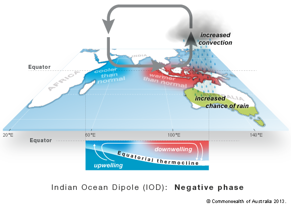
Convection, cloud and rain increase over Australia’s longitudes during a negative phase of the IOD. (Source: BOM)
First negative IOD in three years
Negative IODs, and their counterpart positive IODs, on average occur every one in five years.
However, the Indian Ocean has been exceptionally active during the past decade, with only three years (2017, 2002 and 2024) remaining neutral.
The prospect of a negative IOD returning in 2025 was first flagged by the Bureau of Meteorology (BOM) back in autumn when their long-range modelling was showing the driver would likely develop at some point in winter.
Despite little observational verification, the BOM’s modelling consistently stuck to that prediction through June.
However, water temperatures off the east coast of Africa began to drop notably in July.
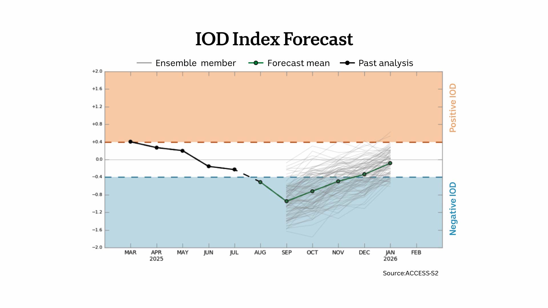
The index used to measure the state of the Indian Ocean reflected this change, and its latest weekly value sits at -0.6 degrees Celsius, below the negative IOD threshold of -0.4°C for the second consecutive week.
The BOM’s modelling shows negative IOD conditions will intensify further into early spring and remain until December. (Source: BOM)
However, for 2025 to officially become a negative IOD year, the index is required to remain below -0.4°C for at least another six weeks.
That scenario now appears increasingly likely with the latest modelling showing the index falling to around -1°C in September before gradually climbing back to neutral in December, easily sufficient time to have a lasting impression on the nation’s weather.
Major boost to winter and spring rainfall
The life span of an IOD event is shorter than Pacific El Niño-La Niña episodes, which normally last about nine months.
A typical IOD will develop in winter, quickly peak, then decay by early summer when the monsoon erodes any influence on tropical Indian Ocean winds.
The impacts, shown in the table below, are most pronounced in spring when the national average rainfall is on average 36 per cent higher than during neutral years, calculated using 13 negative IOD events from 1960 to 2024.
Winter sees an average 20 per cent boost to precipitation, and by summer it falls to 13.9 per cent.
In terms of spatial extent, negative IODs can lift rainfall across most of the country, as illustrated by the map below.
The greatest impact lies over the south-east inland where the mean across nine classic events is in the ninth decile — rainfall totals in the top 20 per cent of all years.
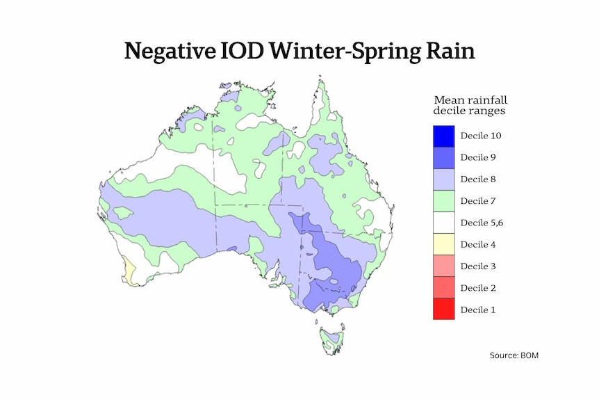
An average of nine classic past negative IOD years have shown a clear increase in rainfall across most of Australia. (Source: BOM)
However, not all events are the same, and considering many negative IODs coincide with La Niña, 2025 rainfall may not be as widespread or intense.
So what can we expect during the coming months?
The most accurate forecast for seasonal weather patterns is now model data, as opposed to the old method, a few decades ago, of using past years as a guide.
The BOM’s latest outlook for spring shows a 70 to 80 per cent chance of above-median rain across most of central and eastern Australia, a forecast closely matching a typical negative IOD footprint.
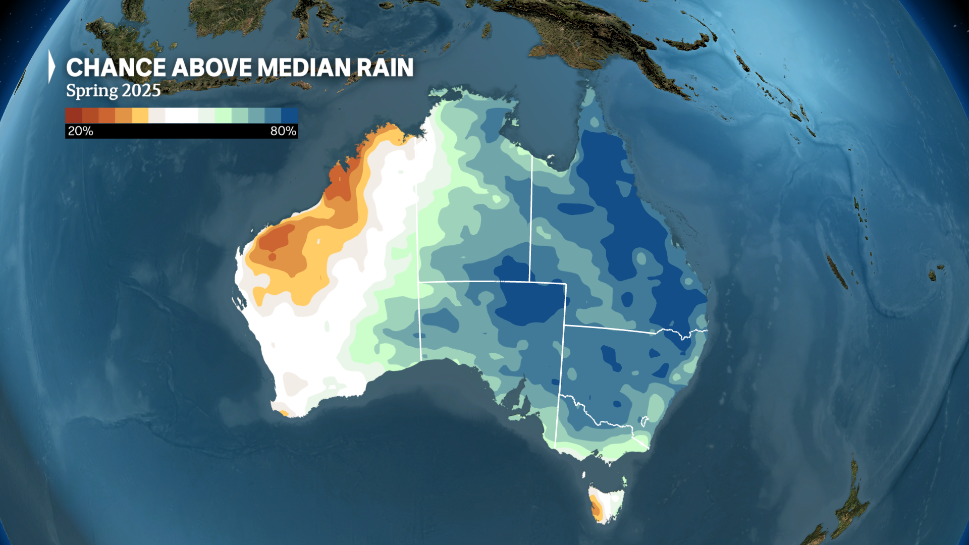
The latest spring outlook favours above-median rainfall across most of Australia with the greatest likelihood over the eastern inland. (ABC News)
Another impact of a negative IOD is on temperatures.
Climate change ensures most Australian seasons are comfortably warmer than normal, however, during extended wet periods, the additional cloud cover can lower daytime temperatures.
Again, the seasonal outlook concurs with this past trend, showing parts of Australia’s central and eastern areas are favoured to record below-median maximums from August to November.