
When Tasmania separated politically from New South Wales in 1825, it was decided that all islands south of Wilsons Promontory would belong to the new colony of Van Diemen’s Land.
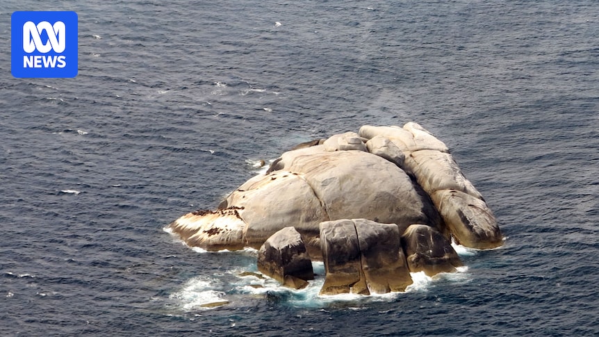
But when the proclamation included more specific coordinates, it mistakenly put the border right through a 2-hectare granite island.
The bungle created an 85-metre land border between Tasmania and what would later become Victoria. It is shown on official maps.
The rocky island, 56 kilometres east of the southernmost point of mainland Victoria, is Australia’s shortest land border.
Maritime Museum Tasmania’s Colin Denny said there was some skepticism about Boundary Islet and whether it was a legitimate border, so the organisation conducted its own research.
“It’s not as simple as it sounds, and we have to go right back to the discovery of Australia by Europeans to find out how the boundary came about,” he told Joel Rheinberger on ABC Radio Hobart.
Mr Denny said the issue arose when an order-in-council in the United Kingdom defined the new colony of Van Diemen’s Land.
“[The council] basically said the islands of Bass Strait would be part of Van Diemen’s Land and north of there would remain New South Wales,” he said.
“It was very indeterminate.”
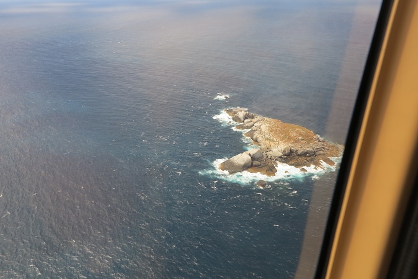
Tony Wheeler flew over Boundary Islet and captured photos. (Supplied: Tony Wheeler)
Governor Ralph Darling, who was overseeing New South Wales, wanted the border to be more definite and drew a line at 39 degrees 12 minutes latitude, based on it being below Wilsons Promontory.
“The charting that had been done by various people was inaccurate,” Mr Denny said.
“When Governor Darling drew the line, it was found that it went through Boundary Islet.”
The blame lies with Captain John Black, who surveyed Bass Strait after Matthew Flinders and George Bass circumnavigated Tasmania and proved it was separate from the Australian mainland.
Keeping in mind the technology used would have been sextants, circumferentors, and low-level theodolites, which led to wonky borders across the country.
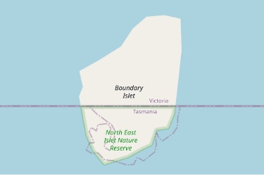
Boundary Islet in Bass Strait is officially a land border between Victoria and Tasmania. (Supplied: Geoscience Australia)
Boundary Islet ‘accepted’ as border
A spokesperson for the Department of Natural Resources and Environment Tasmania (NRE Tas) said the parallel latitude of south 39 degrees 12 minutes had been accepted as the Tasmania–Victoria border.
“Boundary Islet is known as the North East Islet Nature Reserve,” the spokesperson said.
“It was historically known as North East Islet. Its name change was gazetted in 1990.
“There was some ambiguity in the description of the location of the border in the historical proclamations of the colony of Van Diemen’s Land upon its separation from NSW in 1825.”
The spokesperson said there were several border anomalies between Australian jurisdictions.
The island is part of the Hogan Group, with Hogan Island being the largest island in the group.
Hogan Island, which is 232 hectares, has been leased to graziers in the past, but is now a conservation area.
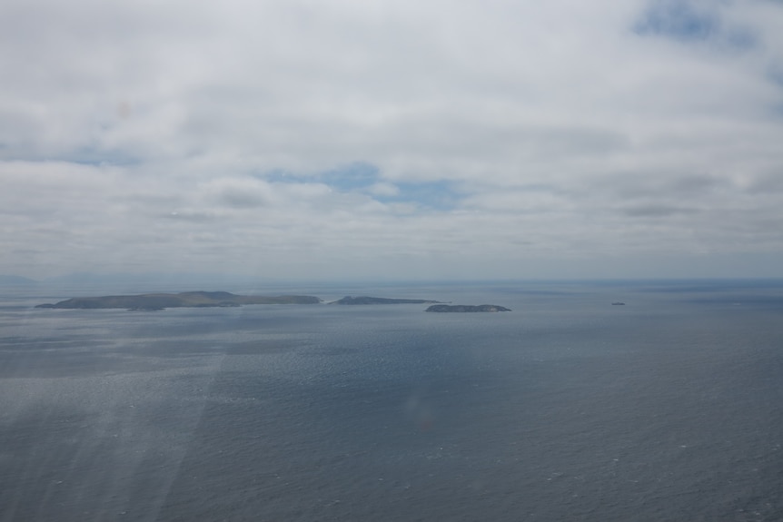
The Hogan Island Group in Bass Strait. (Supplied: Tony Wheeler)
Island’s only residents are seals
In terms of inhabitants, there has been one formally recorded sighting of an Australian fur seal according to NRE Tas.
Veteran travel writer Tony Wheeler can confirm there are actually many seals, after flying low over the island by helicopter while writing his book Australia’s Islands.
“Captain John Black, in his survey of 1801, had slightly misplaced North East Islet and the boundary runs smack through the middle of the 2-hectare island,” Mr Wheeler said.
“The constitution would have to be amended to correct the problem, and neither Tasmania nor Victoria seems too concerned about their curious meeting point.”
It’s unclear whether the seals are Victorian or Tasmanian residents and would depend on which side of the island they choose to inhabit.