
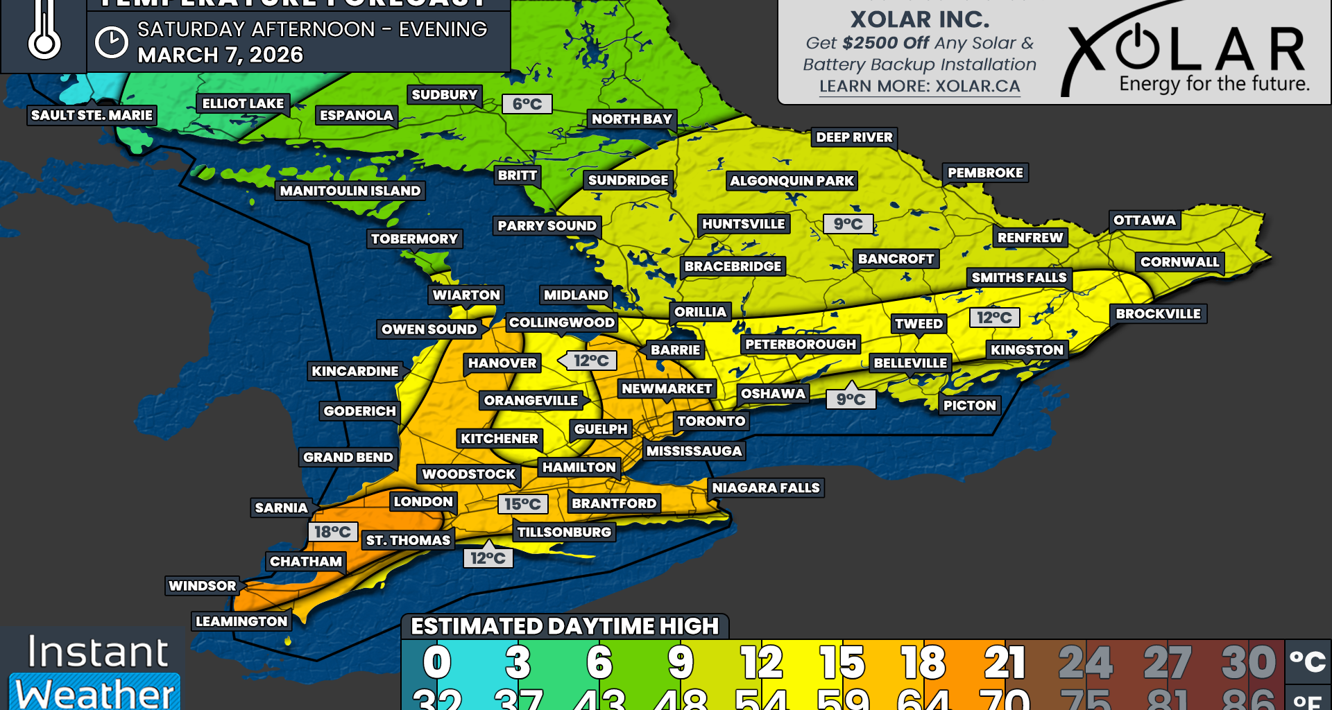
In terms of temperatures, the warmest air is expected to arrive on Saturday. Daytime highs will climb well into the double digits by late morning and afternoon across most of Southern Ontario. For many locations, this will likely be the warmest day experienced so far in 2026.
The warmest conditions will likely occur across Deep Southwestern Ontario, including Windsor, Sarnia and Chatham. Current data support temperatures reaching the upper teens and possibly even approaching the 20°C mark for the first time this year. It is still somewhat uncertain whether temperatures will reach that milestone, but if it happens, the Windsor area would be the most likely location.
Across the rest of Southwestern Ontario and into the Golden Horseshoe, daytime highs are expected to reach the mid to upper teens. Areas closer to the shorelines of the Great Lakes, along with higher elevations northwest of the Greater Toronto Area, may end up slightly cooler with highs closer to 12 to 15°C.
Double-digit temperatures should also extend into Central and Eastern Ontario. Highs around 12 to 15°C are expected from Lake Simcoe through Peterborough and into Brockville.
Areas directly along the Lake Ontario shoreline from Oshawa to Kingston will likely remain slightly cooler with daytime highs around 9 to 12°C due to the influence of the cold lake waters.
Across the rest of Central Ontario and Eastern Ontario, including the Ottawa Valley, temperatures are expected to reach the high single digits or low teens, with most areas topping out around 9 to 12°C.
A brief cooldown will arrive late Saturday night as colder air moves back into the region. Overnight lows will fall back near the freezing mark or into the low single digits. Daytime highs on Sunday will struggle to climb out of the single digits for many locations.
However, this cooldown will be short-lived. Double-digit temperatures are expected to return again on Monday, Tuesday and possibly Wednesday as the active weather pattern continues.