
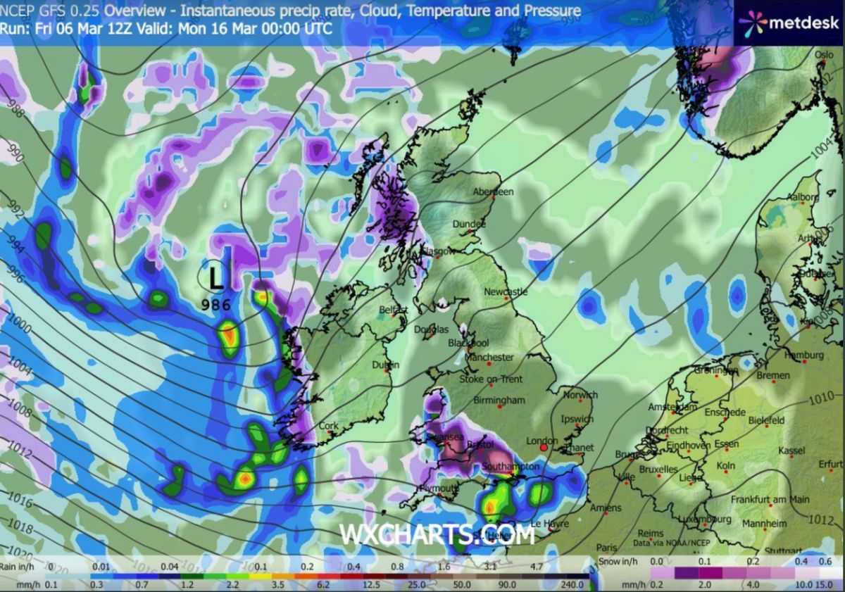
Snow looks set to bury UK cities including London and Birmingham as weather forecasting maps show a major blizzard will sweep across the country while temperatures plummet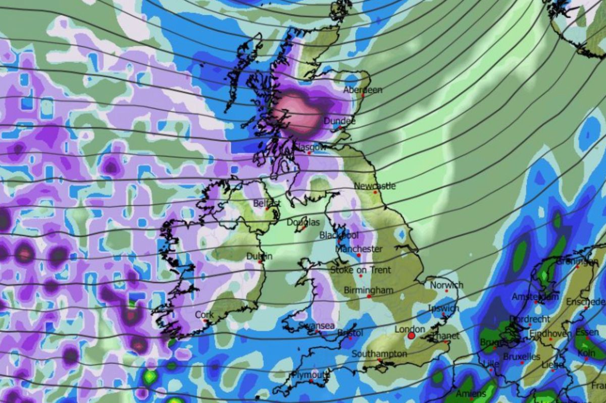
Snow (in purple) falling at 9am on March 15(Image: WXCHARTS)
Temperatures could soon drop as low as -12C as snow hits major cities in the UK as far south as London – despite this week bringing the hottest day of the year so far.
The mercury soared above 19C on Thursday in London. However, advanced weather forecasting maps reveal a blizzard could be just days away from bringing snow to roughly 60% of the country.
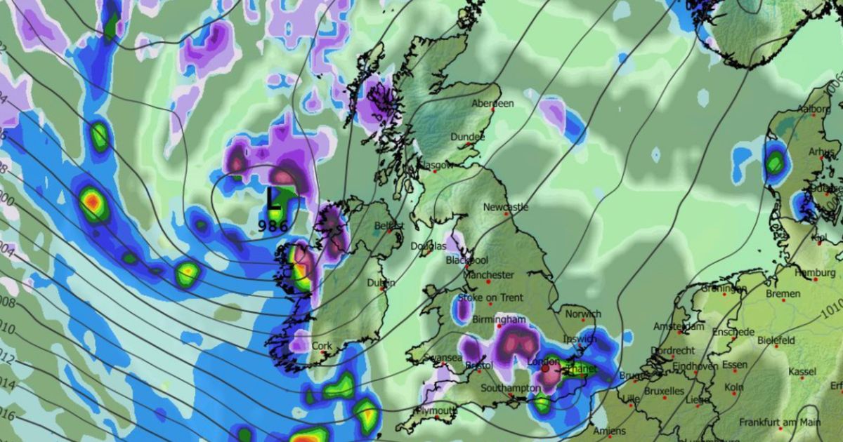
The GFS weather model shows snow falling over a massive stretch of the UK at around 9am on March 15. The heaviest snow is expected in the north of Scotland to begin with, but flurries are also expected to impact Wales, Northern Ireland and the north-west around this time, with Manchester in the firing line.
Snow could hit southern areas on March 16(Image: WXCHARTS)
READ MORE: UK snow maps reveal eight-day blizzard as far south as London in -2C freezeREAD MORE: Snow maps reveal shock twin blizzards to bury UK and hit eight major cities
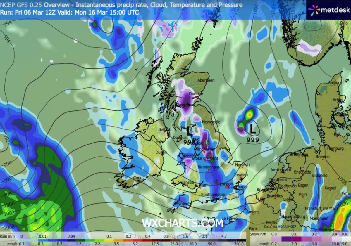
In the early hours of March 16, the maps show a second wave of snow moving across southern England and Wales. South Wales, Gloucestershire and Hampshire can expect the heaviest flurries to begin with.
By 3am, the most intense snow is shown falling over London and Essex. Some of the white stuff might also impact the Midlands, including Birmingham, around this time. While by 3pm snow is expected to have drifted northwards, falling over North Wales, the Pennines and Scotland.
Even London could be impacted by the blizzard(Image: WXCHARTS)
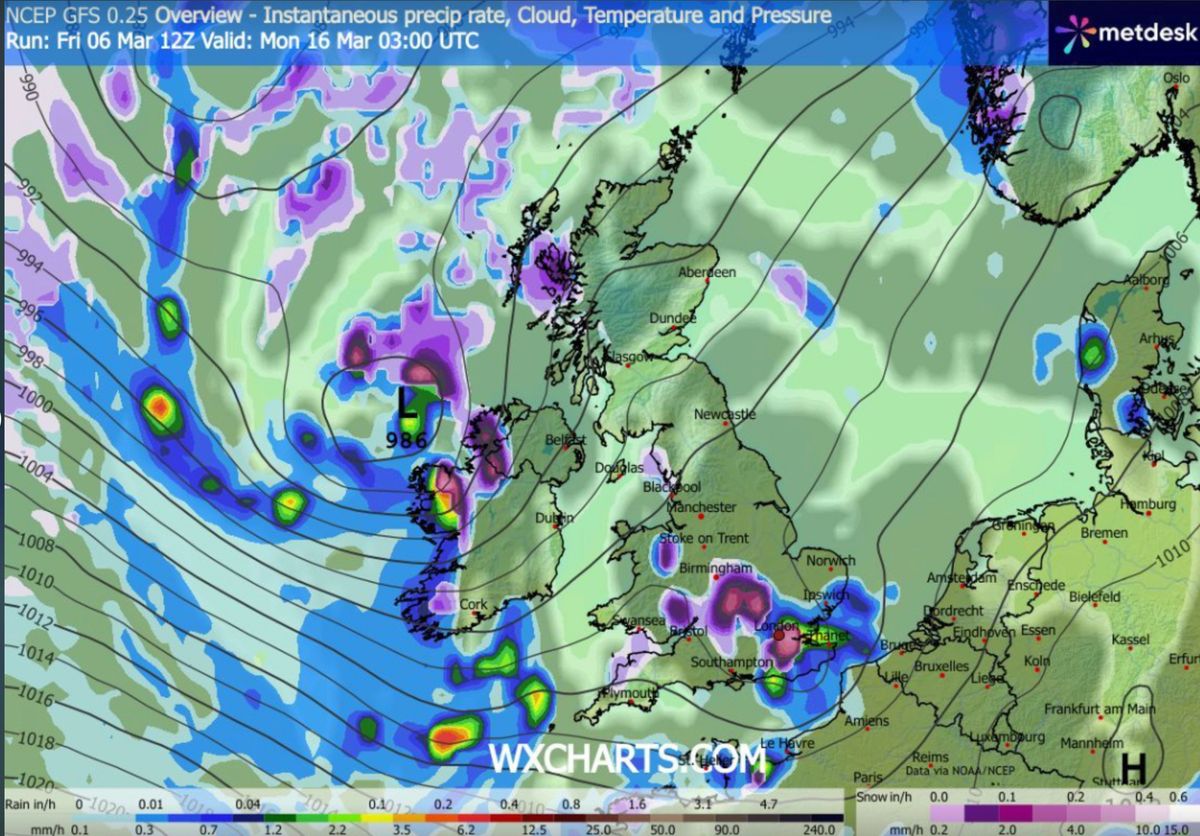
Snow coverage maps reveal huge swathes of southern England, the Midlands, Wales, the north-west, Northern Ireland and Scotland will have the white stuff settled on the ground by 6am on March 16.
Temperatures could plunge as low as -12C in the far north of Scotland, the data suggests. Northern Ireland and northern England face lows of -3C, with Wales set for -5C.
More snow is expected in the afternoon on March 16(Image: WXCHARTS)
The Met Office has warned of a potential “colder spell” to come later this month. However, if it is to come, the national weather agency expects it after March 20.
The Met Office forecast for March 20 to April 4 states: “The start of this period could see unsettled conditions fairly widely across the UK, with spells of rain and strong winds affecting many areas at times, although western areas likely remain wettest.
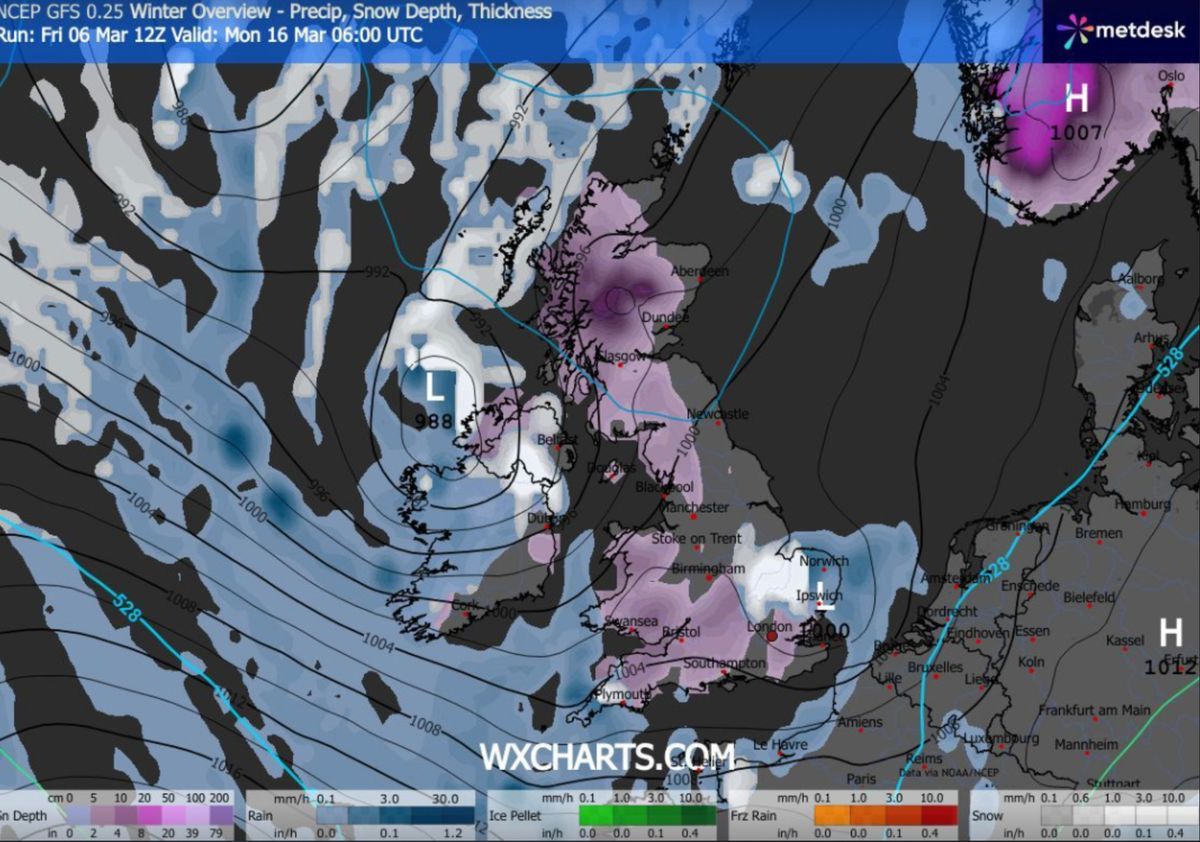
Roughly 60% of the UK will be covered, maps suggest(Image: WXCHARTS)
“Then, whilst confidence in the details is low, there is the potential for weather patterns to become slower-moving by late March, with unsettled weather possibly becoming more confined to parts of the south west, as areas towards the north turn drier. Overall, temperatures will probably end up near to average, and at present there are indications of a cooler spell towards the turn of the month.”
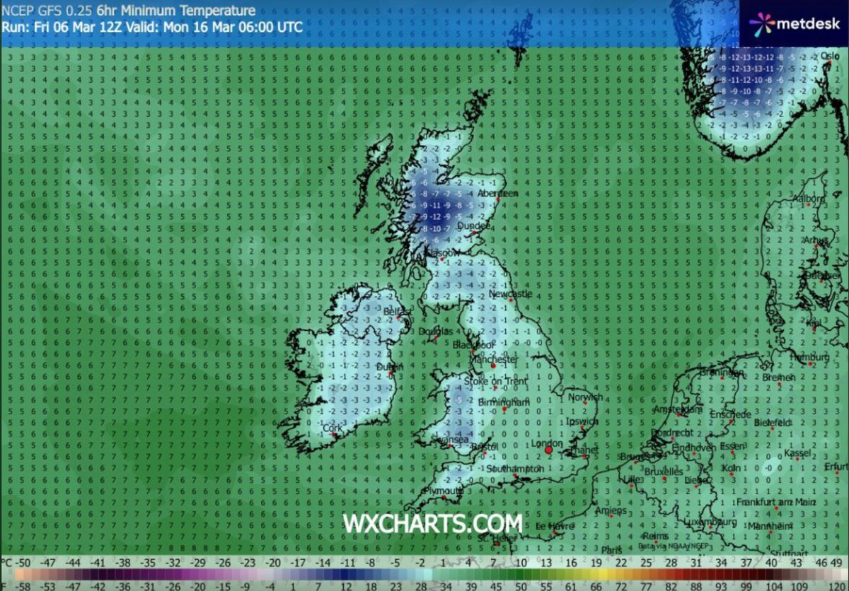
Temperatures could drop as low as -12C(Image: WXCHARTS)
BBC Weather has warned of “wintry showers”. Its forecast for March 16 to 22 states: “It will probably be a little bit cooler overall, although day to day temperatures will vary a bit as weather systems come in from the Atlantic.
“These weather systems will also bring spells of showery weather, and it is still early enough in the year for there to be a chance of some wintry showers over higher ground in the north of the UK.”