

Flurries of snow could fall across Greater Manchester this week
Parts of the UK could see snowfall this week(Image: PA)
Snow is forecast across parts of the North West this week just one week after an exceptionally mild spell in the UK.
Met Office maps show flurries of snow over northern parts of Scotland from Thursday morning (March 12), extending into northern England by around 9pm.
Snow is expected to fall overnight into Friday morning (March 13), with the heaviest snowfall forecast in Scotland, Northern Ireland and parts of northern England.
Get MEN Premium now for just £1 HERE – or get involved in our WhatsApp group by clicking HERE. And don’t miss out on our brilliant selection of newsletters HERE.
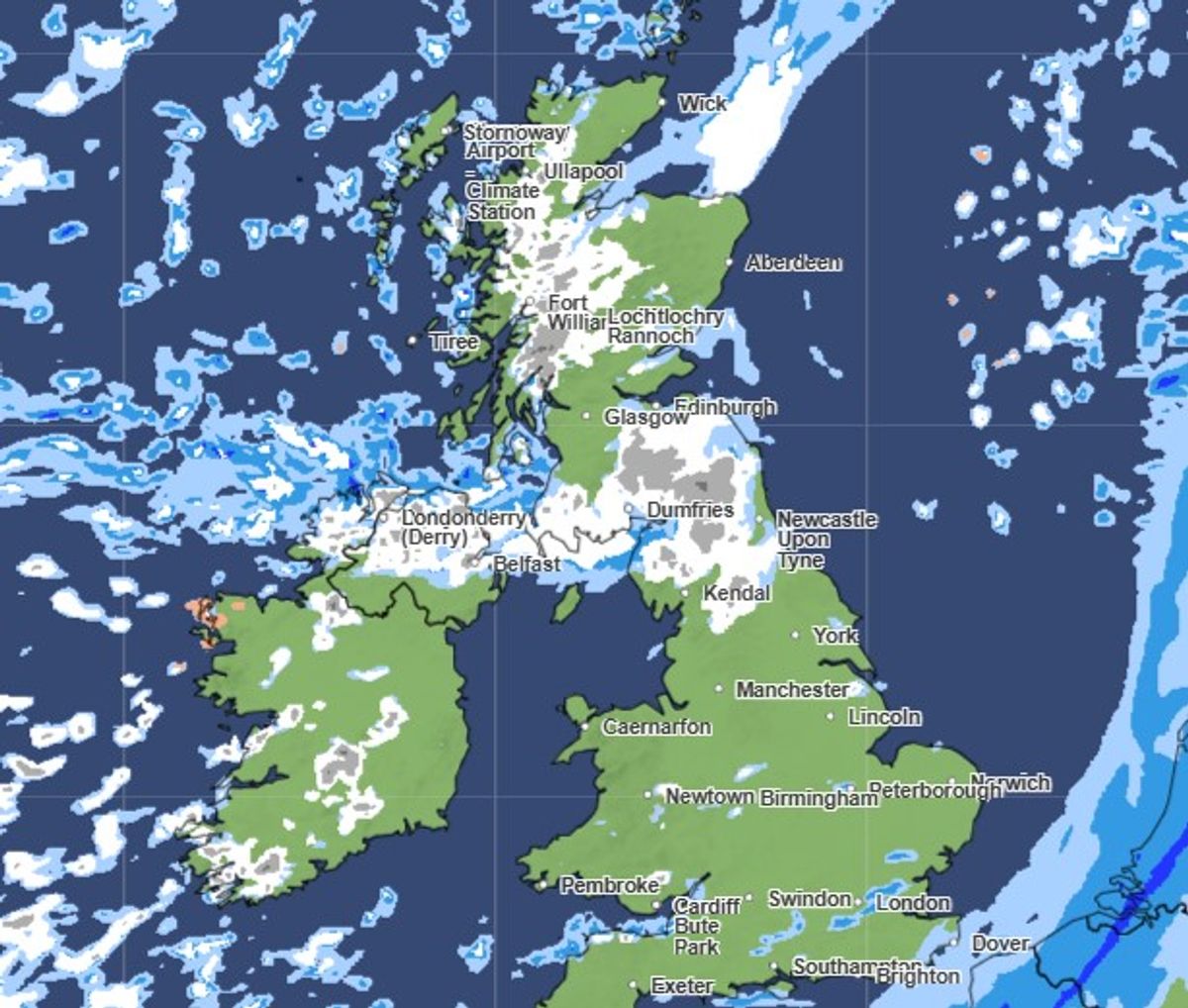
Snow is forecast across the UK on Friday morning, March 13(Image: Met Office)
Maps show patches of snow and rain across northern parts of the UK throughout Friday, extending south into Greater Manchester in the early hours of Saturday morning (March 14).
Snow is forecast across Manchester, Bolton and Rochdale at 3am, continuing until 6am in parts of Rochdale and Manchester.
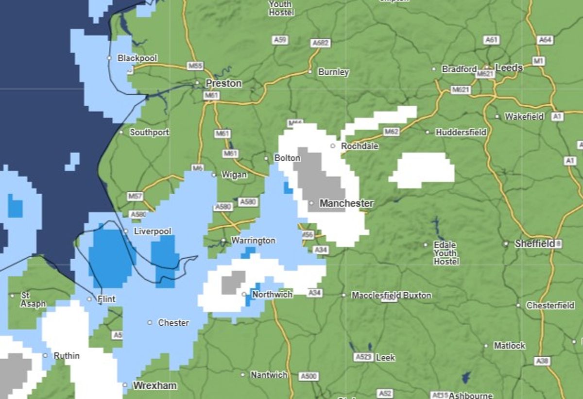
Snow forecast over Greater Manchester at 3am on March 14(Image: Met Office)
The wintry weather follows a mild spell across the UK after the start of meteorological spring. Last Thursday (March 5), temperatures topped 19C in west London, marking the warmest day of the year so far.
While temperatures will continue to be above average in the southeast of the country, with peaks of 15C possible on Wednesday (March 11), cooler temperatures will be felt in the northwest, the Met Office said.
Forecasters said blustery showers will follow into the northwest with a chance of snow on Scottish mountains on Thursday. Overnight temperatures are also forecast to drop to 0C in some areas on Friday into Saturday.
Jason Kelly, Chief Operational Meteorologist for the Met Office said: “A notable shift in wind direction to a north-westerly flow will bring a markedly colder day nationwide on Friday, with the potential for a mixture of sunny spells, heavy showers, coastal gales, and snow over high ground.
“There’s also the possibility of accumulations on lower hills too. The picture will become clearer closer to the time, so keep an eye on our forecast as the week progresses.”
The Met Office said in a blog post: “Rain continues moving in from the north and west [on Friday], and northwestern areas will see frequent showers. Some of these showers will fall as snow down to around 200 metres, fairly low levels for this stage of the year. Hail is also possible in the most intense showers.
“With temperatures struggling in the single figures, below the seasonal average, icy patches could develop through Friday morning and again into Saturday. In contrast, the south and east fare better with drier conditions, although it will still feel chilly widely.”
The Met Office long-range forecast, which runs from Saturday until March 23, says ‘frost and hill snow will be possible’ across the UK.
It states: “Mostly changeable through this period, with Atlantic frontal systems passing close to or across the UK at times. These will bring spells of rain and showers, most frequent and heavy in the west or northwest, and perhaps accompanied by strong winds.
“However, there should also be some drier interludes under transient ridges of high pressure, with longer dry periods most likely in the south and east, though even here some wet weather is likely at times.
“Temperatures will be near average for the period as a whole, but with some shorter-duration colder interludes at times when frost and hill snow will be possible. Later in the period there may be a transition to more blocked or slower evolving weather patterns, though confidence in the detail of this is low.”