
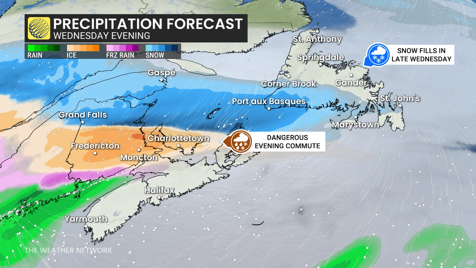
Precipitation rates pick up around the evening commuting hour, with heavy snow in the north and ice pellets in the south.
Overnight, the ice pellets lift north. Freezing rain takes its place for Fredericton, Moncton and P.E.I. through Thursday morning.
Rainfall is forecast for Nova Scotia at this time.
On Thursday afternoon, rainfall takes over across the southern Maritimes. but it could change to wet snow by the evening.
Newfoundland starts out with seeing widespread snow Thursday morning, then changing to ice and/or freezing rain by the afternoon and rain by the evening.
Heavy snow: Highest impact will be northern New Brunswick with 20-40 cm possible. Western Newfoundland could see 15-30 cm.
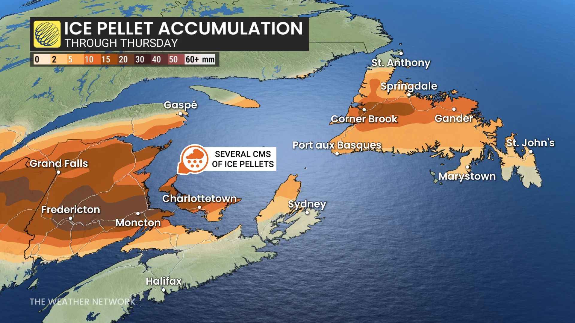
Ice pellets: Highest impact will be southern and central New Brunswick and P.E.I. Several centimetres are possible.
WATCH: Ice pellets and freezing rain explained
Freezing rain: Highest impact will be southern and central New Brunswick and P.E.I. Up to 12 hours of icing is possible.
Rain: Highest impact will be southern Nova Scotia and southern Newfoundland. 10-30 mm and localized flooding possible.
Accumulations of ice may create slippery and hazardous travel or walking conditions. Ice buildup on trees and utility infrastructure may cause damage or outages.