
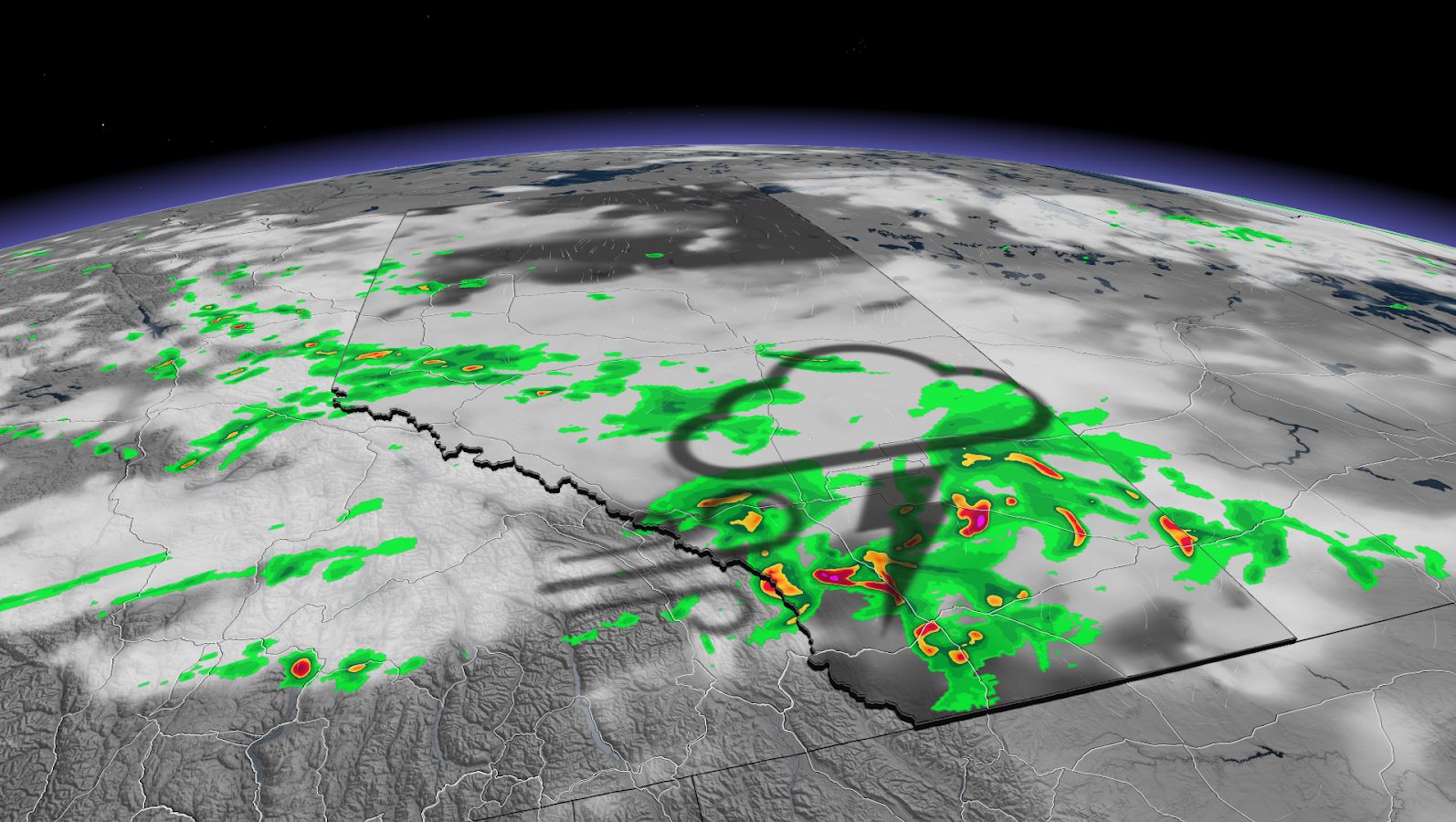
The ample amount of moisture, combined with the daytime heating, will be the initially fuel. The boundary will be the trigger for development.
The main risks include heavy downpours and the possibility of large hail.
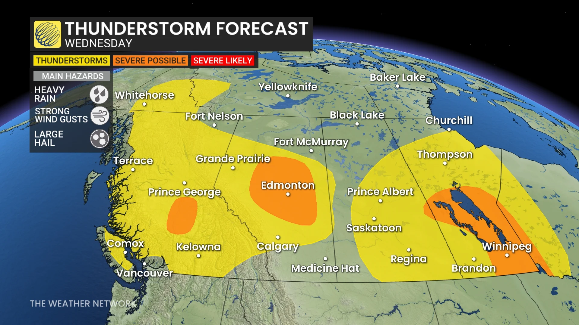
Meanwhile, in Manitoba, a low pressure sweeping across Manitoba is being fuelled by the ample moisture. As the warm fronts lift into southern Manitoba through the morning, it will start out as rain and embedded thunderstorms ahead of the warm front.
Into the evening, the cold front cuts through the moisture-rich area, triggering some of the severe storms, which are expected to remain quite isolated in nature with some along the Interlake region lining out. The main hazard will be large, loonie-sized hail, strong winds and heavy rainfall.
The threat will pop up on Thursday once again, with strong to severe storms possible across southern Saskatchewan and Manitoba into the late evening and overnight periods. Heavy rain will persist on the back end of the low pressure through Thursday and into Friday.
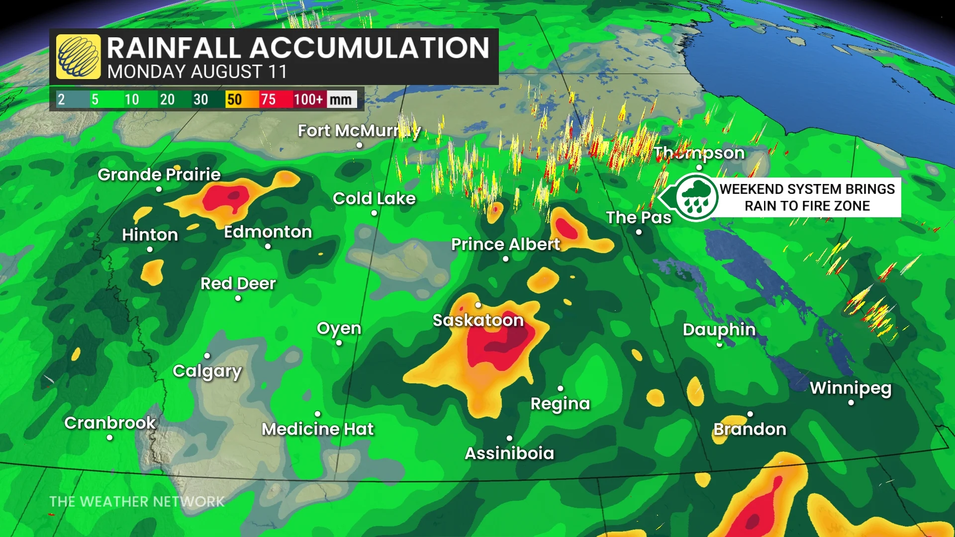
Some of the rain totals by Saturday may top 50 mm.