

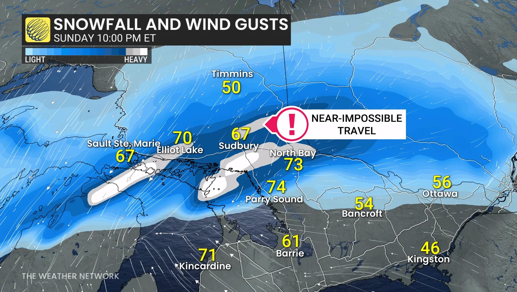
Wind gusts reach up to 100 km/h along the Lake Superior shoreline.
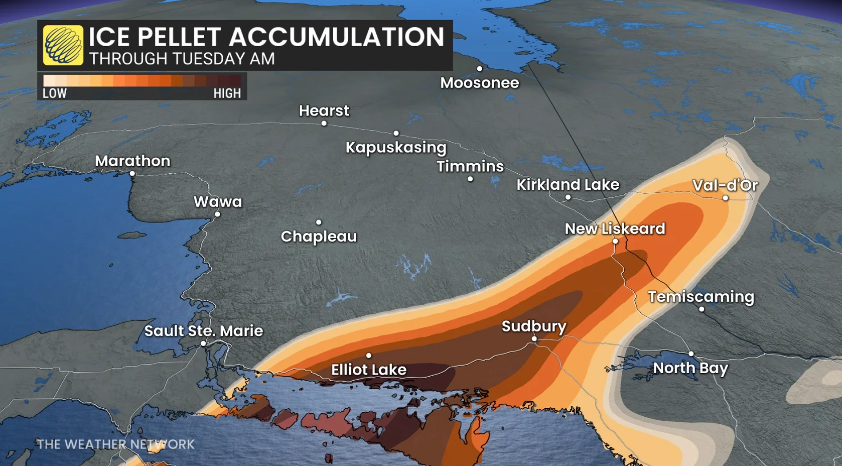
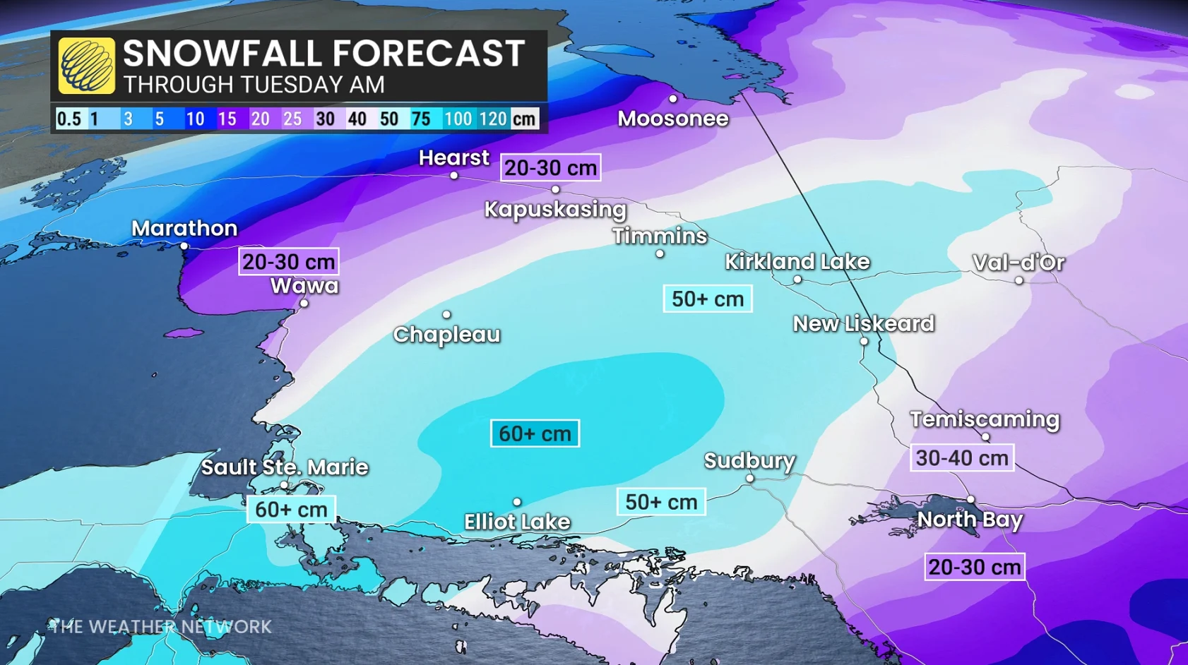
T40-50+cm is forecast in the hardest-hit regions, in communities east of Lake Superior, including Sault Ste. Marie, Chapleau, Timmins, Kirkland Lake, New Liskeard, Elliott Lake, and Sudbury. Surrounding areas like Kapuskasing and Sudbury could see 30+ cm.
Highways 11, 17, 101, 129, 144 and 631 are expected to see hazardous travel conditions throughout much of Monday. Road and highway closures are near certain.
Conditions decline near Timmins, and the heaviest snowfall pivots across the community with widespread blowing and drifting snow.
Blizzard conditions are forecast near Lake Superior, from Wawa to Sault, as sustained, northerly winds peak to 40-60 km/h and gusts approach 100 km/h. Power outages are likely with the heavy snow and damaging wind gust threat.
Snowfall eases by Monday evening, with any mixing that occurs changing back to snowfall late Monday as cool air funnels in.