
The major weekend snowstorm in Minnesota is winding down Sunday evening, but a NEXT Weather Alert will remain in effect through overnight Monday.
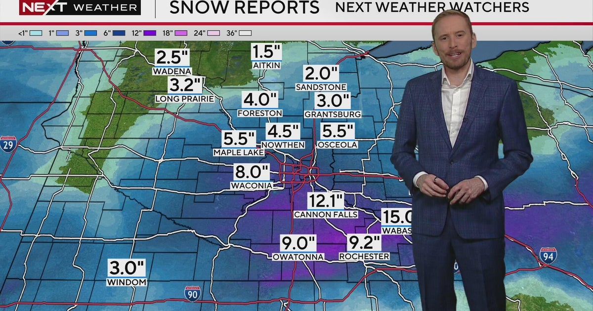
According to the National Weather Service, the heaviest snow fell across southeastern Minnesota, with most in the region seeing around a foot of accumulation, including the southwest metro.
Around 20.5 inches of snow fell overnight in Wabasha, while Rochester racked up around 14 inches of accumulation.
Closer to the Twin Cities, Prior Lake got around 13.7 inches of snow. Maple Grove and Eagan both gained 10 inches, and Bloomington saw 9.5 inches. Snow wasn’t much of an issue to the north or to the west.
As the day continues, snow is expected to taper off. But the strong wind is another part of the weather equation, as it’s picking up and blowing the flakes, creating blizzard conditions.
The Minnesota Department of Transportation issued a no travel advisory on Sunday morning for southern Minnesota due to the whiteout conditions. Roads closer to the Twin Cities are completely covered, MnDOT said.
The Minnesota National Guard is on standby in various spots in southern Minnesota, prepared for activation should rescue operations be needed during the storm.
More from CBS News