
Environment Canada and Avalanche Canada are warning that a prolonged atmospheric river will bring heavy rain to parts of Vancouver Island and create high risks for avalanches.
A rainfall warning is in effect for West Vancouver Island, where forecasters say storm totals of 100 to 150 millimetres are expected between Sunday and Wednesday morning, with some areas potentially seeing close to 200 mm.
A wind warning is also still in effect for northern Vancouver Island, with Environment Canada calling for “significant” winds of up to 90 kilometres an hour, with gusts of up to 110 km/h.
Watch the report below:
A special weather statement has also been upgraded to a rainfall warning for inland areas of Vancouver Island, where rainfall totals of up to 150 mm are also possible over the same period.
Environment Canada says the atmospheric river will begin making landfall on the B.C. coast Sunday and remain over the region until Wednesday.
“The heaviest rainfall is expected on Monday and Monday night,” the agency said in its statement.
Initially, freezing levels will be near sea level, meaning some precipitation could fall as snow. However, those levels are expected to quickly rise overnight, reaching between 2,500 and 3,000 metres by Monday morning.
The combination of heavy rainfall and melting snow at higher elevations could significantly increase water levels in rivers and streams.
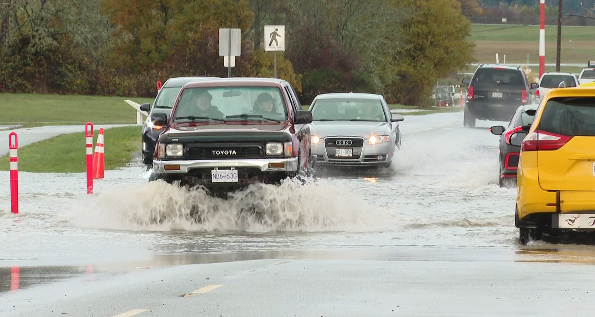
Forecasters warn the event could lead to water pooling on roads, washouts and localized flooding. Saturated ground may also increase the risk of landslides, particularly on steep slopes or in areas affected by previous wildfires.
A close eye is also being kept on higher elevations for potential avalanche risks.
Avalanche Canada says, depending on conditions in the coming days, the rainfall could create “unintuitive avalanche problems” following the storm.
“The more snow we get, the more avalanches we get, but when we have long breaks between our snowfalls, we can have a situation that develops with an unintuitive avalanche problems that form,” said Colin Garritty, field technician and forecaster for Avalanche Canada.
This month’s snow basin index report has put all of Vancouver Island’s snowpack levels at 48 per cent of normal, which is the lowest in the entire province. In March 2025, snowpack levels were at 76 per cent of the normal amount.
Depending on conditions like temperature and wind, Garritty says the rain may not have enough time to bond with the snow at higher elevations, which would form a weak layer.
“Maybe we get a little bit of snow on the crust, and then we get a cold snap, and it doesn’t snow for a couple of weeks. That snow on that crust could turn into a really nasty weak layer, and when it snows again, we could have a real problem on our hands.”
Late afternoon on Sunday, Avalanche Canada increased its danger rating to ‘High” for Vancouver Island.
“Heavy rain is creating very dangerous avalanche conditions. Avoid all avalanche terrain,” reads the website.
Environment Canada is urging residents to monitor conditions closely and watch for rapidly rising water near rivers, creeks and culverts.
While the heaviest impacts are expected on the west and inland portions of the Island, southern areas such as Victoria are forecast to see steadier but lighter rain.
Environment Canada’s forecast for the capital calls for rain Monday with totals of about 10 to 15 millimetres and southeast winds up to 40 km/h near the water in the morning.
The atmospheric river is expected to weaken and move out of the region by Wednesday morning.