
Those regions are forecast to fall to freezing before midnight, increasing the risk for a local burst of heavy snow.
Very gusty, southwesterly winds build through Monday, producing gusts of 60-80 km/h. They will be strongest along the Lake Ontario and Lake Erie shorelines.
Damaging, west-northwesterly winds are forecast along the Lake Huron shore and Georgian Bay shores as the low lifts north, reaching as high as 90 km/h for those regions, and the north shore of Lake Ontario through Monday night and early Tuesday.
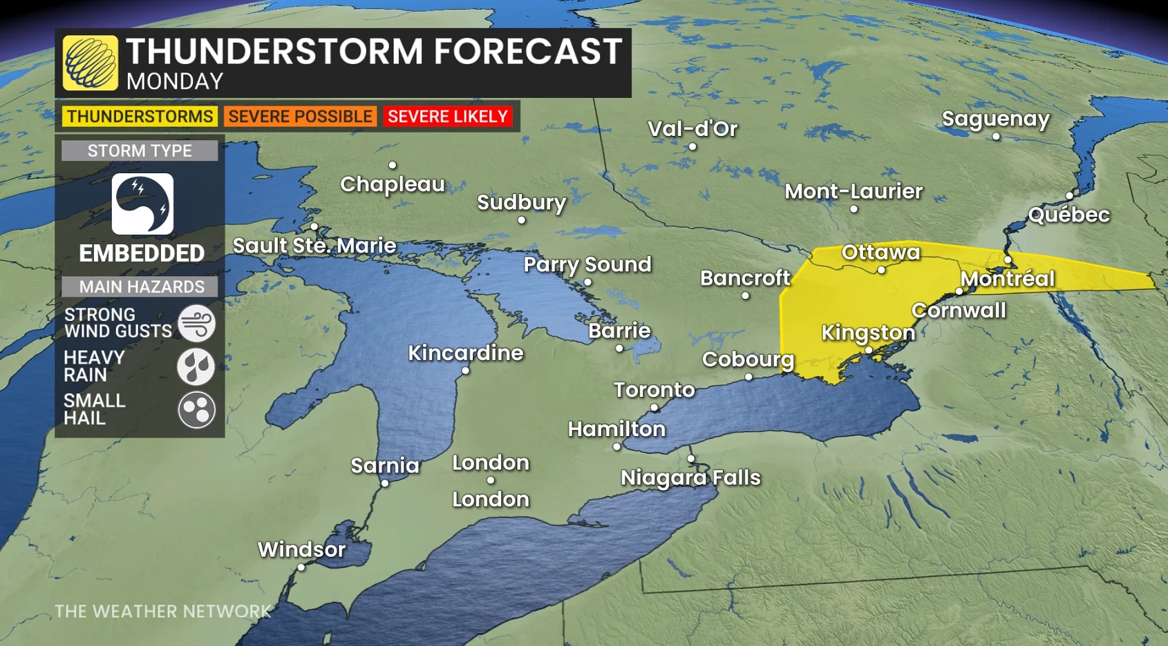
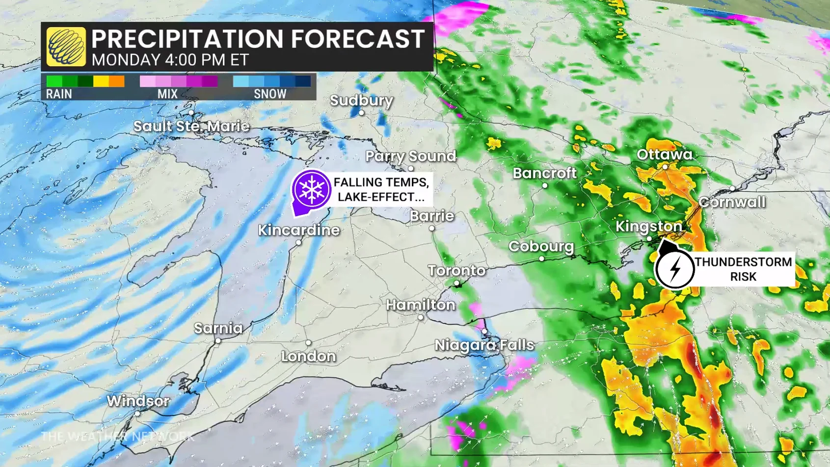
Early Monday may also feature sporadic rumbles of thunder across southern Ontario, but a more organized thunderstorm threat is looming in extreme eastern Ontario, east of Kingston. Strong winds, heavy rainfall and small hail are the primary threats.
On Monday night, rapidly falling temperatures will occur, making untreated surfaces and lingering puddle freeze–creating slick surfaces and slipping hazards.
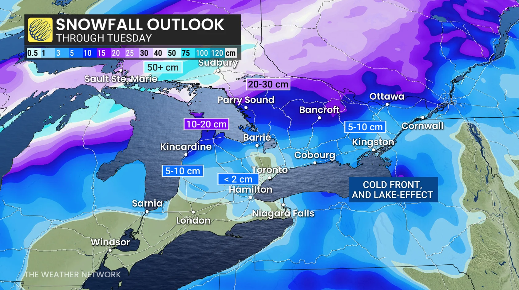
5-10 cm of snowfall is forecast in less than six hours east of the Greater Toronto Area (GTA), including for the National Capital Region, the same locales that will likely reach the 20-degree mark by late Monday.