

RELATED: ‘A messy day ahead,’ another winter storm keeps some Newfoundland schools closed

Snow is expected to transition to a wintry mix across the Avalon and southern Newfoundland as temperatures rise above the freezing mark.
As the low pressure system deepens and moves northeast of Newfoundland on Tuesday afternoon however, strong winds will raise concerns for blowing and drifting snow across the province.
WATCH: Snowplows are busy after March snowfall in Nova Scotia
Wind gusts are expected to reach 70-90+ km/h through Tuesday, with northern coastal areas of Newfoundland potentially experiencing gusts exceeding 100 km/h.
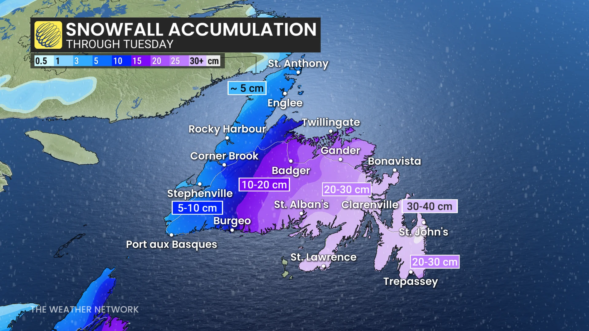
By Tuesday night, the precipitation is set to taper off as the low tracks north of the region.
RELATED: Thundersnow is a rare and electrifying experience
Two systems are set to impact Atlantic Canada again on Thursday and Friday, bringing mixed precipitation. While the exact storm track remains uncertain, current forecasts suggest primarily rain for southern areas, including Halifax, with snow expected for the northern parts of the region.
Colder-than-average temperatures are likely to settle in over the weekend and persist into most of next week.
WATCH: Lore says these March days are ‘mad’ stormy; is it true?