

Published on Mar. 24, 2026, 2:47 PM
A strong cross-country storm to impact B.C. and Alberta early this week
A powerful storm system is moving across Canada this week, beginning with significant impacts in British Columbia and Alberta.
The Pacific low will bring strong winds and heavy alpine snow to B.C.’s coast and the Interior on Tuesday evening.
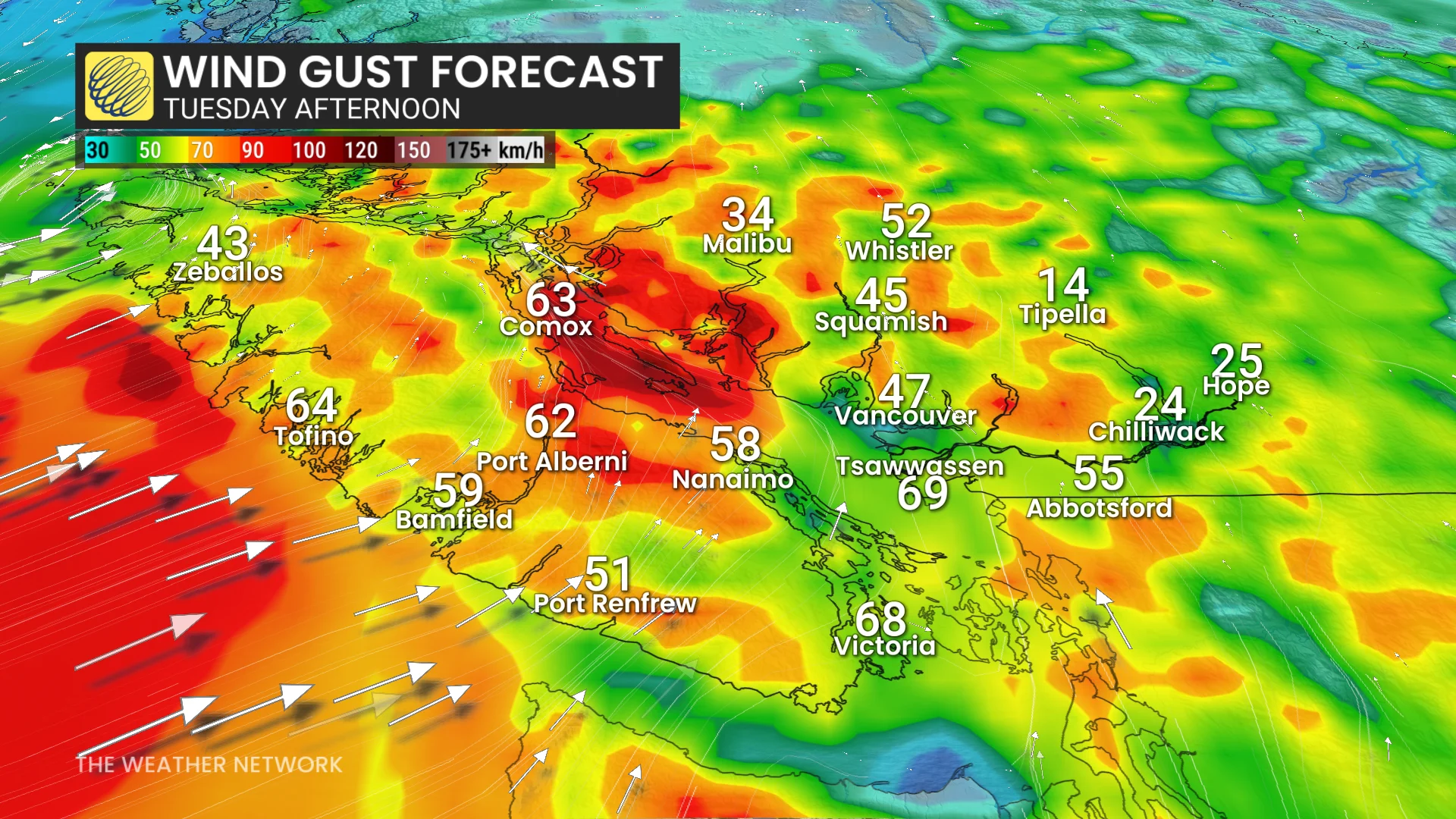
Southeast winds in the Georgia Strait could gust between 80-90 km/h Tuesday evening, with similar gusts in mountain passes and inland valleys, creating potential whiteout conditions at alpine levels.
The Lower Mainland is forecast to receive 30-40 mm of rain, while up to 50 cm of alpine snow will benefit ski destinations like Whistler Blackcomb.

Freezing levels will rise above 1,500 m, keeping snow limited to mountain passes in both B.C. and Alberta.
Kootenay, Rogers, and Kicking Horse passes in B.C. could see 15-30 cm of snow by Tuesday night, while Alberta’s Rockies could receive an additional 20-30 cm, keeping the Icefields Parkway closed due to avalanche concerns.