

Published on Apr. 2, 2026, 1:36 PM
Back-to-back storms could bring up to 50 cm of snow to parts of northeastern Ontario this Easter weekend. An icy mix is expected to create hazardous travel on sections of Hwy 11 and Hwy 17
Two Colorado lows will sweep across Ontario this Easter weekend, bringing close to 50 cm of snow to northern regions. Road closures and isolated power outages are possible. Meanwhile, parts of southern Ontario could see temperatures soar into the 20s, with the risk of a rumble of thunder or two.
Weather Highlights:
Thursday–Friday (First Low): Heavy snow (15-30 cm) and freezing rain from Lake Superior to Sudbury
Saturday (Second Low): Additional 10-20 cm of snow, with 6-12 hours of freezing rain from Wawa to Timmins. Road closures likely
Sunday: Snow tapers off by afternoon; regions with ice/rain transition to flurries. Snow totals may exceed 50 cm in northeastern Ontario.
DON’T MISS: Will Canada’s April bring a summer preview or a winter rewind?
First system: Heavy snowfall rates and freezing rain Thursday through Friday
The first system will bring snow, freezing rain, and ice pellets beginning Thursday morning.
Snowfall rates of 2-4 cm/h are expected overnight northeast of Lake Superior.
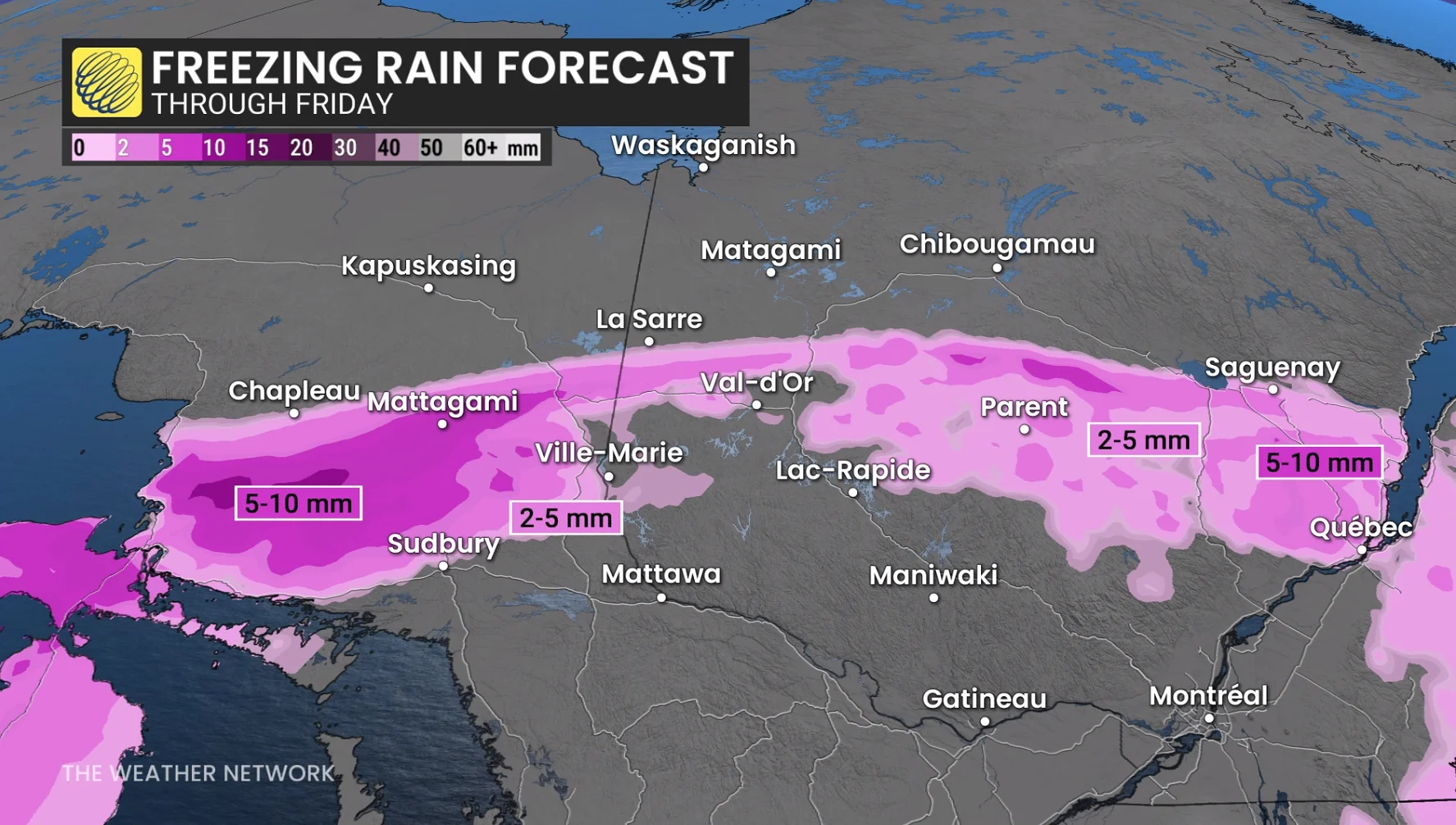
Freezing rain east of Lake Superior and Georgian Bay could reach 5-10 mm, creating slick roads and isolated power outages.
DON’T MISS: Freezing rain is the ‘worst’ type of precipitation. Here’s why
Areas near Sudbury will see heavy rain and freezing rain, while 10-15 cm of snow is forecast for northwestern Ontario, including Thunder Bay.
By Friday morning, between 15-30 cm of heavy snow will affect northeastern Ontario, with road closures possible. A band of freezing rain and ice pellets will persist south of Timmins before precipitation tapers off by the afternoon.