
As mentioned, this event will feature significant variation in snowfall totals across the region, making it difficult to pinpoint exact amounts. This is due to both the scattered nature of the snow and temperatures hovering near freezing, along with ground warmth from the recent mild weather. That means not everyone will see accumulating snow, even within the highest forecast zone.
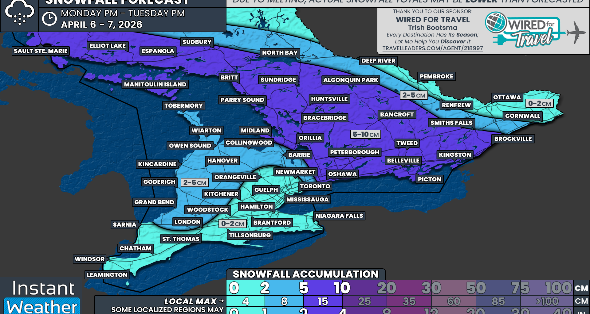
The zone of highest accumulation is expected to include much of Central Ontario extending into Eastern Ontario south of the Ottawa Valley. This includes Kingston, Belleville, Peterborough, Bancroft, Orillia, Bracebridge, Huntsville, Algonquin Park, Parry Sound, Sudbury and Elliot Lake. These areas could see general totals of 5 to 10 cm, with localized pockets potentially exceeding that up to 15 cm. Not everyone within this zone is guaranteed to see 5 cm, as local temperatures will determine how much of the snow is able to stick.
A few centimetres of snow are expected around the Lake Huron and Southern Georgian Bay shoreline, including Grand Bend, Goderich, Kincardine, Owen Sound, Hanover, Collingwood and Barrie. Around 2 to 5 cm is possible here, but due to the nature of lake effect snow, some localized areas could see up to 8 cm, while others may get completely missed.
A trace to a light dusting of snow is expected for Deep Southwestern Ontario into the Golden Horseshoe, along with the Ottawa Valley. Much of this is unlikely to stick to the ground.
No matter how much snow you receive, it will almost certainly be gone within 24 hours thanks to temperatures rising above freezing by Wednesday. That means you likely won’t need to bring those shovels back out of storage.