
After lightning and hail the size of ping pong balls hit the Bay Area on Friday, an even more vigorous storm is on tap Saturday.
A potent squall line is forecast to sweep through the region Saturday afternoon, raising the risk of lightning, downpours, severe wind gusts and even an isolated tornado.
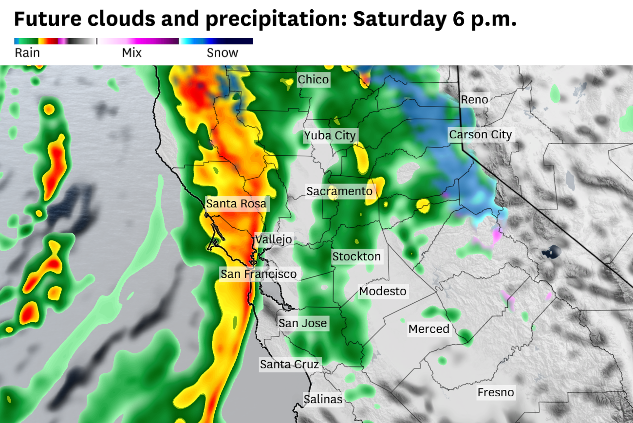
Scattered showers in the morning aren’t expected to pose a threat, but that will change in the afternoon. A squall line, scientifically known as a narrow cold frontal rainband, is anticipated to move from west to east in the afternoon and evening.
“The timing for greatest concern will be 5 to 11 p.m.,” said Matt Mehle, a meteorologist at the National Weather Service.
Widespread rainfall rates in excess of a half-inch per hour are predicted, with up to an inch per hour possible in the hardest-hit areas, including parts of San Francisco and Oakland. Downpours could overwhelm small streams and creeks and cause urban flooding along roadways and low-lying areas.
The weather service said it was not planning a flood watch, but could potentially issue short-fused warnings and advisories for flooding and other hazards.
Severe winds are expected to accompany the squall line. Gusts could exceed 60 mph and cause damage to trees and powerlines. There is also a slight chance of embedded waterspouts and tornadoes, especially along the immediate coastline.
The front could disrupt the Cherry Blossom Festival in San Francisco but appears it will hold off in San Jose until after the U.S. Women’s National Team soccer match concludes.
Cold air behind the front will drag the snow line down to 4,000 feet. Snowfall rates up to 3 inches per hour are possible in the Sierra Nevada on Saturday night, with storm totals of 1 to 4 feet through Sunday prompting a winter storm warning for Donner Summit. South Lake Tahoe, Tahoe City and Truckee could pick up a half-foot to a foot.
Active weather will persist in the Bay Area after the squall line moves through.
Downpours Saturday night and Sunday may contain small hail, erratic wind gusts and dangerous cloud-to-ground lightning strikes.
The weekend storm will be energized by two systems merging off the California coast — a lobe of cold air stemming from the Gulf of Alaska and a warm, humid cutoff low that has slowly nudged closer all week. Cold air overspreading the warm, humid environment in place will provide the ingredients for powerful storm cells.