
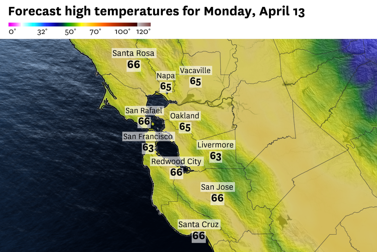
Monday will bear remnants of the departing storm system in the form of chilly temperatures. Kids returning to school Monday after spring break will need some heavy jackets and maybe even a winter hat. The day will start with temperatures in the upper 30s and low 40s in most spots.
Despite increasing sunshine as Monday wears on, the chilly temperatures will persist. Highs Monday will run anywhere from 5 to 15 degrees below normal for mid-April, with nearly every location topping out in the 50s and 60s.
Temperatures will gradually warm on Tuesday and Wednesday as high pressure tries to work its way back over California.
But it’s in for a fight, and it sets the stage for what appears to be a fast moving and unsettled weather pattern that will persist through next weekend.
By Thursday, another storm system will pass to our north and shift to the interior mountain West. That’s a pattern where offshore winds should develop on both Thursday and Friday, warming temperatures a bit more and providing what should be a decent stretch of weather into next weekend.
Beyond that, all bets are off. The active storm pattern in the eastern Pacific will continue to send shots of low pressure toward the West Coast. We miss the midweek storm, but the next one looks to have more of an impact by the end of next weekend.
But forecast confidence is quite low at that timeframe and considering the active nature of the atmosphere. Details are likely to change a few times as the week progresses.
San Francisco: Morning clouds will give way to sunshine by midday. Highs will reach only the upper 50s in the western half of the city and the low to mid 60s downtown. Northwest winds at 10 to 20 mph will keep a chill in the air, though. Conditions will stay mostly clear overnight with lows near 50 degrees.
North Bay: The wet landscape will lead to some patchy fog early in the valleys, but then sunny skies will take over. Coastal Marin and Sonoma counties will stay in the 50s, while inland areas won’t be much warmer, with highs in the mid to upper 60s in the Highway 101 corridor and back through Napa. Conditions will be clear and chilly Monday night, with lows falling into the upper 30s in the coldest valley pockets and low 40s elsewhere.
East Bay: Low clouds are likely along the bayside and in the Berkeley hills in the morning. But eventually, mostly sunny skies will develop across the East Bay. Temperatures in the interior will reach the upper 60s, while it will be slightly cooler, in the mid-60s in Oakland and Berkeley, where northwest winds will be stronger. Skies will be mostly clear overnight with lows settling into the upper 40s.
Pacific Coast and Peninsula: Fog will likely be in place along the coast in the Peninsula hills on Monday morning, but sunshine will take over by the afternoon. Highs in Half Moon Bay and Pacifica will be right around 60 degrees. South San Francisco and SFO won’t be much warmer. The mildest temperatures will be in Redwood City, where highs should reach the upper 60s. Northwest winds will be gusty at 10 to 25 mph. Conditions will be mostly clear and still breezy on Monday night, with lows in the upper 40s.
South Bay: Monday morning will see just a slight chance of a stray shower or two in the South Bay hills. Otherwise, it will be a mostly sunny day with light winds and some of the warmer readings in the region. Highs should reach the upper 60s in Silicon Valley. Overnight will be mostly clear and cool, with lows falling back into the 40s.