
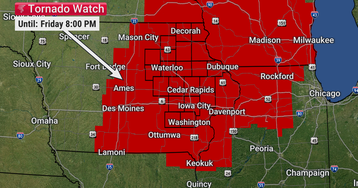
Severe weather threats this afternoon.
10 AM update: The warm front is moving through right now with temps climbing quickly through the 60s into the 70s. Winds are starting to gust over 30 mph leading to a rise in dew points (humidity) to the mid 60s. Skies are partly to mostly cloudy leading to a rapidly destabilizing atmosphere. Meanwhile, the strong cold front is pushing past northwestern Iowa and approaching Fort Dodge. Not much has changed with the forecast below.
Today [LEVEL 3/5 SEVERE RISK]: A strong south wind at 15 to 25 mph, gusting to 40 mph, draws in more humidity with dew points into the mid 60s and warmer temps with highs reaching the mid 70s to low 80s. This warm and humid air, along with cold air aloft, means that there will be a large amount of instability for storms to develop.
Window #1 for storms will be between 1 and 4 PM and will be more likely east of I-380. These will be isolated, or discrete, storms that should quickly become supercells (a rotating thunderstorm). Within this window, any storms that develop will pose a risk for large hail 1 to 3” in diameter and tornadoes which could be strong (up to EF-3 most likely). These storms form from a combination of the unstable air and some atmospheric lift ahead of the front as the weak cap erodes.
Window #2 for storms will be between 3 and 8 PM as a strong cold front moves through. Areas along and east of Highway 63 will be favored more for this round of storms. A robust line of storms is expected to develop and sweep to the east through this time period. Main threats would be damaging straight line winds, some significant over 75 mph in our eastern counties, and some embedded tornadoes can’t be ruled out.
Flash flooding is possible in the heaviest areas of rain due to an already saturated ground. Most of the area receives between a quarter inch to inch of rain.
Tonight: Once the rain is over, clouds decrease and temps fall quick. We’ll have lows around freezing and a northwest wind at 10 to 20 mph, gusting to 30 mph, pushing the wind chills in to the 20s.
Saturday: The forecast has improved a little for Saturday with mostly sunny skies, but highs are still only in the upper 40s to low 50s with a strong northwest wind at 15 to 25 mph, gusting to 35 mph.
Sunday: Partly cloudy with a blustery northwest wind at 10 to 20 mph, gusting to 30 mph, as highs reach the mid 50s.
Next Week: It’s looking quieter and milder with the next chance for rain on Thursday.
-Brandon