
A Flood Watch has been issued from 4 pm to Wednesday morning for the potential of street flooding
What you need to know about tonight’s storm chance for San Antonio (Copyright 2026 by KSAT – All rights reserved.)FORECAST HIGHLIGHTS
MOST OF TODAY: Partly cloudy, warm, and humid
4PM-8PM: Storms fire up along Rio Grande west of SA, some will be severe
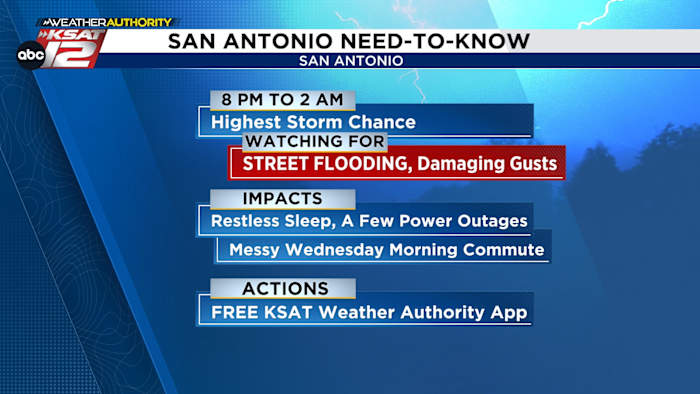
8PM-2AM: Highest storm chance for San Antonio
RISKS: Primarily street flooding, damaging wind gusts
IMPACTS: Restless sleep, few power outages, snapped branches
ACTIONS: Make sure you have FREE KSAT Weather App
SUNRISE WEDNESDAY: Rain moves east, morning commute may still be affected with low water crossings closed
FORECAST
FLOOD WATCH
A Flood Watch is in effect from 4 pm Tuesday through Wednesday morning due to the risk for street flooding. (Copyright 2026 by KSAT – All rights reserved.)
A Flood Watch will go into effect for the counties in green (including San Antonio & Bexar County) from 4 pm this afternoon until Wednesday morning, as the main risk for storms tonight will be street flooding.
REMEMBER: A “Watch” means we’re simply watching for flooding. If you get a flood “warning” that means street flooding is happening, and you should stay off the roads if possible until the warning expires.
But the timeframe of storms depends on where you live…
TIMING OF STORMS LATER TODAY
For those along the Rio Grande, storms will fire as early as 4pm. Any storm that develops in the 4pm-7pm timeframe will be capable of large hail or even a tornado. This threat is mainly for those west of San Antonio.
Future radar for 4pm today (5/26) (Copyright KSAT-12 2026 – All Rights Reserved)
From 8pm on, the storms will form into a line and march east. Any storm that form out of ahead of the line will be capable of large hail, but the main threats will be gusty winds and heavy rain with the line itself.
Threats for severe weather tonight (Copyright KSAT-12 2026 – All Rights Reserved)
Those at Spurs outdoor watch parties will want to pay close attention to forecast
Heavy rain will peak around midnight, however, showers and storms could linger through sunrise Wednesday. Street flooding will be a concern and the Wednesday morning commute could be affected.
Future radar for 12am Wednesday (5/27) (Copyright KSAT-12 2026 – All Rights Reserved)
WEDNESDAY
Much of what occurs on Wednesday will depend on what unfolds tonight. Odds are that the atmosphere will become stable, should we see a healthy round of storms overnight. That said, by Wednesday afternoon, a few more isolated storms could develop.
NEXT RAIN CHANCE
The next best rain chance after today will be late Saturday night and into Sunday. Currently rain chances sit at 40%.
The latest forecast from Your Weather Authority (Copyright 2026 by KSAT – All rights reserved.)Daily Forecast
KSAT meteorologists keep you on top of the ever-changing South Texas weather.
QUICK WEATHER LINKS
Copyright 2026 by KSAT – All rights reserved.
About the AuthorsJustin Horne headshotJustin Horne
Justin Horne is a meteorologist and reporter for KSAT 12 News. When severe weather rolls through, Justin will hop in the KSAT 12 Storm Chaser to safely bring you the latest weather conditions from across South Texas. On top of delivering an accurate forecast, Justin often reports on one of his favorite topics: Texas history.
Sarah Spivey headshotSarah Spivey
Sarah Spivey is a San Antonio native who grew up watching KSAT. She has been a proud member of the KSAT Weather Authority Team since 2017.
Sarah is a Clark High School and Texas A&M University graduate. She previously worked at KTEN News.
When Sarah is not busy forecasting, she enjoys hanging out with her husband and cat, and playing music.