

Published on Jun. 9, 2026, 11:35 AM
Ontario will see high heat and humidity this week, with humidex values nearing the 40s and increasing thunderstorm risks through Thursday, bringing potential for torrential downpours, localized hail, and strong winds
Ontario will experience a surge in heat and humidity this week as high atmospheric moisture and low pressure systems approach the Great Lakes. Temperatures will feel like the 30s, with humidex values nearing the 40s. The warmest days are forecast for Wednesday and Thursday.
DON’T MISS: Visit our complete guide to Summer 2026 for an in-depth look at the Summer Forecast, tips to plan for it and much more!
The muggy air will help to fuel a thunderstorm risk with the threat for torrential downpours at times.
Heavy rain and hail risk in eastern Ontario Wednesday
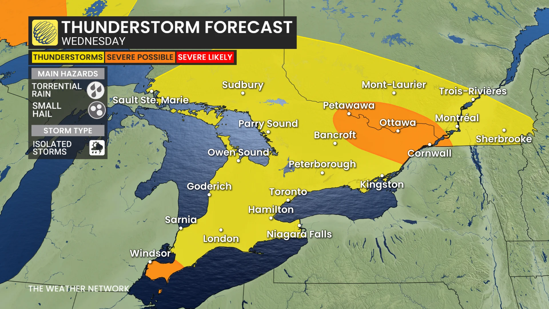
On Wednesday, isolated thunderstorms may develop in eastern Ontario, including Petawawa, Ottawa, and Cornwall, bringing a risk of intense rainfall, localized hail near 2 cm, and slow storm movement.
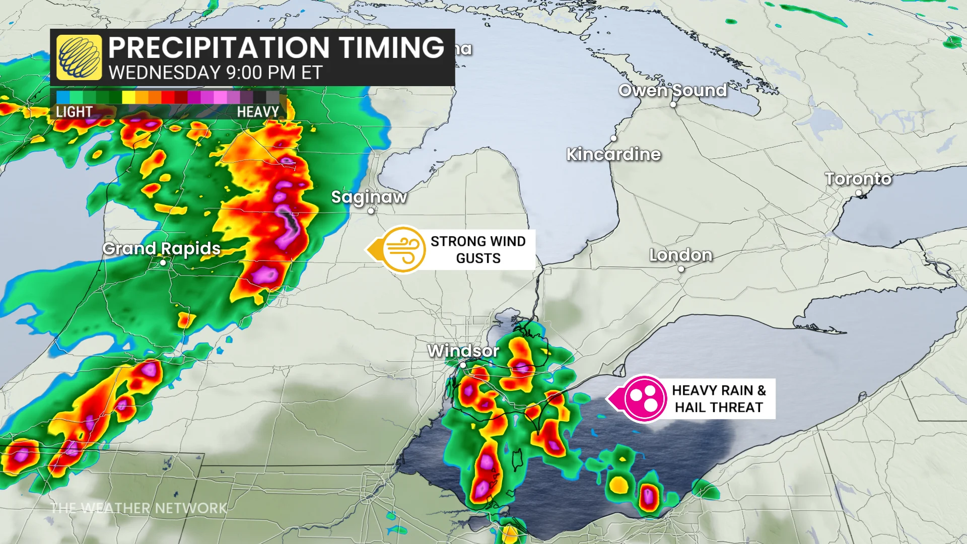
By late evening and overnight, storms moving from Michigan could impact Windsor-Essex with heavy rain, large hail, and potential strong wind gusts.
Monitoring of these storm systems continues, particularly for their overnight development.
The thunderstorm risk grows Thursday with increasing atmospheric instability and moisture. While the severity remains unclear, conditions will support storm development.