

Published on Jun. 15, 2026, 1:57 PM
Updated on Jun. 15, 2026, 2:00 PM
Ontario will experience an unsettled weather pattern this week with multiple rounds of rain showers and thunderstorms expected. This will result in significant rainfall totals and temperatures remaining below seasonal norms
Ontario’s weather this week will be shaped by a significant, upper-level, low-pressure system over Central Canada. Several surface, low -pressure systems will pass through, bringing periods of showers and thunderstorms.
DON’T MISS: Visit our complete guide to Summer 2026 for an in-depth look at the Summer Forecast, tips to plan for it and much more!

Temperatures are forecast to remain seasonably cool, with highs in the low 20s. Normal temperatures for Toronto this time of year are 24°C.
An unsettled week across Ontario with rounds of rain and thunderstorm chances
Southern Ontario enjoyed a sunny, but cooler, start to the week.
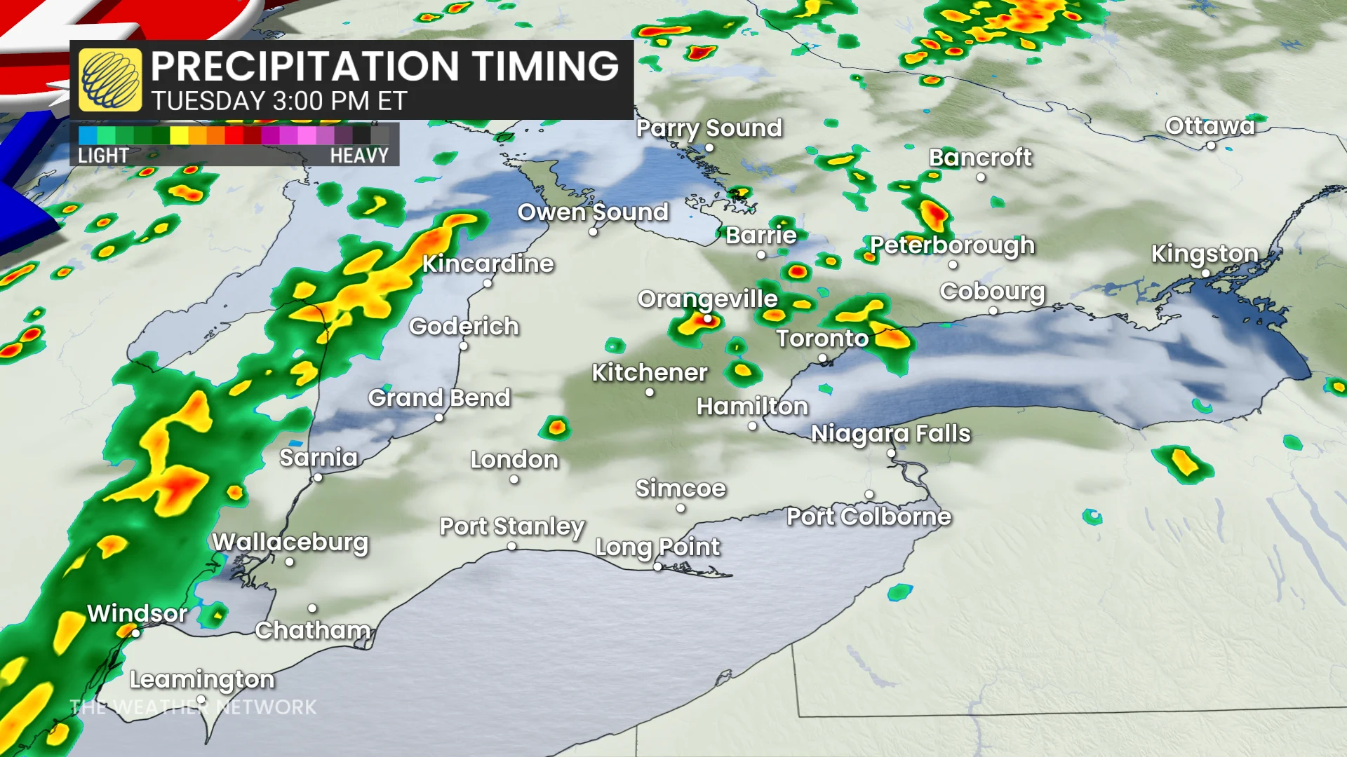
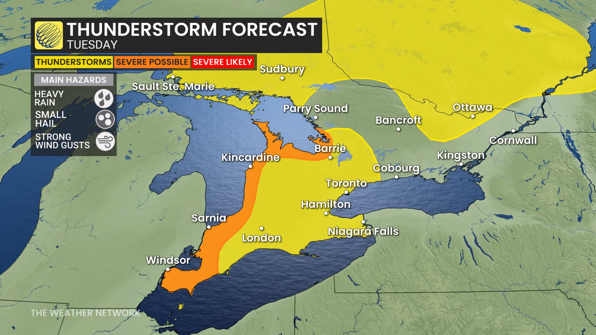
A second low-pressure system arrives Tuesday, spreading showers and thunderstorms into northeastern Ontario with its warm front.
Southern Ontario could also see isolated pop-up showers and thunderstorms in the afternoon and evening as a cold front moves closer. Regions near Georgian Bay and Lake Huron may experience stronger thunderstorms, with heavy rain, gusty winds, and small hail.
By Tuesday night into Wednesday morning, the cold front will bring widespread showers.