
A tropical system in the Bay of Campeche could bring heavy rain to the Texas coast this weekend, especially in coastal counties south of Houston.
Author: Jaime E. Galvan, Kim Castro, Chita Craft
Published: 10:47 AM CDT August 14, 2025
Updated: 1:27 PM CDT August 14, 2025
![]()
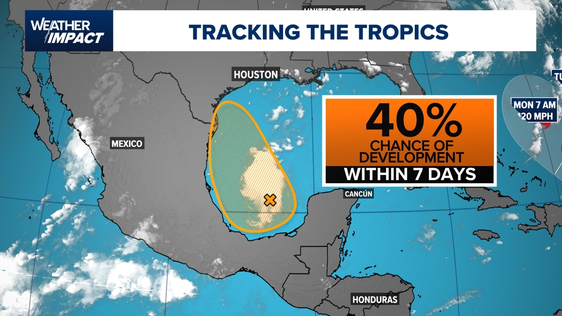
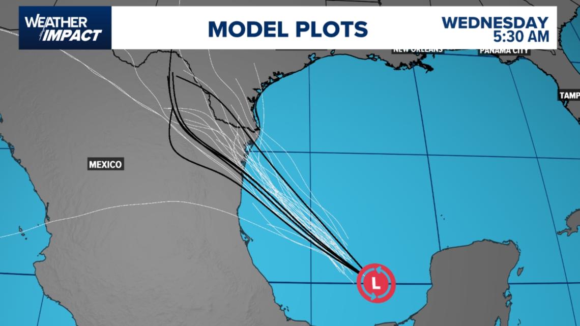
HOUSTON — A broad area of low pressure over the Bay of Campeche is drifting toward the southwestern Gulf, bringing increased rain chances to the Texas coast and northeastern Mexico by the weekend.
As of 1 p.m. Thursday, the National Hurricane Center gives the system a 40% chance of tropical development over the next 7 days, locally heavy rainfall is possible along portions of southern Texas and northeastern Mexico Friday into Saturday. Hurricane Hunters are scheduled to investigate the system this afternoon.
A building high-pressure system over Texas will keep the center of circulation just south of the U.S – Mexico border.

Timing the Impacts
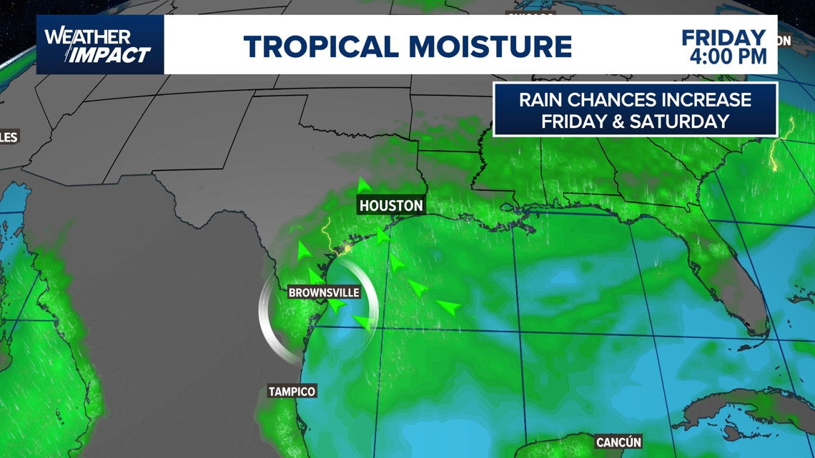
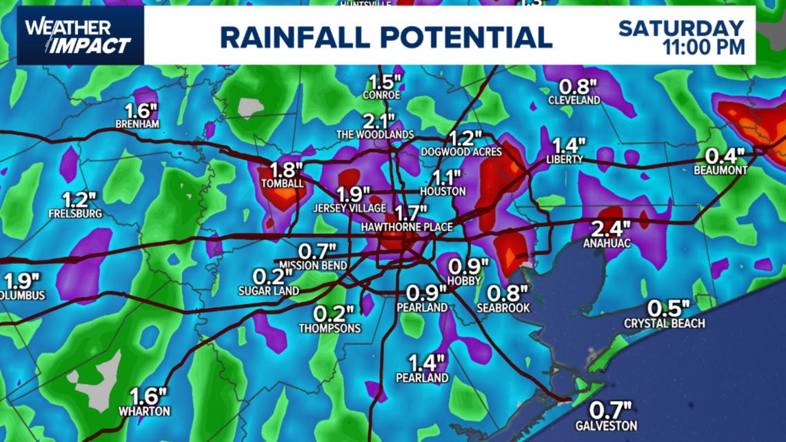
Friday: A line of showers and thunderstorms moves in with the tropical wave. Quick downpours could bring 0.5–1 inch of rain. Rain wraps up by 4–5 p.m.Saturday: Scattered downpours possible late morning through midday, with activity tapering off by evening.

Areas most affected
Coastal counties and areas south of Houston could see the highest rainfall totals.Inland areas, including Katy, Sugar Land, Jersey Village, Spring, and the Medical Center, may still pick up brief but heavy showers.Northeastern Mexico and the Rio Grande Valley face the highest rain risk from the tropical wave.

What you should do
For Friday commutes: Have rain gear ready; plan for slowdowns during midday downpours.For Saturday plans: Morning and midday outdoor events could be impacted by scattered showers.Keep an eye on updates if you live in flood-prone or low-lying areas, as tropical moisture can produce localized street flooding.
Looking ahead
Once the tropical wave moves inland late Saturday, rain chances will taper off, with warmer, mostly dry weather returning for the start of next week.
RELATED: Hurricane season 2025: Interactive storm tracker; supply lists, evacuation info and more