
Weather HeadlinesNEXT 9 HOURS: Muggy, storms likely missSHORT TERM: Staying hot and humidLONG TERM: Some changes, eventuallyLatest Forecast
CEDAR RAPIDS, Iowa (KCRG) – Elevated temperatures and humidity could cause you problems if you don’t treat them with respect.
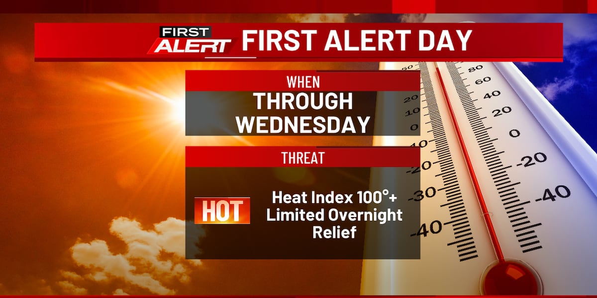
Our First Alert Day continues through at least Wednesday evening, with the ongoing potential for very high heat index readings. There is a chance this could be extended later into the week.
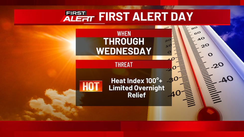 A First Alert Day continues into Wednesday.(KCRG)
The National Weather Service has an Extreme Heat Warning in effect for the entire TV9 viewing area. This just serves as extra notice that the heat is here, and here to stay for at least a little while.
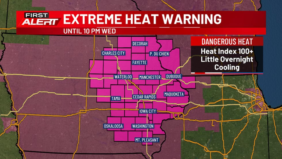 An Extreme Heat Warning continues through Wednesday evening.(KCRG)
Overnight, skies remain partly cloudy, with lows in the upper 70s. Areas of showers and storms developing along a cold front to our west will try to move toward us, but will likely diminish before making it this far east. If some were to survive, they would affect our northern zones later tonight. All in all, expect little relief from the high heat of the daytime hours, which will be a recurring theme of the week.
Tuesday’s conditions look like they’ll be pretty similar to what we felt and experienced today. Partly to mostly sunny skies will be accompanied by fairly strong southwesterly breezes. But, those winds will just serve to reinforce the hot and humid air mass in the region. High temperatures hit the low to mid 90s, with heat index readings in the 100 to 110 range for much of the afternoon and early evening.
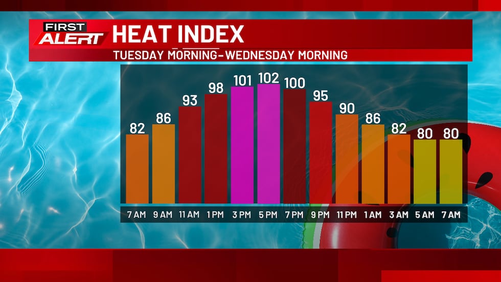 Forecast heat index values for the 24-hour period beginning on Tuesday morning.(KCRG)
For the most part, we’ll repeat the same type of conditions on Wednesday, too. Hot, humid conditions with a breeze, as well as mostly dry weather, too. Temperatures on the thermometer will reach the low to mid 90s, with 100 or higher for a heat index during the daytime hours.
With temperatures this hot, and especially for this long, the risk for heat-related illness is high if you don’t take precautions to help keep yourself safe. First and foremost, avoiding exposure to the heat as much as possible is the best course of action. Drink plenty of water to help keep yourself hydrated. Avoiding sugary, caffeinated, or alcoholic drinks can help in this endeavor, too. Wearing lightweight, light-colored, and loose-fitting clothes will give your body a better chance at regulating its temperature. If you must be outdoors, make sure to take plenty of breaks in air-conditioned spaces.
If you are experiencing any of the following symptoms, you need to take action. You can combat heat exhaustion by immediately getting to an air-conditioned area and taking various steps to cool yourself off. If you or someone near you is showing signs of heat stroke, call 911 right away. It’s a life-threatening medical emergency and requires immediate care.
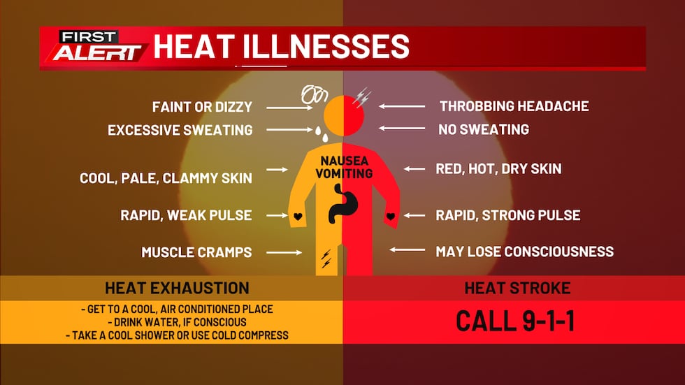 You should know the symptoms of heat exhaustion and heat stroke in order to stay safe during a heat wave.(KCRG)
Later in the week, our temperatures and dew points will retreat a little bit. With highs closer to 90 and dew points in the low 70s, it’ll still be plenty warm and muggy. However, this may keep us out of the danger zone for shorter-term heat exposure. A long day spent outdoors could still be dangerous, so we still suggest caution from Thursday through the weekend.
We’re also watching the potential for shower and storm chances to work their way into eastern Iowa. For now, that chance seems quite low, with dry weather in the forecast through Wednesday. Slight chances exist in our forecast from Wednesday night through Sunday. The exact timing and placement of rounds of showers and storms are typically difficult to determine with much lead time in a weather pattern like this. But, there are some indications that the chances could be at their highest toward the holiday weekend as our current weather pattern begins to break down a bit.
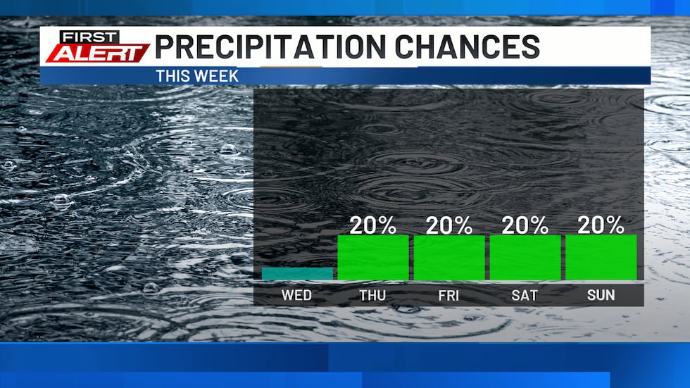 The chance of rain and storms will be present later this week.(KCRG)
This “ring-of-fire” weather pattern (when storm systems track on the edge of a “ring” of hot and humid air) can sometimes surprise us, too, with a complex of storms or two that tracks in a way that you might not expect. If this occurs, the northern zones of the TV9 viewing area would have the best chance to get involved with storms at night or in the morning on a given day. Thus, we just encourage you to stick with us for additional updates as we go throughout the week. You can find them here on KCRG.com, KCRG-TV9, and the KCRG First Alert Weather app.
As that higher chance of storms comes into play this weekend, we’ll see temperatures slip even further. Highs on Independence Day on Saturday are still slated to reach the upper 80s to low 90s, with muggy weather persisting. By Sunday, they may not make it out of the mid to upper 80s.
This downward trend sticks with us into the following week. The last few days on our 9-day forecast are dry, with dew points back down into the low to mid 60s at times. While still warm, it’ll be better than what we’ve got right now.
Copyright 2026 KCRG. All rights reserved.