
July 3 Friday Morning Report
Thank you for reading this post, don’t forget to subscribe!
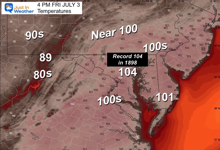
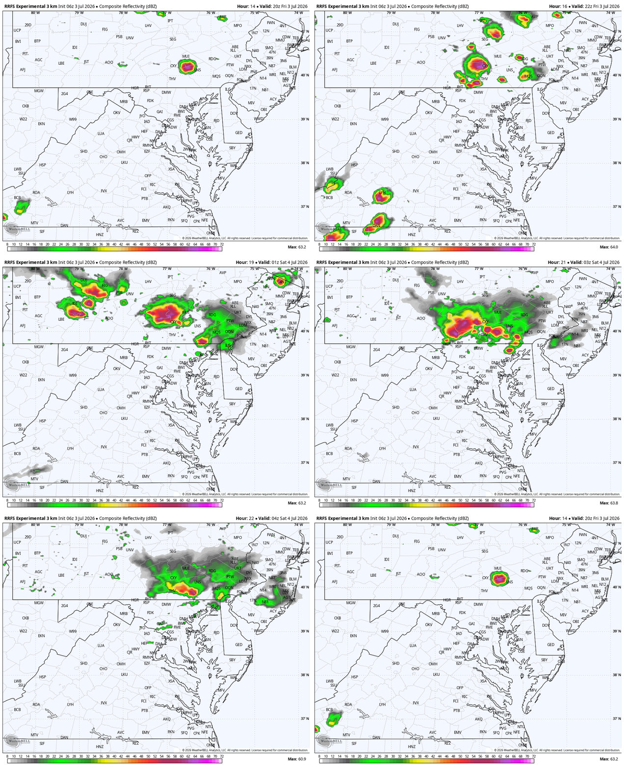
This is the day — Friday’s 104°F has held steady for five consecutive model runs. When the model doesn’t move at this lead time, it means the pattern is locked, and confidence is very high. This evening, there will be storms north of Baltimore, with more widespread storms over the weekend.
Yesterday hit 101℉ in Baltimore, which was not a record. But nearby Washington, D.C. hit 102℉, which broke their 128-year-old mark. We have a chance to do that in Maryland today. Then matched by another 100℉+ day tomorrow. If so, then the 8th time on record we have that trifecta!
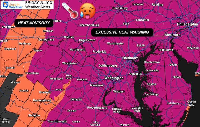
Excessive Heat Warning
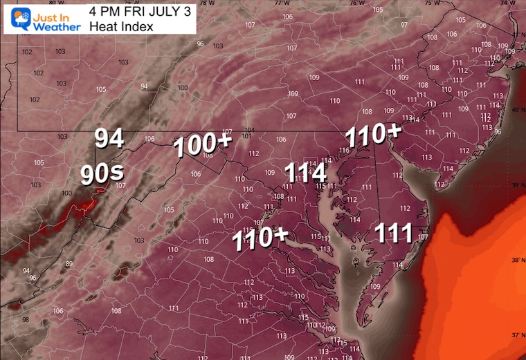
Heat Index Values will reach 105℉ to 115℉. This will be dangerous to be outside for many, the elderly, and pets. Also, it is a concern for anyone without air conditioning. Buildings are retaining more heat, especially with overnight lows in many spots near or above 80℉.
Key Notes:
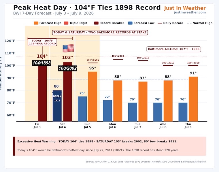
104°F today would be Baltimore’s hottest day since July 22, 2011 (106°F) — that’s a 15-year gap you can headline with
The 1898 record has stood for 128 years — older than the Wright Brothers’ first flight, older than the airplane itself!
Saturday actually bumped hotter (102° → 103°) — the peak isn’t a one-day story, it’s a two-day story
Three records still in play total:
Today: 104°F ties 104°F (1898) high
Today’s overnight low (already happened): if it verifies at 80°F, it ties the 1898 warm-min ← check this against actual observation when available
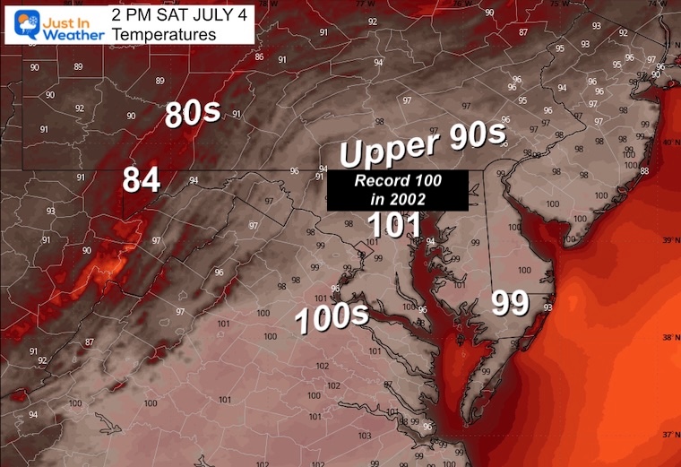
Saturday: 103°F breaks 100°F (2002) high
Saturday: 80°F low breaks 78°F (1911) warm-min
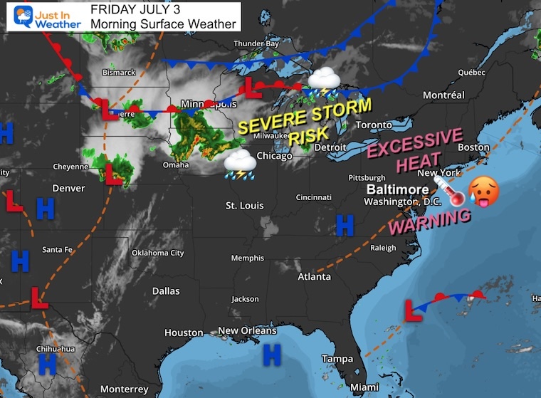
Morning Surface Weather
Storm Forecast Friday Afternoon To Sunday Evening
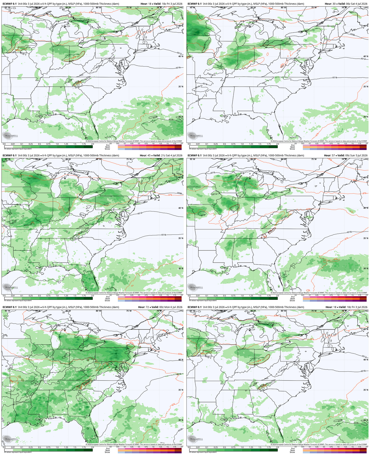
Severe Storms
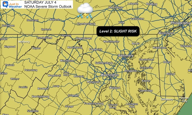
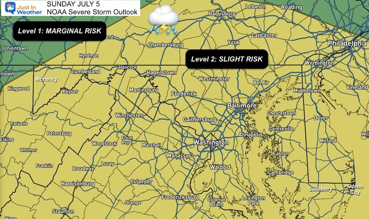
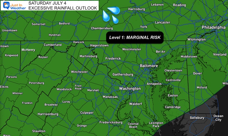
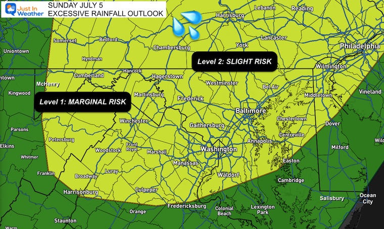
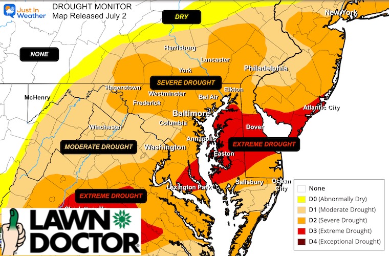
As we break the heat wave, severe storms become likely, and this may impact plans for the holiday weekend. The rain may linger with a flood risk heading into next week as a frontal boundary may stall over our region. We need rain, and this could make a dent in our drought.
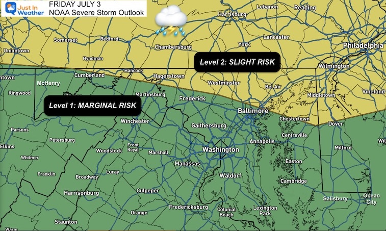
NOAA Severe Storm Risk
Friday
Saturday
Sunday
Excessive Rainfall: Potential Flooding
Saturday
Sunday
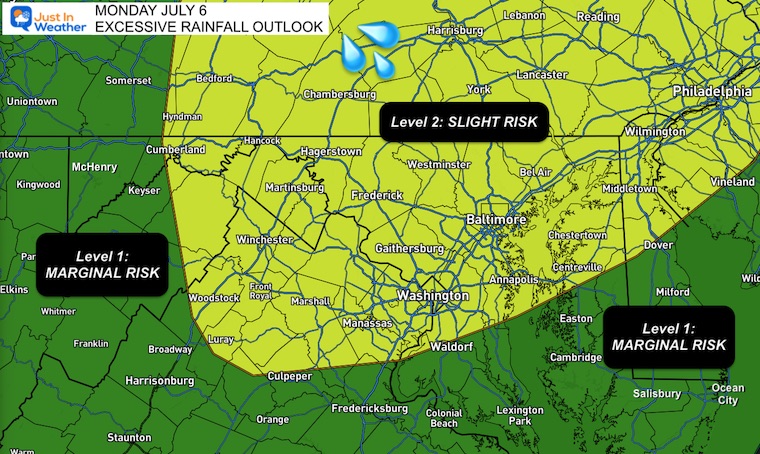
Monday
Live Radar Widget
Let’s Take A Look
My goal is to Make You Aware So You Can Prepare
AND NEVER TO SCARE!
Subscribe for email Alerts
Weather posts straight to your inbox
Sign up and be the first to know!
TODAY
High Temperatures
Peak Heat Index
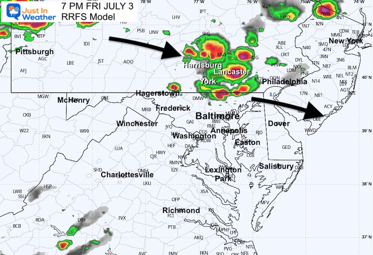
Radar Simulation 4 PM To Midnight
SUGGESTION NOT A PROMISE
6 PM Radar Snapshot
MOUNTAIN CAM: WESTERN MARYLAND
This webcam is positioned at The Greene Turtle Deep Creek Lake and shows Wisp Resort, including a zoomed-in view of Squirrel Cage, The Face, the terrain park, Boulder, the mountain coaster, the tubing park and a shot of McHenry Cove at Deep Creek Lake!
CLIMATE DATA: Baltimore
Yesterday: Low 77°F; High 101°F 🔥
Precipitation: 0.00″
Snow Depth: 0″
Season Snow Total: 17.6″
Top Wind Gust: 21 mph
TODAY July 3
Sunrise at 5:45 AM
Sunset at 8:36 PM
Normal Low in Baltimore: 67ºF
Record Low: 50ºF in 2001
Normal High in Baltimore: 89ºF
Record High: 104ºF in 1898
Rainfall Deficit at BWI
Prior 2 Years (2024 + 2025) = -16.91″
2026 YTD = -6.42″
DROUGHT MONITOR
Rain Deficit since January 1 = -6.42”
Since Jan 1 2024, at -23.33”
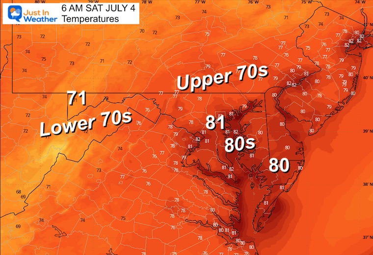
SATURDAY
Morning Temperatures
Afternoon Temperatures
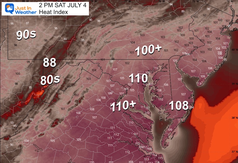
Peak Heat Index
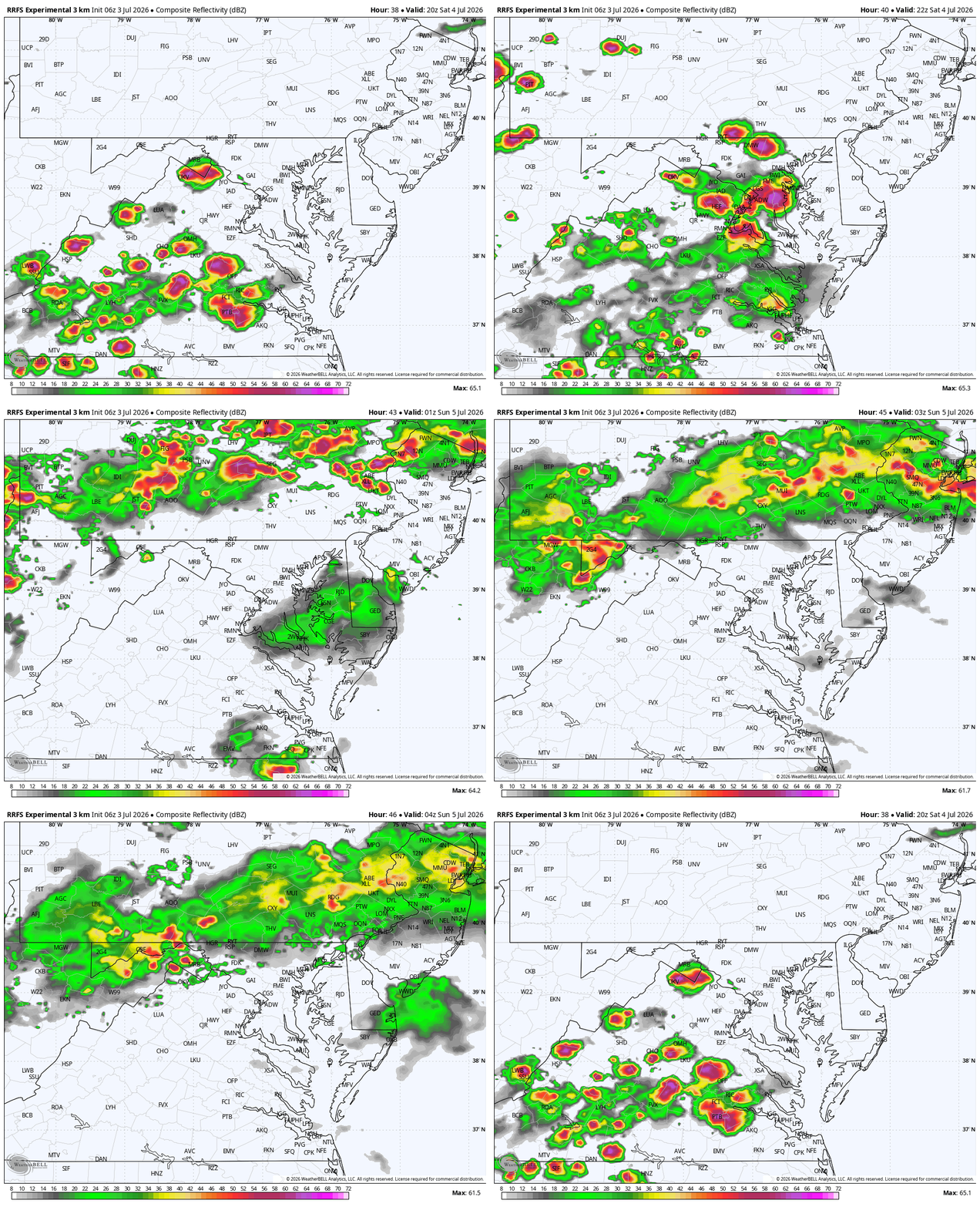
Radar Simulation 4 PM To Midnight
SUGGESTION NOT A PROMISE
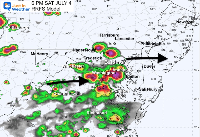
6 PM Radar Snapshot
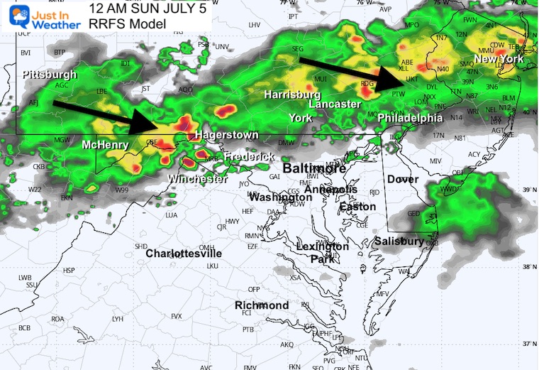
Midnight
RECORD HEAT HIGHLIGHTS
104°F today would be Baltimore’s hottest day since July 22, 2011 (106°F) — that’s a 15-year gap you can headline with
The 1898 record has stood for 128 years — older than the Wright Brothers’ first flight, older than the airplane itself
Saturday actually bumped hotter (102° → 103°) — the peak isn’t a one-day story, it’s a two-day story
Three records still in play total:
Today: 104°F ties 104°F (1898) high
Today’s overnight low (already happened): if it verifies at 80°F, it ties the 1898 warm-min ← check this against actual observation when available
Saturday: 103°F breaks 100°F (2002) high
Saturday: 80°F low breaks 78°F (1911) warm-min
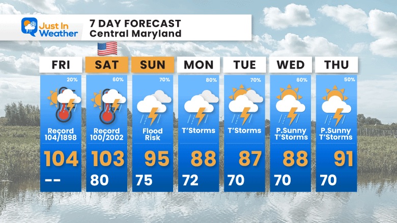
7-Day Forecast
Friday: Record 104/1898 (20%). High 104ºF, Low —
Saturday: Record 100/2002 — 4th of July (60%). High 103ºF, Low 80ºF.
Sunday: Flood Risk (70%). High 95ºF, Low 75ºF.
Monday: T’Storms (80%). High 88ºF, Low 72ºF.
Tuesday: T’Storms (70%). High 87ºF, Low 70ºF.
Wednesday: Partly Sunny, T’Storms (60%). High 88ºF, Low 70ºF.
Thursday: Partly Sunny, T’Storms (50%). High 91ºF, Low 70ºF.
Subscribe for email Alerts
Weather posts straight to your inbox
Sign up and be the first to know!
THANK YOU:
Baltimore Sun Magazine Readers’ Choice Best Of Baltimore

Maryland Trek 13 Is Set For August 2 to 8
Help Support The Programs at Just In Power Kids
The annual event: Hiking and biking 329 miles in 7 days between The Summit of Wisp to Ocean City.
Each day, we honor a kid and their family’s cancer journey.
Fundraising is for Just In Power Kids: Funding Free Programs For Kids And Families Facing Childhood Cancer.
I never have and never will take a penny. It is all for our nonprofit to operate.
Click here or the image to donate:

STEM Assemblies/In School Fields Trips
Click to see more and ‘Book’ a visit to your school

RESTATING MY MESSAGE ABOUT DYSLEXIA
I am aware there are some spelling and grammar typos and occasional other glitches. I take responsibility for my mistakes and even the computer glitches I may miss. I have made a few public statements over the years, but if you are new here, you may have missed it: I have dyslexia and found out during my second year at Cornell University. It didn’t stop me from getting my meteorology degree and being the first to get the AMS CBM in the Baltimore/Washington region. One of my professors told me that I had made it that far without knowing and to not let it be a crutch going forward. That was Mark Wysocki, and he was absolutely correct! I do miss my mistakes in my own proofreading. The autocorrect spell check on my computer sometimes does an injustice to make it worse. I can also make mistakes in forecasting. No one is perfect at predicting the future. All of the maps and information are accurate. The ‘wordy’ stuff can get sticky. There has been no editor who can check my work while writing and to have it ready to send out in a newsworthy timeline. Barbara Werner is a member of the web team that helps me maintain this site. She has taken it upon herself to edit typos when she is available. That could be AFTER you read this. I accept this and perhaps proves what you read is really from me… It’s part of my charm. #FITF
Please share your thoughts and best weather pics/videos, or just keep in touch via social media.